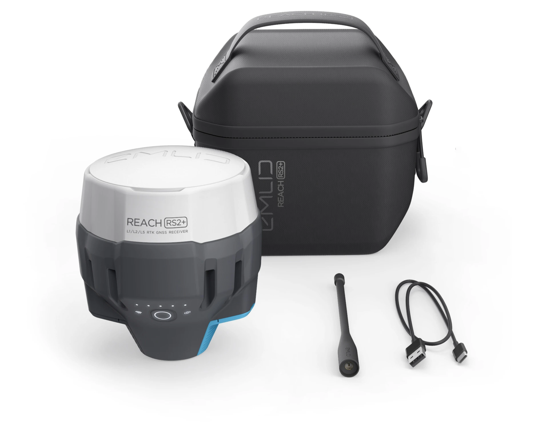
REACH RS2 / RS2+
Precision RTK receivers
for archaeology
Map out the excavation sites and pinpoint findings with centimeter precision.
$2499
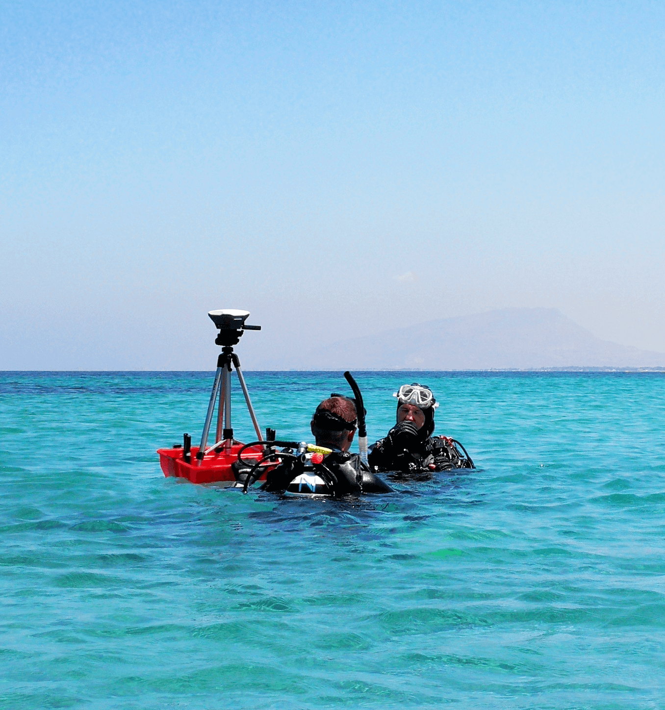
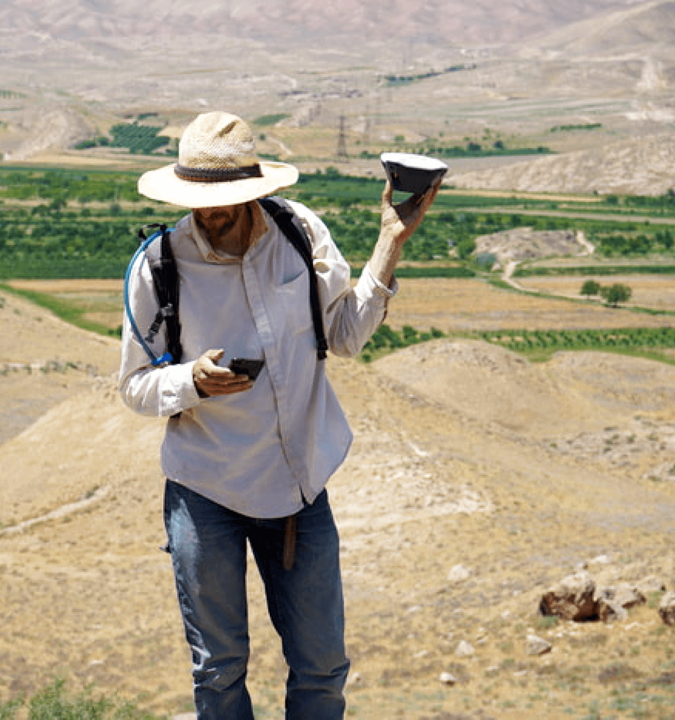
Choose a receiverResearchers of the Joukowsky Institute for
Archaeology & the Ancient World in Petra, Jordan
A complete solution
for survey and mapping
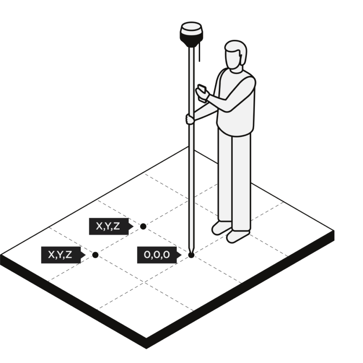
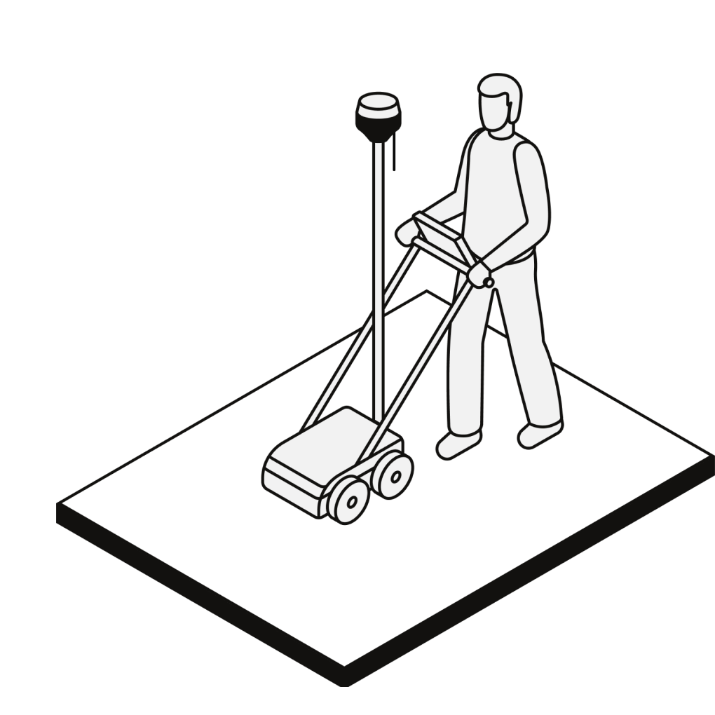
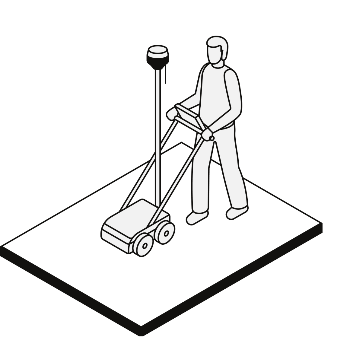
Establish
a site grid
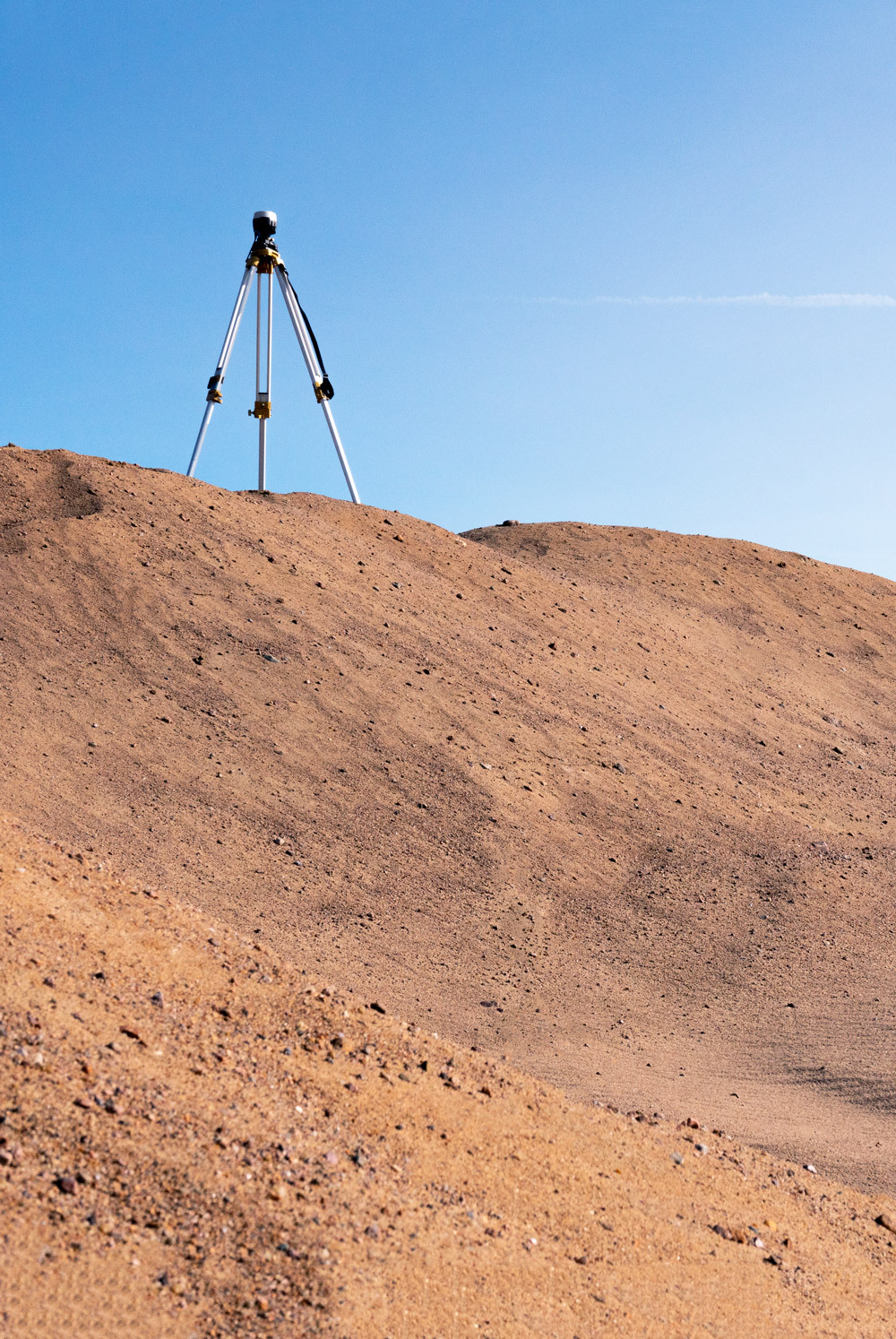
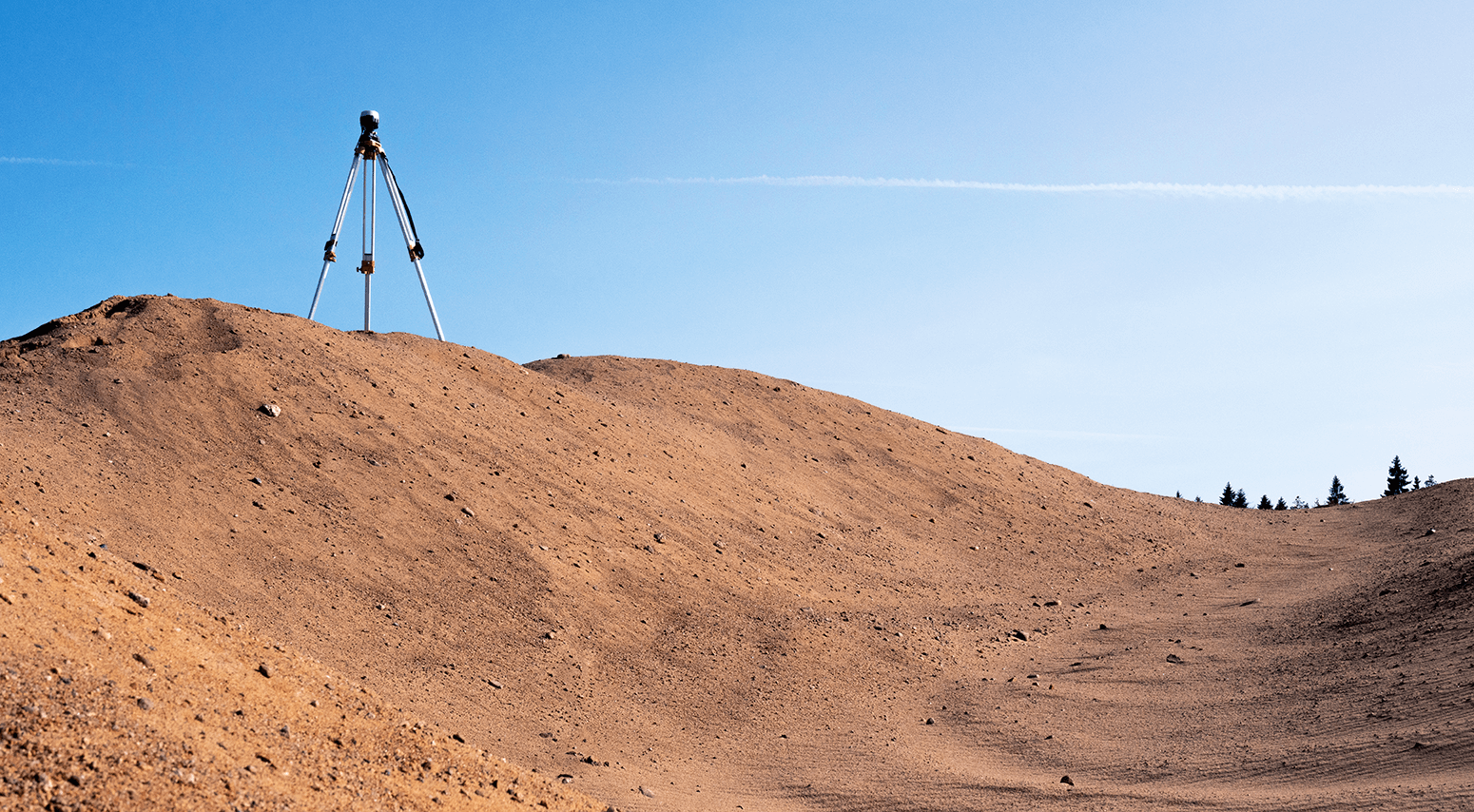
Speed up grid layout on site. Reach allows you to mark up the squares with high precision relatively to any reference point on site.
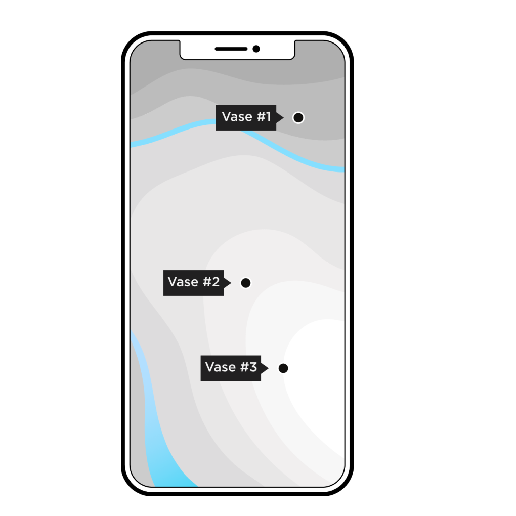
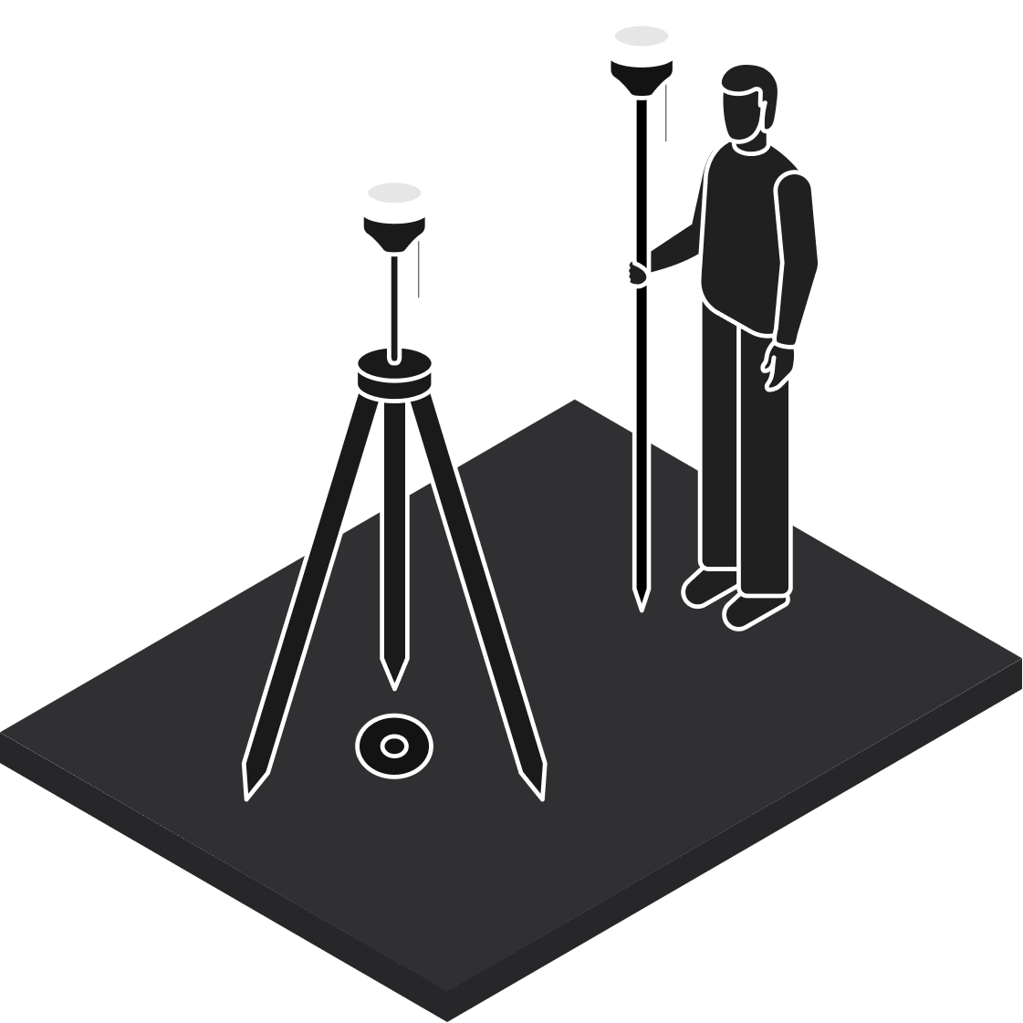
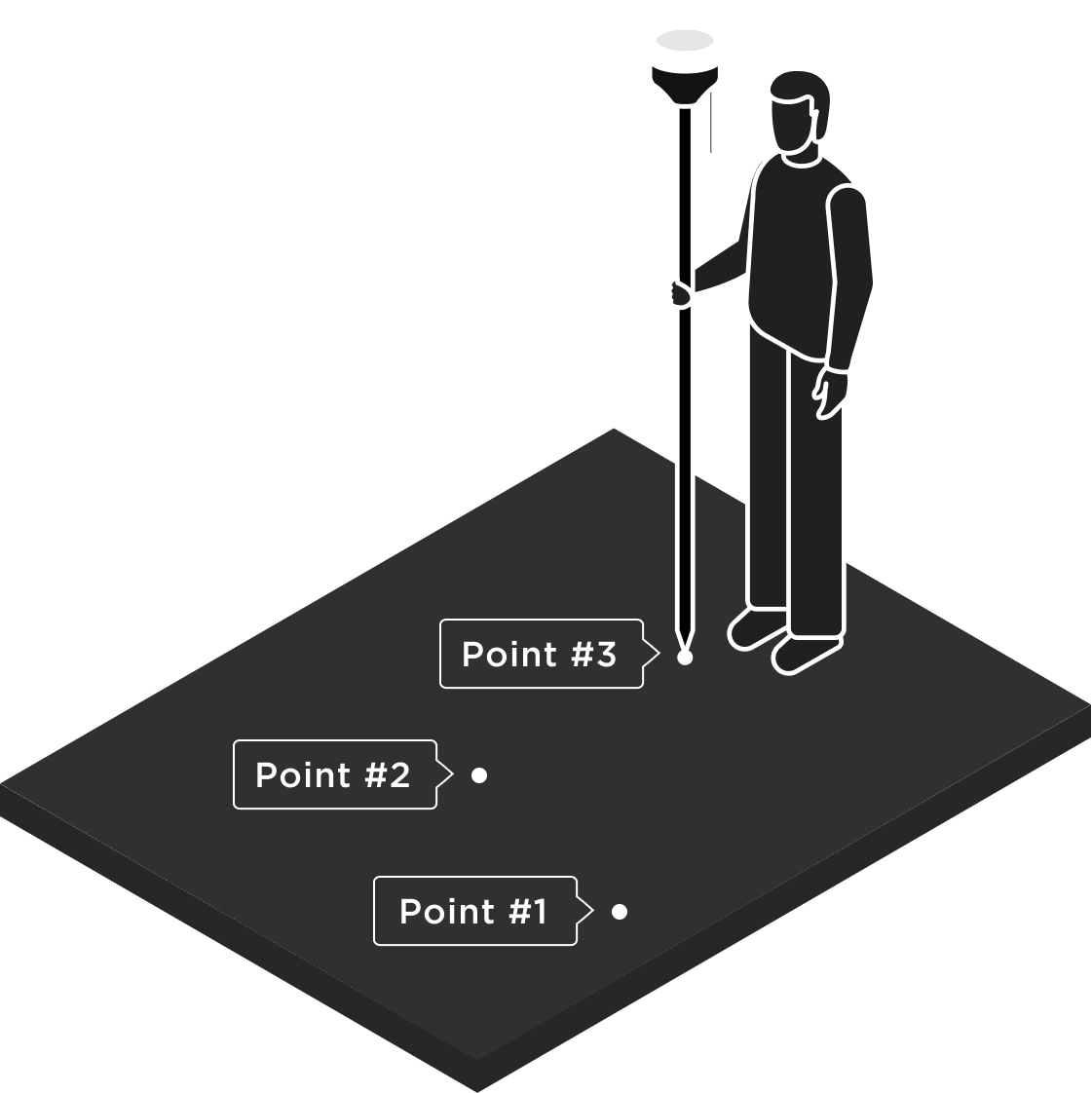
Collect
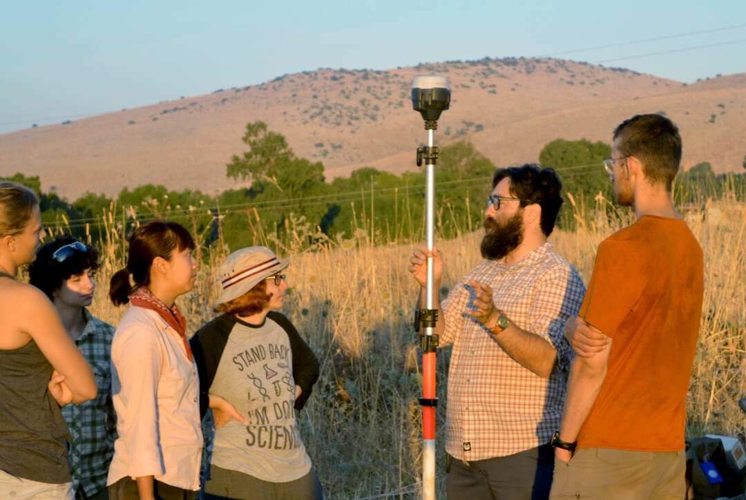
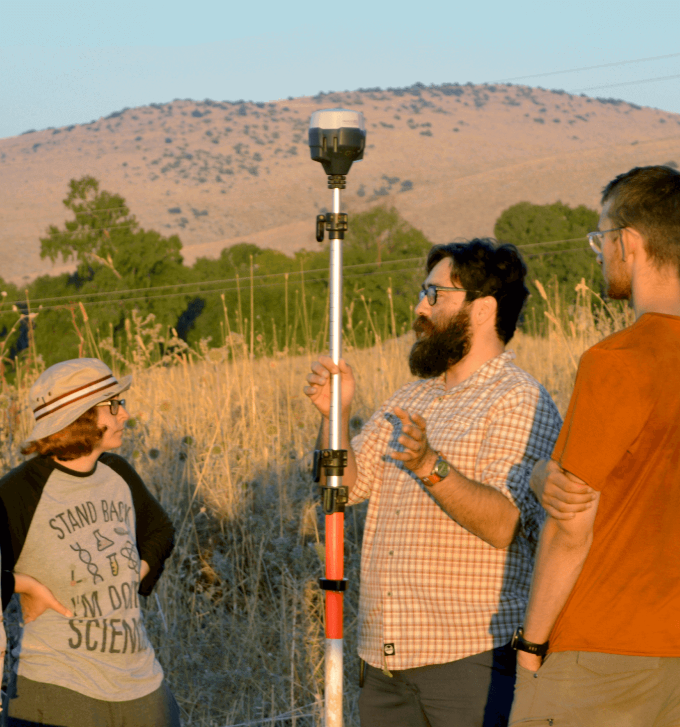
positional data
Get the precise position of discovered artifacts and visualize it with your field software.
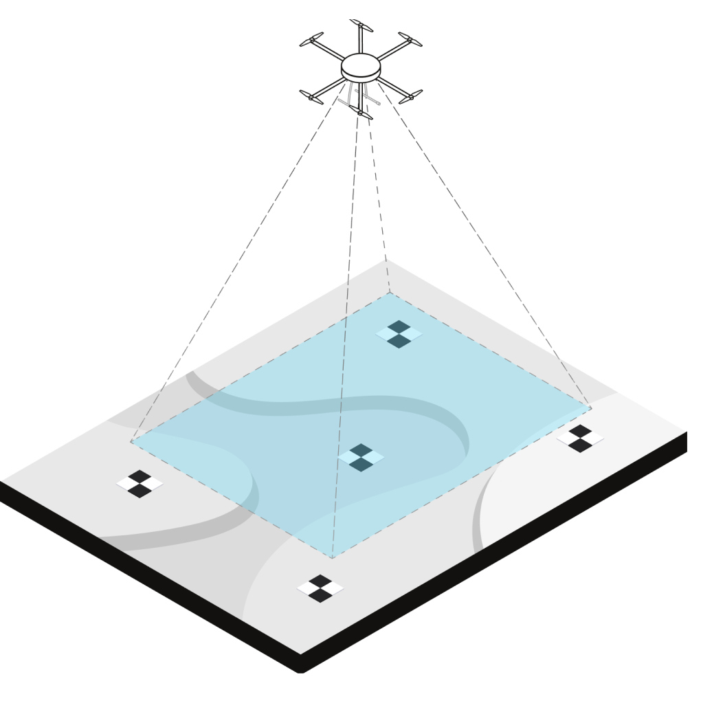
Measure GCP
for aerial mapping
Establish ground control points (GCP) with Reach prior to flying a site of interest. Upload GCP coordinates to your processing software to georeference the map with centimeter precision.
Integrate with geophysical instruments
Enhance the positional precision of data collected with your Ground Penetrating Radar or Gradiometer. Reach smoothly integrates with geophysical equipment over BT, RS-232 or USB.
How Reach receivers work
Reach is an RTK receiver. RTK is a technique used to improve the accuracy of a GPS receiver. Traditional GPS receivers could only determine the position with 2–4 meters precision. RTK can give you 1–2 centimeter accuracy.
You don’t necessarily need a second unit for RTK all the time. Usually, there are local services that share base corrections over the Internet. This technology is called NTRIP.
How to get started


1.
Download
the Emlid Flow app
In App Store or Google Play, or scan the QR code inside the Reach box.
2.
Place a base or connect to an NTRIP service to get corrections
Reach needs a base station as a source of corrections. The base might be another Reach RS2+ receiver or an NTRIP service.
3.
Start collecting data
with a rover
Now you can collect and stake out points with a rover.

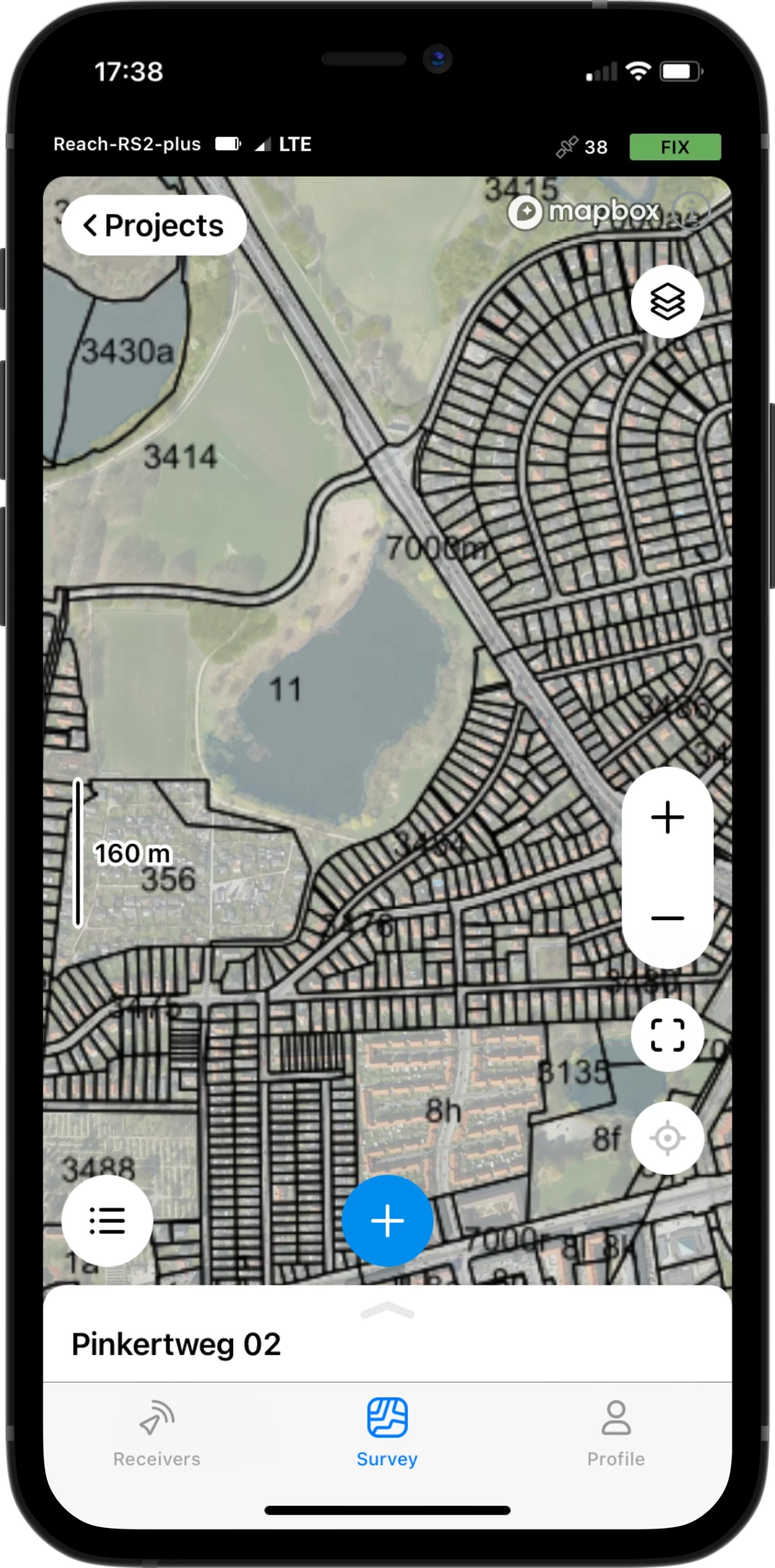
Survey with Emlid Flow
and manage data with Emlid Flow 360
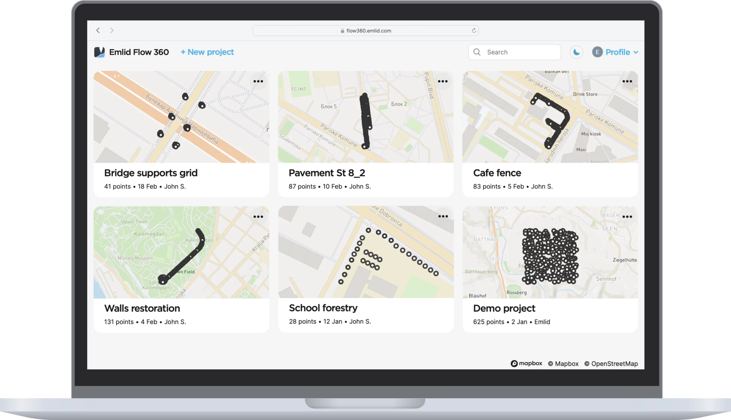
Emlid Flow is a mobile app for iOS and Android. It handles all the fieldwork—receiver settings, data collection, coding, linework, and stakeout. All survey data is in sync with the cloud-based service Emlid Flow 360, which allows you to access your projects from your browser and manage survey data and code lists.
Collect and stake out points
Use any coordinate system you need
To create a project for data collection, choose your coordinate system from the library or enter its parameters manually. The app supports thousands of coordinate systems, projections, grids, and geoids.
In the stakeout mode, the app displays East-North and straight-to-line distances and supports cut and fill indications. A close-up alignment mode helps you to center precisely above the point.
WGS84, NAD83,
GDA2020, and others

Collect and stake out lines
Create linework on the go, start new lines, and continue collecting existing ones
You can either use predefined geometry types or a full-blown code library. The linework is displayed right away, so you can always see how your project is progressing.
During the stakeout, you can easily navigate to a line, and stake it out with an offset and with a chainage.
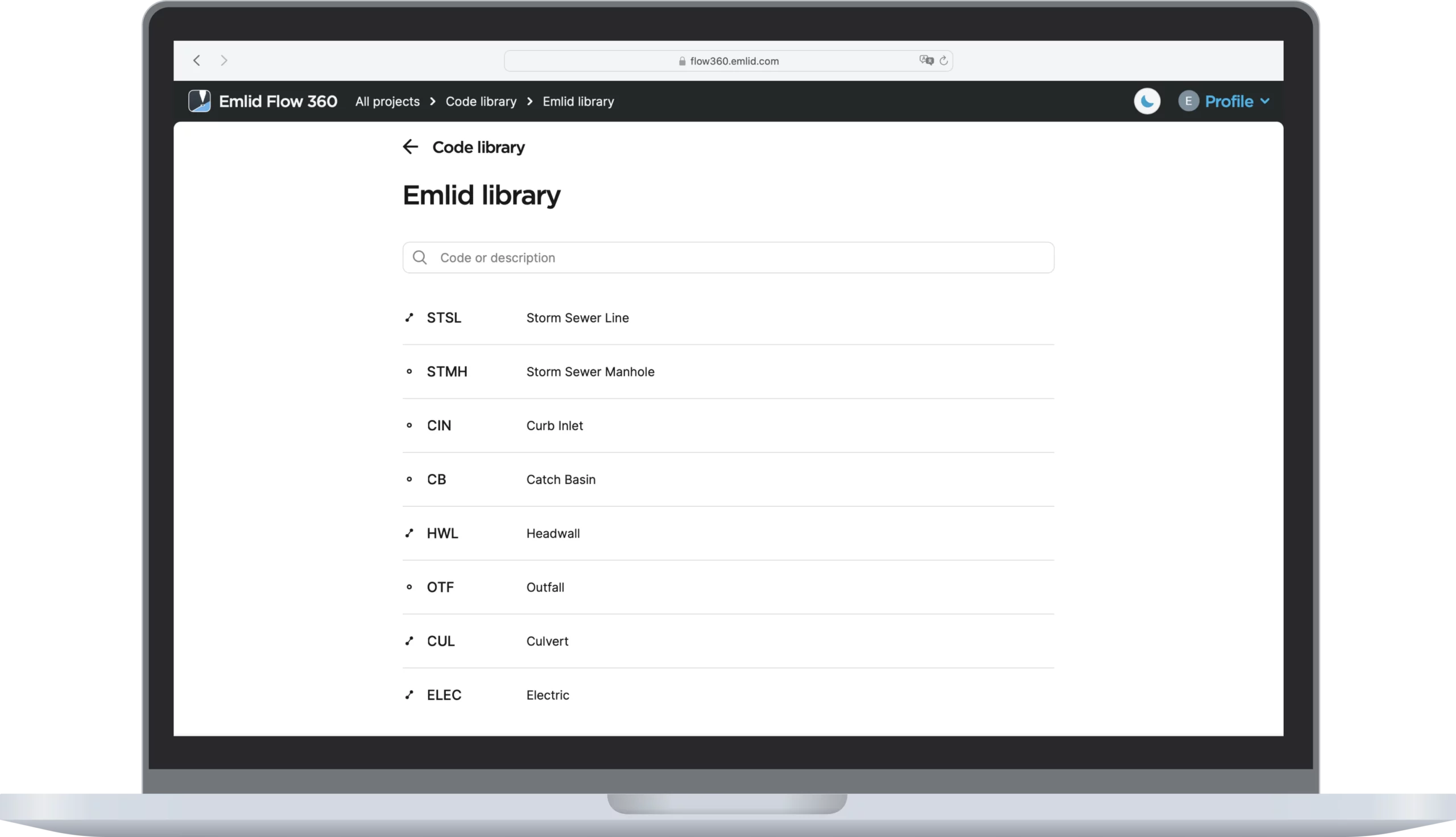
Coding
Quickly switch between different object codes as the whole library is at your fingertips at all times
To measure and describe objects, upload your custom code library or use a built-in one with more than a hundred codes. Easily create new codes on the fly right in your survey project.
Work with different
background maps
Upload topographic maps, cadastral plans, and aerial imagery from WMS and WMTS sources or work with a built-in satellite map.
Manage your projects in the cloud
The Emlid Flow app is synchronized with the Emlid Flow 360 service. This allows you to create and access survey projects, manage coordinate systems, and export and import data using both the mobile app and the cloud service at flow360.emlid.com.
CSV, DXF, and Shapefile
Manage your code libraries
Import your code library to Emlid Flow 360, and it is immediately available for your projects inside the Emlid Flow mobile app. No need to check if the latest version is on the collector, as it all syncs automatically.
The full list of features is available with the Survey subscription.
Try it in Emlid Flow 360 for $25/month.
The basic functions are available
with the Free version.
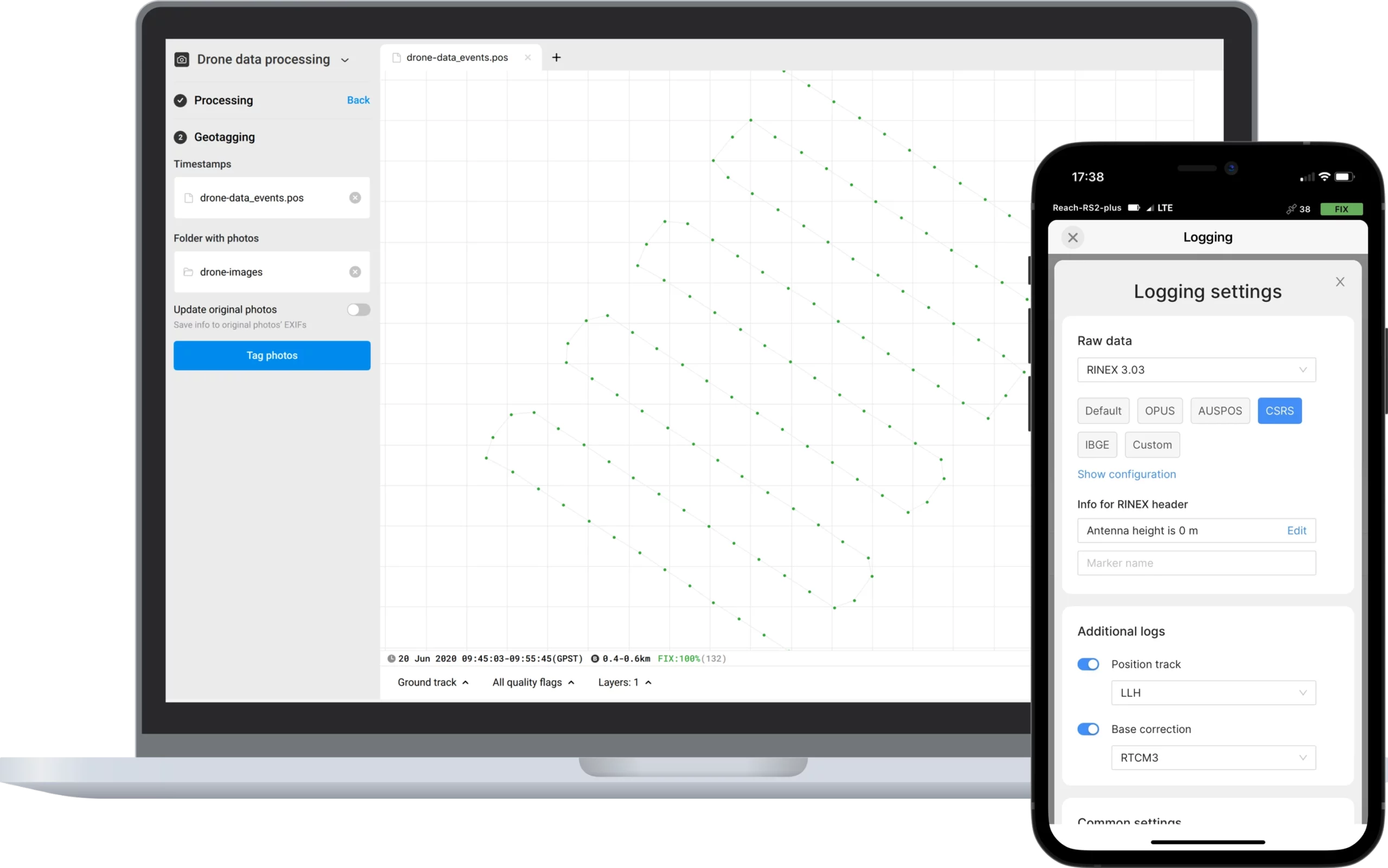
Log raw data in RINEX
Point collection and recording of raw data are independent processes and can be used simultaneously. RINEX logs are compatible with OPUS, AUSPOS, and PPP services, so you can get cm-precise results anywhere on Earth. For post-processing, you can use our free PPK software Emlid Studio.
Designed
for harsh conditions
Reach receivers are designed to work in challenging conditions, even in dusty areas and under the burning sun
-20 to +65 ºС
Working temperature. Isn’t afraid of either heat or cold.
IP67
Can be held 1 meter deep underwater for half an hour.
Up to
22 hours
Industrial LiFePO4 battery that doesn’t die of cold. Can charge over USB from a powerbank.
User reviews
Austin Chad Hill
The Reach system provides a novel approach to recording accurate landscape data. Reach RS can be used to record coordinates quickly and accurately using a system that is low cost and ultra-portable.

Archaeo Perspectives
Thanks to Reach, together with our partners we managed to record centimeter-accurate coordinates of archaeological structures as well as underwater features and produce valuable data for further research.
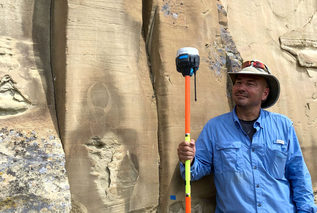
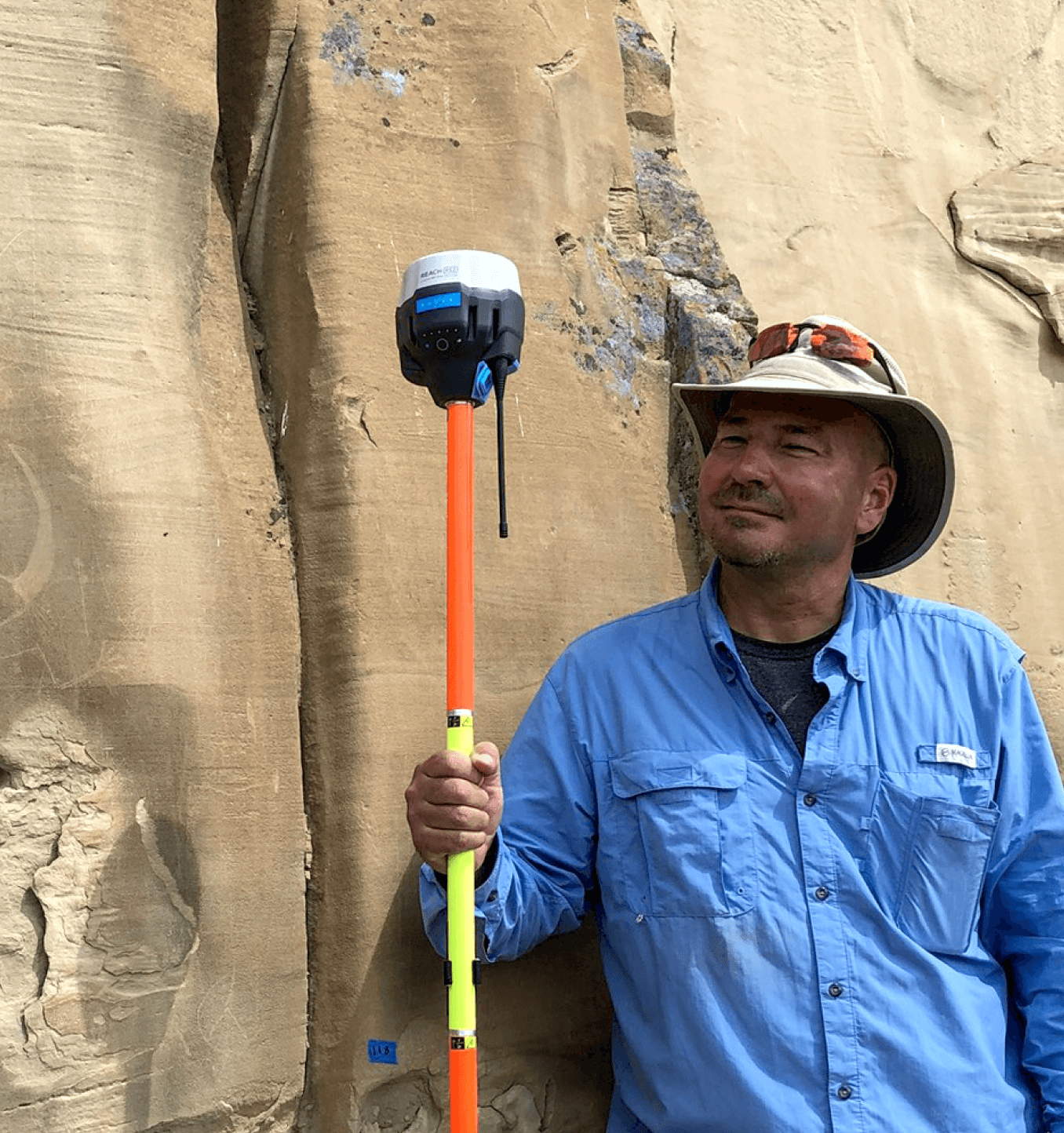
Mark Willis
We've also been using the RS2 for our archaeological studies of prehistoric petroglyphs. It's is perfect when we need highly accurate location information. It can keep a fix against a cliff wall!
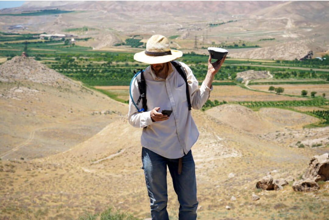
Peter Cobb
We use Reach for spatial recording during our archaeological fieldwork in Armenia. This equipment facilities data collection through its affordability and ease-of-deployment.
Reach
in the Emlid Store
The basic features of Emlid Flow are available for free to all Emlid users.
Shipping from Chicago
2-3 days by USPS Priority Mail Express
2-7 days by FedEx, UPS
Specification
135 kb
Mechanical
- Dimensions 126 x 126 x 142 mm
- Weight 950 g
- Operating tº -20 to +65 ºC
- Ingress protection IP67
Electrical
-
Autonomy
16 hrs as LTE RTK rover,
22 hrs logging - Battery LiFePO4 6400 mAh, 6.4 V
- External power input 6–40 V
- Charging USB Type-C 5 V, 3 A
- Certification FCC, CE
Positioning
-
Static
H: 4 mm + 0.5 ppm
V: 8 mm + 1 ppm -
PPK
H: 5 mm + 0.5 ppm
V: 10 mm + 1 ppm -
RTK
H: 7 mm + 1 ppm
V: 14 mm + 1 ppm - Convergence time ~5 s typically
Connectivity
-
Lora Radio
Frequency range
Power
Distance 868/915 MHz
0.1 W
Up to 8 km -
LTE modem
Regions
Bands Global
FDD-LTE: 1,2,3,4,5,7,
8, 12, 13, 18, 19, 20,
26, 28, 66
TD-LTE: 38,40,41
UMTS (WCDMA/FDD):
1,3,2,4,5,6, 8,19
Quad-band, 850/1900,
900/1800 MHz SIM card Nano-SIM -
LTE modem
Regions
Bands Global
FDD-LTE: 1,2,3,4,5,7,
8, 12, 13, 18, 19, 20,
26, 28, 66
TD-LTE: 38,40,41
UMTS (WCDMA/FDD):
1,3,2,4,5,6, 8,19
Quad-band, 850/1900,
900/1800 MHz SIM card Nano-SIM - Wi-Fi 802.11 b/g/n
- Bluetooth 4.0/2.1 EDR
- Ports RS-232, USB Type-C
Data
- Corrections NTRIP, RTCM3
- Position output NMEA, LLH/XYZ
- Data logging RINEX
-
Internal storage
16 GB
160+ days of logging at 1 Hz
GNSS
-
Signal tracked
GPS/QZSS L1C/A, L2C
GLONASS L1OF, L2OF
BeiDou B1I, B2I
Galileo E1B/C, E5b
- Number of channels 184
- Update rates up to 10 Hz
Have a question?
Ask our team
Email us at sales@emlid.com or fill in the contact form. Our application engineers will reply to you within a working day
(9:00-18:00 CET).

Direct Dial: +1 817 865 3334 (ex. 101)