Zero rework: how construction subcontractors win with GNSS
Construction is a business of tight margins. A misplaced trench, a slab poured at the wrong elevation, a retaining wall staked two feet off—these aren’t just field mistakes, they’re expensive ones.
Rework eats into profit, delays ripple downstream, and waiting around for a surveyor isn’t always an option. Here’s the shift happening on job sites: more subcontractors are picking up RTK GNSS receivers and doing positioning work in-house.
Not to replace their surveyor, but to reduce daily dependence on them. Routine checks, stakeouts, and as-builts that used to require scheduling a third party can now be done by your own crew, on your own time.
This article covers RTK GNSS for subcontractors and specialty contractors—what it solves, how it fits into daily workflows, and which Emlid tools to use.
1. Utility and wet utility
Installing water mains, sewer lines, storm drains, gas, and telecom infrastructure comes with a lot of precision pressure—and most of it happens underground. Once a line is buried, verifying its position gets significantly harder.
The typical pain points are: trench depths that don’t match design specs, pipelines misaligned by a few feet, and as-built documentation that’s rushed or inaccurate because it was done after the fact. Any of these can trigger expensive rework or, worse, future conflicts with other underground utilities.
RTK GNSS for subcontractors helps at multiple stages. Before digging, crews can:
- Stake out the designed alignment directly in the field, without waiting for a survey crew.
- During installation, they can check depth and slope in real time.
- After backfill, they can collect as-built data while conditions are still fresh, giving the general contractor (and future contractors) accurate record drawings.
- Also, an RTK receiver combined with a scanning app lets you create 3D models of open trenches to document and calculate volumes accurately.
Related reading: How to get precise 3D models in minutes
2. Earthwork
In earthwork, volume accuracy equals money. Mass grading, cut-and-fill, and building pad prep all depend on reliable terrain data from start to finish.
The problem is that earthwork sites change fast. A grade check that was correct on Monday may be wrong by Friday. Waiting for a survey crew slows the feedback loop, so equipment time and material quantities often get decided on rough estimates.
With a GNSS rover, crews can check grade as work progresses, run cut-and-fill checks, measure stockpile and excavation volumes, and stake reference points for operators. Progress gets verified in real time, using terrain data collected directly on site.
Related reading: The Reach RX2 for GIS and construction teams: simple and scalable data collection
3. Concrete
Concrete work is unforgiving. Once the pour happens, you’re committed. A column in the wrong spot, slab edges misaligned with steel, sleeves placed off-center—these aren’t just punch-list items. They mean cutting, patching, or full demolition.
Hand measurements of control points compound across large slabs and multi-story structures. Each transfer adds a little drift, and by the time you’re forming the fourth floor, that drift has a cost.
With RTK GNSS, crews can stake directly from the design file and verify critical layout points before forms are set or concrete is placed. Column locations, slab corners, embeds, and penetrations can be checked on the spot instead of relying on chained measurements from previous control marks.
Instead of transferring control across the slab, crews can return to the same coordinate system every time, reducing accumulated error and making sure each floor or section stays aligned with the design.
For large pours or complex layouts, that means fewer layout mistakes, fewer surprises during inspection, and far less rework after the concrete sets.
4. Paving
Paving work lives or dies on grade. A parking lot that doesn’t drain, an asphalt section that doesn’t tie into curb elevations, a base course that’s off by a tenth—these show up fast, and fixes are expensive.
Traditional grade control relies on stringlines and laser levels, which work fine on straightforward jobs. On larger sites with complex drainage patterns or multiple design surfaces, keeping everything tied to the same reference gets harder.
RTK GPS lets paving crews stake grade points and verify elevations directly against the design, without resetting control for every new section. Less setup, fewer hand-offs, more time paving.
5. Landscaping
Grading for drainage, locating irrigation infrastructure, and placing features that must align with architectural drawings leaves little margin for error. Get it wrong and you’re dealing with drainage problems, warranty callbacks, and disputes with the GC.
Phone GPS isn’t built for this kind of work. With errors of five to ten meters, a terrace, pond, or drainage swale can easily end up in the wrong place.
With RTK GNSS, landscaping crews can stake and verify design points with centimeter accuracy directly from the site plan. Pond edges, terraces, retaining walls, irrigation runs, and drainage features can all be laid out in the field without relying on rough measurements or guesswork.
For ecological designers and restoration crews, this is especially valuable. When you’re building rainwater-harvesting systems, infiltration basins, or terraces where water must move in a specific direction, accurate positioning ensures the finished landscape works exactly as designed.
Instead of discovering problems after the first rainstorm, crews can confirm grades and placement while the work is still adjustable.
Recommended setup for subcontractors and specialty contractors
Most subcontractors and specialty contractors need positioning tools that are quick to deploy, easy to learn, and reliable on active job sites.
The setup should support routine tasks like grade checks, stakeout from plans, and as-built documentation without adding complexity to the workflow. Emlid GNSS receivers are designed specifically to simplify these daily tasks.
1. Reach RX2
Reach RX2 is often the most practical starting point. It delivers centimeter-level accuracy with a simple setup and minimal training, making it well-suited for crews without a surveying background. The receiver pairs with a phone or tablet and works with the Emlid Flow app for data collection, stakeout, and field measurements.
Tilt compensation allows crews to measure points without keeping the pole perfectly vertical, which speeds up work around obstacles or uneven terrain. For corrections, RX2 can connect to a local CORS network over the internet, providing RTK accuracy without the need to set up a base station.
2. Reach RS4 Pro
For crews that require more advanced capabilities, Reach RS4 Pro provides additional flexibility for demanding survey and layout workflows. It supports complex survey tasks, integrates with external equipment, and works across multiple correction sources, including NTRIP over the internet, long-range LoRa radio links, and traditional UHF radio.
This allows teams to adapt to different site conditions, whether they are connecting to a CORS network, running their own base-rover setup, or working in areas with limited connectivity.
RS4 Pro also includes camera-based stakeout and data collection. Using visual positioning, operators can quickly identify and verify design points directly through the camera view, which makes it easier to locate points on cluttered construction sites.
This is particularly useful for hard-to-reach or hazardous areas—such as steep slopes, busy road corridors, or locations behind barriers—where physically walking to the exact point may be difficult or unsafe. By combining visual guidance with RTK positioning, crews can confirm locations more quickly while minimizing time spent in risky zones.
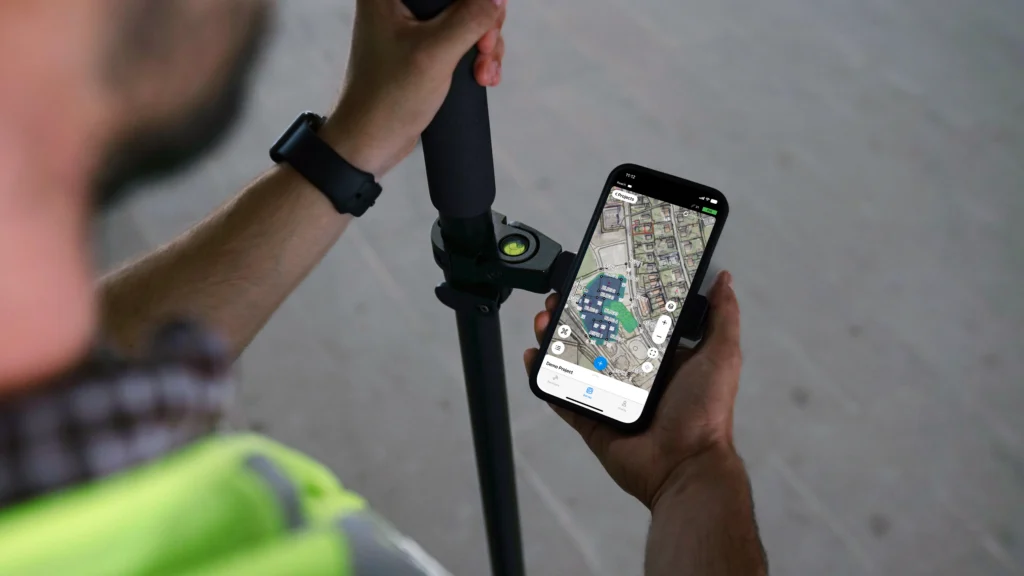
3. Emlid Flow
The Emlid Flow app supports both receivers and provides the main interface for fieldwork. Crews can import project data, including points and linework, and use the app to stake out design locations, collect site features, and verify positions directly from a phone or tablet.
Built-in maps, coordinate system support, and straightforward survey tools make it possible to work with design data and measurements without specialized surveying software in the field.
Collected points, lines, and notes are automatically organized within each project and synced to the cloud through Emlid Flow 360.
This allows office teams to view and manage the latest field data in real time, eliminating the need for manual file exports or transferring data between devices.
For most subcontractors, the choice comes down to workflow complexity:
- Reach RX2 + Emlid Flow: simple setup for daily positioning tasks on construction sites
- Reach RS4 Pro + Emlid Flow: expanded capabilities for teams handling more advanced layouts or hazardous sites.
Both setups give field crews the ability to verify work, document progress, and resolve positioning questions without waiting for a survey visit.
RTK GNSS for subcontractors and specialty contractors: more control on the job site
You don’t need to be a surveyor to use survey-grade tools. RTK GNSS is becoming part of everyday field workflows for subcontractors and specialty contractors who need fast, reliable measurements on site.
Tasks like grade checks, stakeout from design files, as-built documentation, and cut/fill verification can be handled directly in the field. The result is fewer surprises, less rework, and better control over schedule and costs.
Explore how Reach RX2, Reach RS4 Pro, and Emlid Flow help construction crews handle positioning tasks on site: