Reach RS3 GNSS receiver with IMU tilt compensation and UHF radio to work with other base stations
Table of content
- Reach RS3: a perfect tool to survey hard-to-reach points
- Land surveying equipment addressing all survey scenarios
- More than just surveying equipment: from companion app to entire ecosystem
- Real-world applications: Reach RS3 GNSS receiver with tilt compensation in action
- Order Reach RS3 from the Emlid Online Store
Reach RS3 is Emlid’s flagship RTK GNSS receiver with IMU tilt compensation. The most recent in the range land surveying equipment is engineered with a focus on the latest surveying technologies to ensure survey-grade precision even at large tilt angles. Explore the capabilities of Reach RS3.
Reach RS3 GNSS receiver with tilt compensation: a perfect tool to survey hard-to-reach points
The new Reach RS3 receiver enables surveying hard-to-reach points while keeping centimeter-level precision. Tilt compensation makes the Reach RS3 an ideal surveying tool for a wide range of projects with challenging environments on the site. Measure points at building corners, on the roadway, at the edge of an excavation, or even in the water.

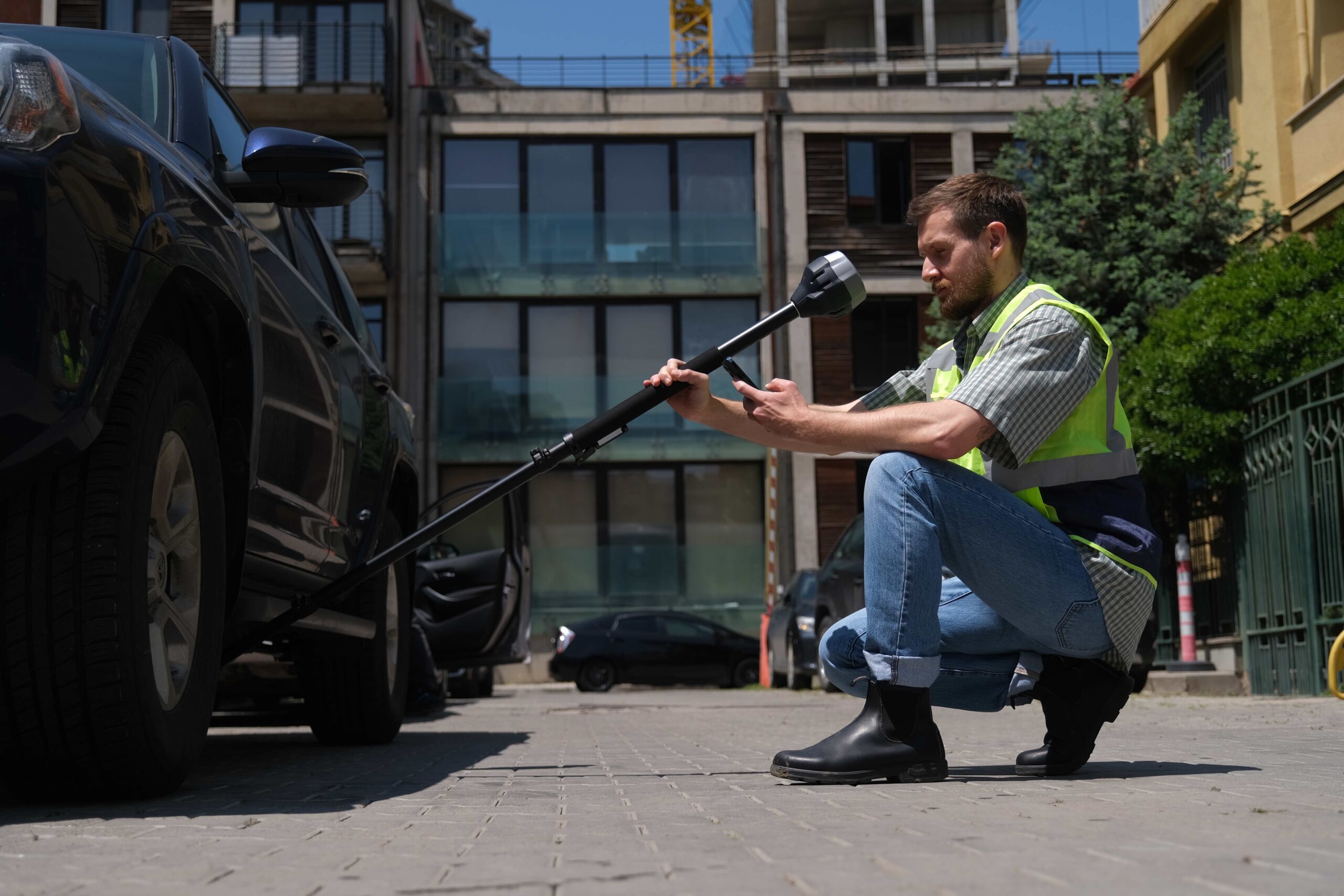
Each unit comes with an individually factory-calibrated IMU sensor and works right out of the box. Just start walking with the receiver or tilt it to initialize the compensation.
To make our surveying equipment meet the latest industry standards, we fitted Reach RS3 with the IMU sensor immune to electromagnetic interference—it simply doesn’t have a magnetometer, which usually accumulates errors from being affected by metallic objects, electronic devices, vehicles, etc. That’s why you no longer need to worry about possible sources of interference to get precise results.
Using tilt compensation is straightforward. Simply establish the RTK connection, get FIX, and orient the IMU sensor by rotating the receiver or walking with it. The Reach’s companion app, Emlid Flow, aids this process with an onboarding series and helpful hints. Learn more about tilt compensation in Docs.
Land surveying equipment addressing all survey scenarios
The Reach RS3 is a multi-band receiver that works both as a base and a rover. It gives you versatile options to receive corrections from an NTRIP service, another Reach over LoRa radio, or even a third-party base over UHF radio. So you can mix and match RTK receivers in your fleet. Besides, you can easily use your Reach RS3 as a base station for RTK drones with RTK drones via two options depending on the availability of an internet connection.
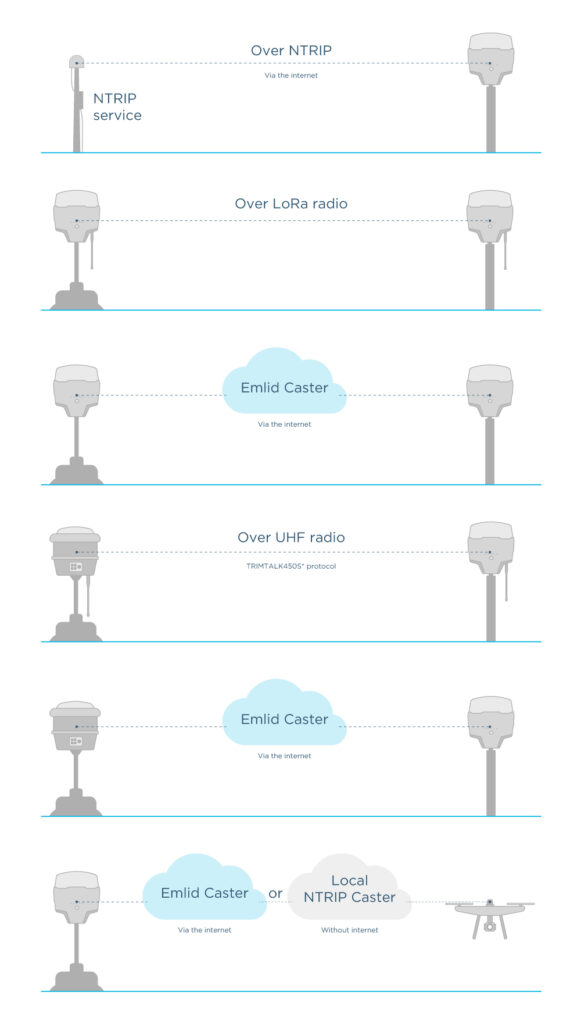
NTRIP connectivity
Surveying the urban area with a reliable internet connection? Receive corrections from an NTRIP service or any other GNSS receiver with Emlid NTRIP Caster. Keeping up with the trends, the Reach RS3 model allows receiving corrections over the internet via your mobile device’s hotspot or the built-in LTE modem. The range is over 60 km in RTK and 100 km in PPK.
Dual-band radio
Receive or send corrections between Reach receivers via LoRa radio. This works on line-of-sight distances up to 8 km and is perfect for areas without internet coverage for NTRIP.
To receive corrections in the RTCM3 format from a third-party base that communicates via UHF radio, use a built-in UHF radio that operates in the 410.0 – 475.0 MHz range and supports the TRIMTALK450S* protocol. This workflow requires an additional 410-470 MHz antenna, which can be purchased from the Emlid store.
RINEX logging and online post-processing services support
If you want to work in PPK or determine your local base coordinates using post-processing services, Reach RS3 is your option. The receiver logs data in the industry-standard RINEX format and makes logs compatible with OPUS, AUSPOS, and PPP services so that you can get high-accuracy results anywhere.
Up to 22 hours on 1 charge
With its industrial-grade battery, the Reach RS3 is well suited for nonstop operations collecting data all day long on a construction site or recording logs for PPK. The battery lasts for 22 hours of logging or 18 hours of operation as an RTK rover with tilt compensation. To charge on the go, just plug Reach into a power bank.
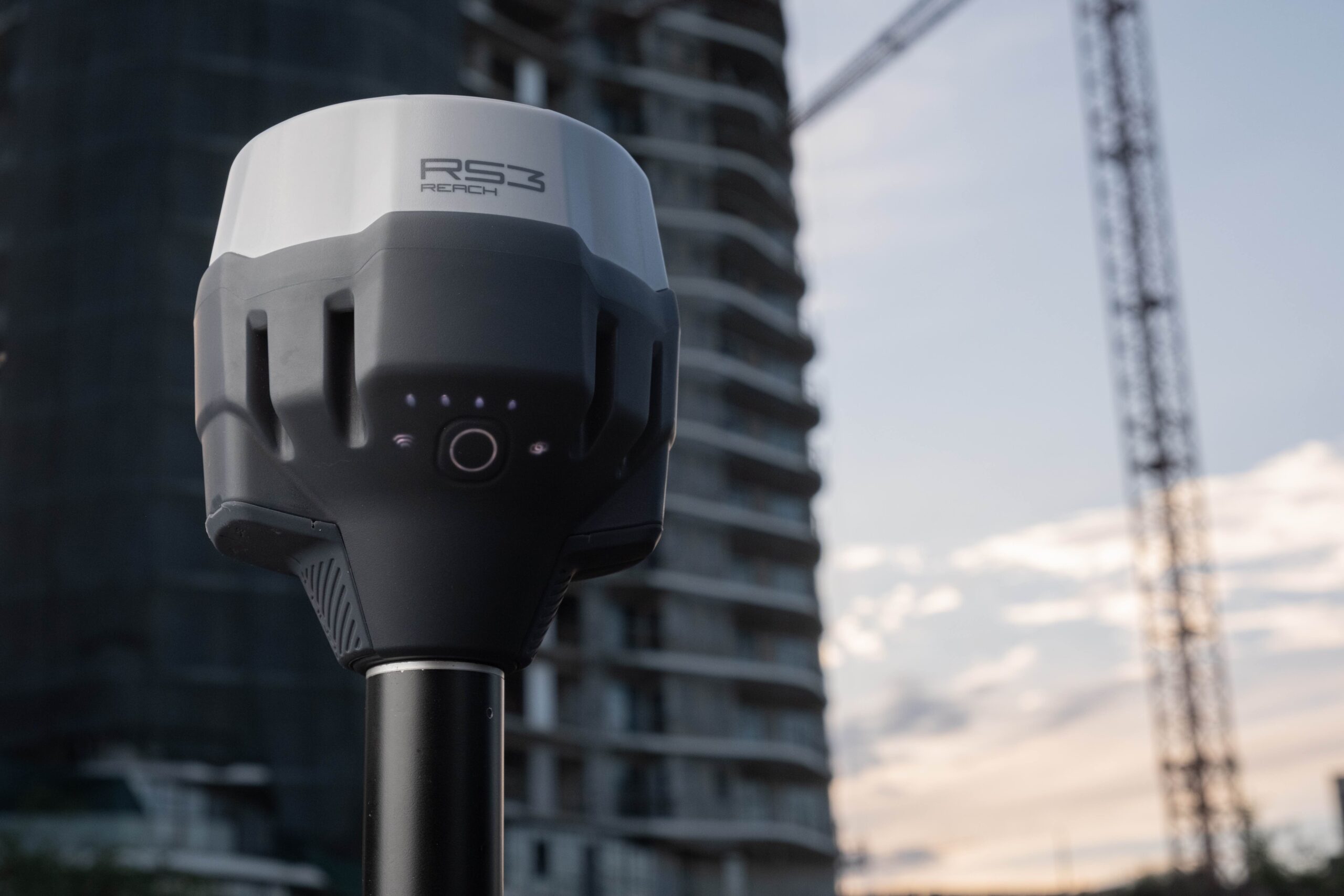
Compact and rugged design
Reach RS3 is 126×142 mm in size, fits in a small bag, and weighs 950 g—less than a typical survey pole. The elastomer-coated polycarbonate housing makes Reach RS3 impact-resistant. The receiver is rated IP67 dustproof and waterproof with an operating temperature range of -20° to 65° C (-4° to 149° F) which makes it ready for even the harshest conditions.
Explore all Emlid Reach RS3 features here.

More than just surveying equipment: from companion app to entire ecosystem
Reach RS3 comes with the mobile companion app—Emlid Flow, available both for iOS and Android. With Emlid Flow, you can fully configure your receiver, enable RINEX data logging, and handle all field-related tasks. The app can be synced with the cloud-based web app Emlid Flow 360 that helps you prepare and manage your projects from the comfort of your office via a browser.
To access additional surveying tools, you can subscribe to the Survey plan. It includes coding, linework, localization, background layers, stakeout reports, Traverse & Inverse tools, and other features coming all the way. A single subscription is valid for both Emlid Flow and Emlid Flow 360.
To get even more out of your Reach receiver, try Emlid NTRIP Caster and Emlid Studio for free. Emlid NTRIP Caster is a handy way to stream RTK corrections from your base to the rovers. If RTK is not an option for your survey workflow, you can post-process your data in the free PPK software Emlid Studio.
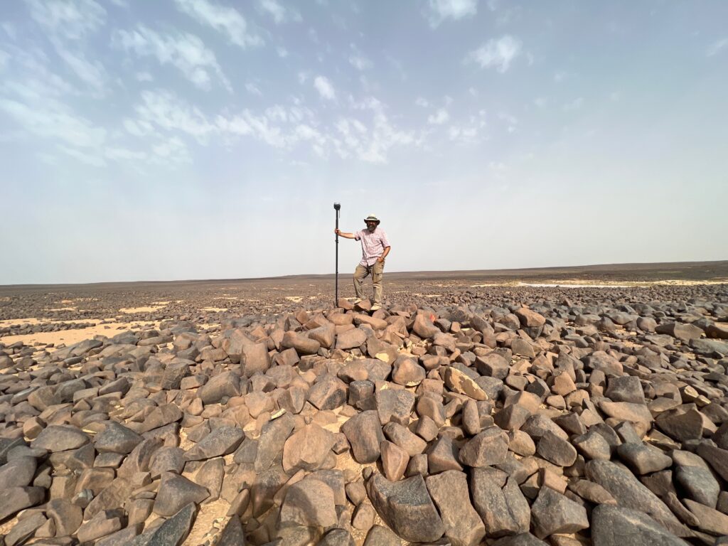
Real-world applications: Reach RS3 in action
When it comes to surveying with Reach RS3, it’s all about proven functionality enhanced with tilt compensation. This new feature has become a real game changer for our users who often work in challenging environments and look for ways to keep the accuracy of their projects at the best possible level.
Austin Chad Hill, Research Associate, Department of Anthropology, USA
All users agree that Reach RS3’s ease of use streamlines project work, saving time and effort while delivering accurate results.
*Trademark of Trimble Inc.
Order Reach RS3 from the Emlid Online Store
Try the all-new Emlid Reach RS3 yourself. The receiver is available for shipping today, order now at the Emlid Store. You can also order Reach RS3 from our official dealers—find your local dealer here.