More than Six Thousand Points over Four Days: Interview with Emlid User
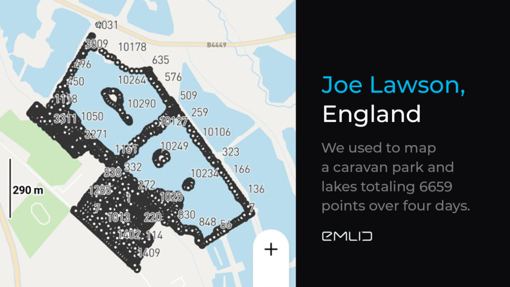
Meet Joe Lawson—owner and director of Arhwithrans Ltd. Arhwithrans Ltd provides all types of surveying services and often takes on non-paying work to help universities and other good causes. Check out the project Joe Lawson shared with us: mapping a caravan park and lakes with an overall size of around 190 acres.
—More than six thousand points in your last project. That’s impressive! Could you tell us a bit more about this?
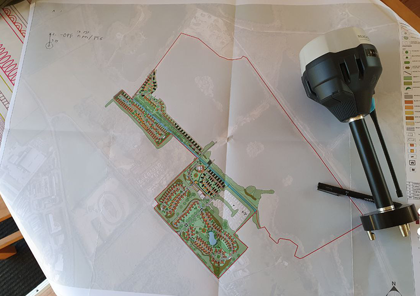
—On the first day, we set up control using a total station to put in fixed points to check back with the rovers each day. The base position was logged for 6 hours and post-processed against a local CORS. After that, we used to map the park totaling 6659 points over four days. All coding was done in ReachView 3.
—What could you say about the precision of your data?
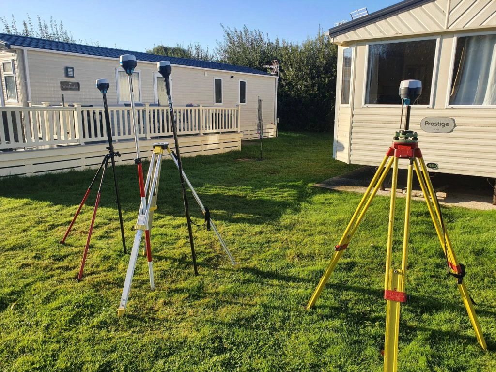
—At the start and end of each day, we placed the rovers over two fixed points and then checked the coordinates against those of the total station (the differences never were more than 15mm). This check was probably unnecessary, but it gave me peace of mind that all the rovers were measuring correctly and any human errors, such as staff height base position, had been eliminated before data was collected.
—Have you faced any difficulties?
—We did lose the LORA signal as we moved further from the base, but I fixed this by recording a point with my rover for 5 minutes. Then I moved the base to the new location and updated its position by reading its geographic coordinates from the point recorded with the rover in the ReachView 3 app. It was so easy and worked perfectly! We checked all three rovers against the fixed points after the base move, and all three were within the 15mm again.
—How did you process such a large number of points?
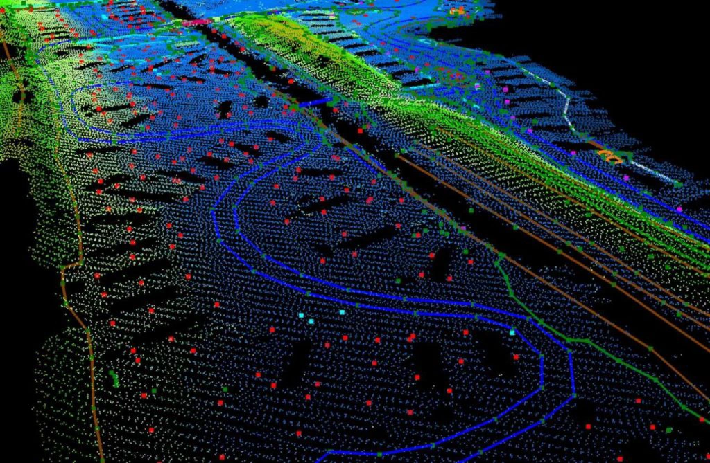
—Once all the data had been recorded, I performed a visual check by overlaying the points on top of our national LIDAR data set for the area. And they were all in the right place. As the coding had been done onsite, minimal drawing was required as the codes do the linework for you (we use a program called LSS).
—How was your experience with the Emlid equipment?
—All in all, we had spent two weeks onsite even using the Emlids, but we were surprised by the units’ ability and could get the job done in half the time! Honestly can’t say how impressed I was with the equipment, so were the guys who helped with the job.
Reach RS2+ / RS3 for Сentimeter Accuracy
The Reach RS2+ / RS3 provides you with high accuracy even when there are obstacles around. As a multi-band receiver, it is the ultimate solution for any kind of survey task. Reach RS2+ and Reach RS3 comes with a handy Emlid Flow app available for iOS and Android. Order your Reach receiver in the official Emlid Store or find a local dealer.