Mosaic 51 integrates Reach RS2+ to unleash precision in mobile mapping
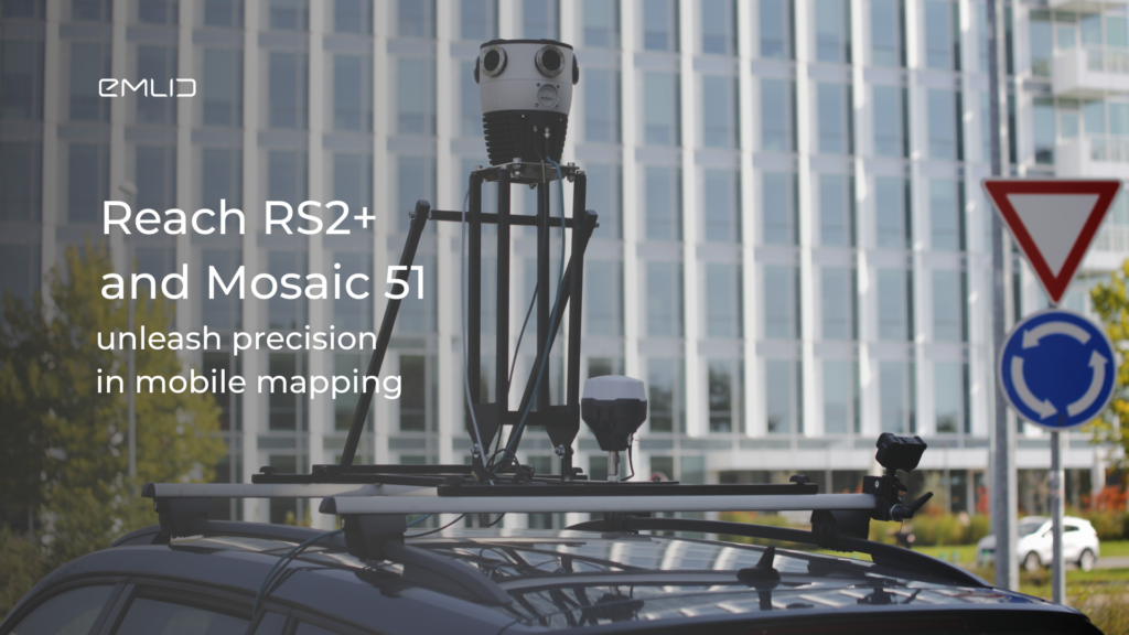
The Mosaic team has integrated Reach receivers with Mosaic 51 cameras to provide customers with the clearest image and centimeter-accurate positioning. See how Reach RS2+ and Mosaic 51 cameras are bundled to deliver high-resolution and high-accuracy mobile mapping.
When extreme image resolution meets centimeter-level positioning
With minimal connectivity limitations and easy setup, Reach receivers integrate perfectly with a variety of sensors, including drones, ground-penetrating radars, and laser scanners. The latest collaboration has allowed Reach RS2+ to be integrated with Mosaic mobile mapping devices.
Mosaic is known for revolutionizing mobile mapping with its 360° camera solutions. To enhance its cameras with precise positioning data, Mosaic has integrated them with Reach RS2+. This collaboration enables RTK for GNSS positioning of the captured imagery, providing highly accurate mapping results for surveying, GIS, infrastructure, and utility companies.


How surveyors benefit from the Reach RS2+ and Mosaic 51 bundle
One of Mosaic’s customers, Catsurveys of the UK, shared how they leveraged the Reach RS2+ GNSS receiver in combo with the Mosaic 51 camera. The decision to integrate both devices into Catsurveys’ operations was driven by the need to improve geolocation accuracy.
This enhancement is critical to providing high-quality data to their artificial intelligence asset identification tool and is expected to increase its success rate and assist in the collection of survey-grade data. Another benefit is the cost reduction of survey projects.
Read more about Catsurvey’s project with Mosaic and Reach GNSS.
Discover Reach capabilities for integrations
Reach receivers bring centimeter-level accuracy to a wide range of applications and can be easily integrated with cameras, UAVs, LiDARs, and other devices. If you develop or distribute any type of device that requires precise positioning, consider Reach for your projects. Feel free to contact us for more information on Reach specifications and Emlid partnership opportunities.