
 BLOG
BLOG
How GNSS technology enhances GIS projects with highly accurate data and faster workflows
Accurate positioning is crucial across many GIS industries, from city planning to precision farming. The application of GNSS in GIS allows professionals to collect spatial data with centimeter-level accuracy, streamlining decision-making and increasing overall efficiency. This article explores how GNSS systems improve project workflows, using real-world examples from urban infrastructure mapping, archaeology, and water conservation.
Why GNSS accuracy matters for modern GIS workflows
Not all GIS applications require centimeter-level accuracy. Tasks like mapping general features, such as store locations or service area boundaries, can typically be handled with the 3–5 meter accuracy provided by consumer-grade smartphone GPS.
However, many GNSS applications demand far greater precision. When documenting underground infrastructure, designing site-specific features, or conducting scientific research, sub-meter or centimeter-level accuracy becomes essential. In these cases, GNSS is used to provide the reliability needed to make data actionable.
Modern survey-grade receivers, like those from Emlid, make the use of GNSS more accessible than ever. With seamless integration into GIS tools like QGIS and ArcGIS Field Maps, professionals across disciplines are now using GNSS in GIS mapping to bring survey-grade accuracy to their everyday fieldwork.
Real-world experience using GNSS in GIS projects
Smart infrastructure mapping
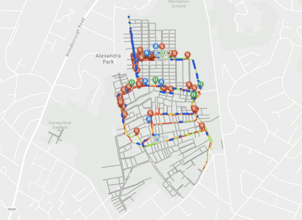
Semir Kahrimanovic and the Bozmaps team from England, UK, started digitizing a maintenance reporting system for a team that previously relied on paper maps. With no GIS background, they initially used mobile phones to tag geographic points and take notes via ArcGIS Field Maps.
However, due to the 3–5 meter inaccuracy of smartphones, especially near trees and hedgerows, the team struggled to precisely locate features—particularly underground utilities. Since smartphone GPS is designed for everyday civilian use, its limited accuracy makes it unsuitable for precise GIS tasks like locating underground infrastructure.

Emlid Reach GNSS receivers for utility mapping
To overcome this, Semir adopted the Emlid Reach RS2+ receiver. After training the team, they went into the field and began capturing accurate utility data.
“We increased the accuracy of our mobile mapping workflow by pairing ArcGIS Field Maps with Emlid Reach RS2+, and it was super quick and easy,” says Semir.
Using a standalone Reach RS2+, they achieved 10–30 cm (3.9 to 11.8 inches) accuracy. With RTK corrections, accuracy improved to 1–2 cm (sub-inch).
This application of GPS in surveying drastically improved the clarity of infrastructure records, reduced time spent on data collection, and enabled more professional field reporting.
Locating ancient Maya ruins
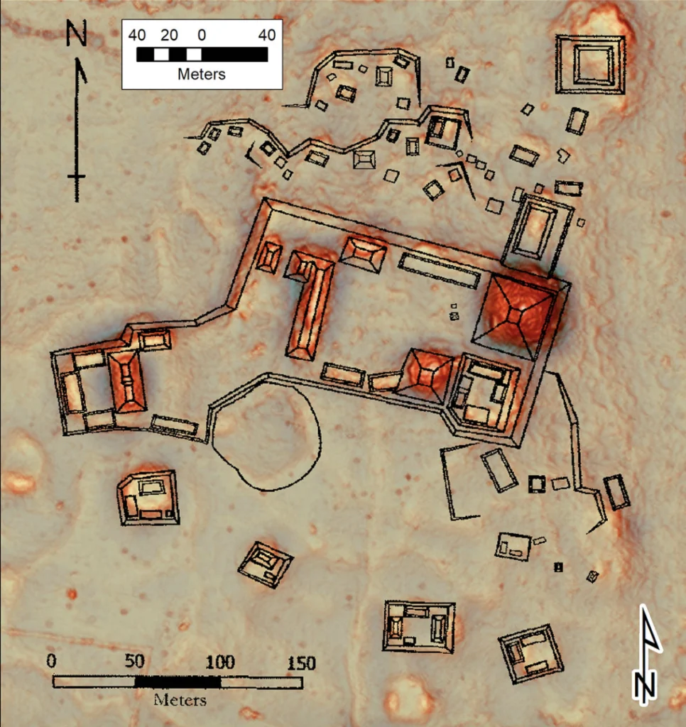
Mark Willis is an archaeologist and independent researcher who collaborates with universities and renewable energy companies across the globe. For his work, especially in drone-based LiDAR mapping, he relies heavily on Emlid GNSS equipment like the Reach RS2+ and Reach RS3 receivers. One of his primary applications involves flying LiDAR-equipped drones over dense jungle in Central America to detect Maya ruins hidden beneath the canopy.
This thick canopy prevents a good connection between the base station and the drone, so he uses PPK instead of RTK corrections with his Reach base station to achieve high accuracy on his 3D models.

a Zenmuse L2 LiDAR
“I use the Reach RS2+ as a base station and the Reach RS3 as a rover. The jungle is so dense that sometimes RTK doesn’t go far, but the base station just keeps recording. With the PPK and Emlid equipment, it’s easy,” says Mark.
In excavation work, Mark sets up accurate control points using the OPUS post-processing service. His team then lays out strings and nails to grid the site. These control points are accurate enough to reference years later, enabling long-term studies.
This shows how the application of GNSS systems is essential in archaeology—both for mapping subsurface topography and maintaining accurate excavation records.
Designing water storage systems
Nick Steiner works in water cycle restoration, designing interventions like ponds and berms that manage rainwater flow. He relies on QGIS to analyze catchments and flow paths, then transitions to field design using the Emlid Reach RX.
“Thanks to the Reach RX, we can design directly within the landscape,” says Nick.
Before adopting GNSS, Nick’s team used phone GPS with several meters of inaccuracy, which made precision planning nearly impossible. Now, with the application of GPS in surveying, his team designs directly on-site with confidence.
This is a great example of how GNSS can be used to improve design efficiency and data accuracy even in landscape architecture.

GNSS benefits go beyond accuracy
While centimeter-level accuracy is a key feature, the uses of the GNSS technology in GIS extend much further. Here’s how:
- Simplified field data collection: GNSS-integrated apps like QGIS and ArcGIS Field Maps let users collect accurate data on the go. So, no more guesswork or manual corrections.
- Increased efficiency: Teams move from manual tools like flags and paper to real-time mobile mapping—receivers use wireless connections for easy setup.
- Flexibility and ease of use: Equipment can use open-source and proprietary software, and is intuitive enough for teams without a surveying background.
These applications use GNSS to unlock smarter, faster, and more scalable GIS workflows.
Try Reach GNSS receivers for your GIS projects
From archaeological digs to infrastructure surveys and water design, Emlid’s Reach GNSS receivers are widely used in surveying that requires precision, speed, and reliability.
If your GIS projects rely on accurate spatial data, it’s time to use GNSS systems like the Reach RX or Reach RS3. These receivers are trusted by professionals in fields that collect spatial data in various industries.
Whether you’re a conservationist, archaeologist, engineer, or city planner, Emlid offers the receivers used by professionals worldwide. Use GNSS in your next GIS project—and experience the impact of accuracy.
Related products
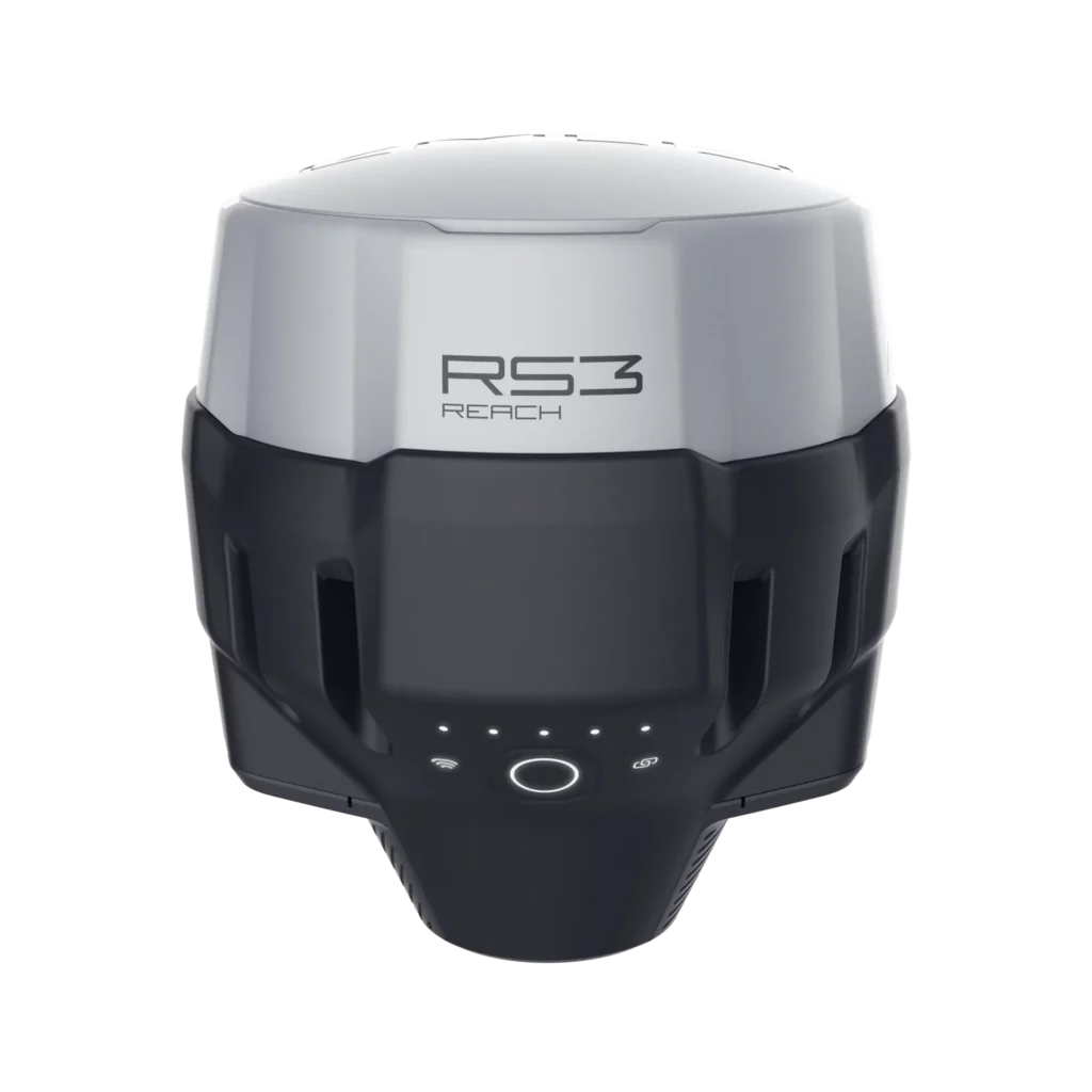
Reach RS3
Survey grade RTK GNSS receiver with tilt compensation.
Acts as a base or rover.

Reach RX
Easy-to-use, lightweight, and compact RTK GNSS rover for GIS and surveying.

Reach RS2+
RTK GNSS receiver with centimeter precision for surveying and mapping.