Reach RS4 and RS4 Pro GNSS receivers: built for large-scale construction and demanding fieldwork
Large-scale projects demand high precision, no matter the conditions, and efficiency at every stage. The new Reach RS4 and Reach RS4 Pro GNSS receivers were built for exactly these challenges: to boost productivity without adding complexity.
The RS4 is a robust GNSS receiver that brings an upgraded tilt experience, improved satellite tracking, and flexible radio options. The RS4 Pro builds on that with dual cameras for augmented reality stakeout and visual point capture. Whether you’re setting control points, working on a construction site, or mapping an inaccessible area, the new Reach family gives you more options and fewer obstacles. All resulting in an increased efficiency in the field.
So, let’s walk through what makes RS4 and RS4 Pro GNSS receivers different, what they’re made for, and what early users have to say.
Better performance in tough environments
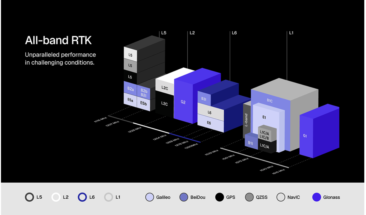
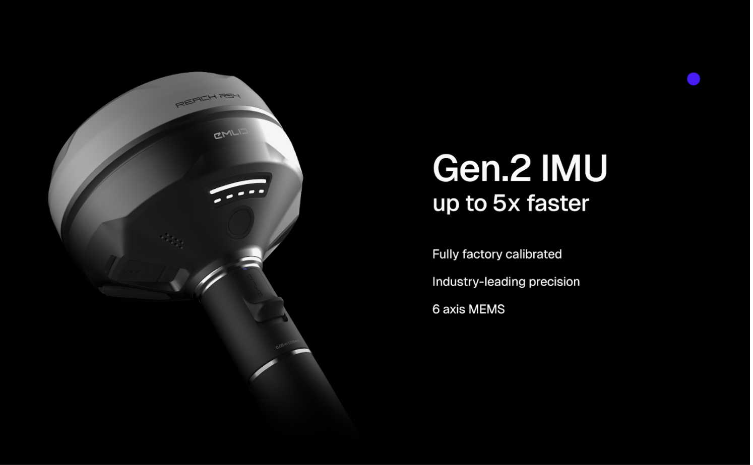
At the heart of both the RS4 and RS4 Pro is a new antenna and GNSS chip that supports L1, L2, L5, and L6 bands across all satellite constellations. That means faster and cleaner signal reception, stronger multipath rejection, and steadier performance under tree canopy and in urban canyons.
“The RS4 Pro is really going to fit into all industries because it has all the features. The improved signal reception and the antenna… that’s going to be a big difference in just reception under tree canopy.”
Joe Douglas, E38 Survey Solutions, US
The all-band RTK capabilities make the RS4 and RS4 Pro especially useful in urban environments, forestry, and infrastructure surveys, where satellite signals are often obstructed.
High precision, no matter the tilt
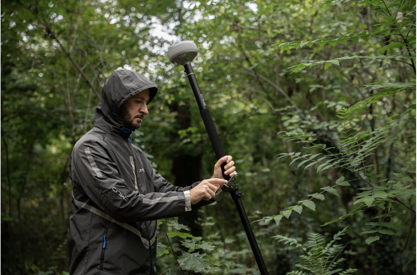
The RS4 generation introduces a refined tilt compensation system that delivers reliable accuracy even at steep angles and a faster initialization time. For example, at a 30° tilt, the Reach RS4 delivers 18 mm precision. Initialization takes just a few quick movements and remains stable throughout the job—no manual recalibration needed.
The receivers are factory-calibrated and resistant to interference from nearby vehicles or metal structures.
Tilt-based measurements at steeper angles can be affected even by the smallest wobble. The custom-designed quick release mount solves the issue with a fast and rock-solid connection between the receiver and your survey pole. It ensures the receiver is locked firmly to a pole, eliminating backlash for reliable data quality. This design gives users more freedom without sacrificing accuracy.
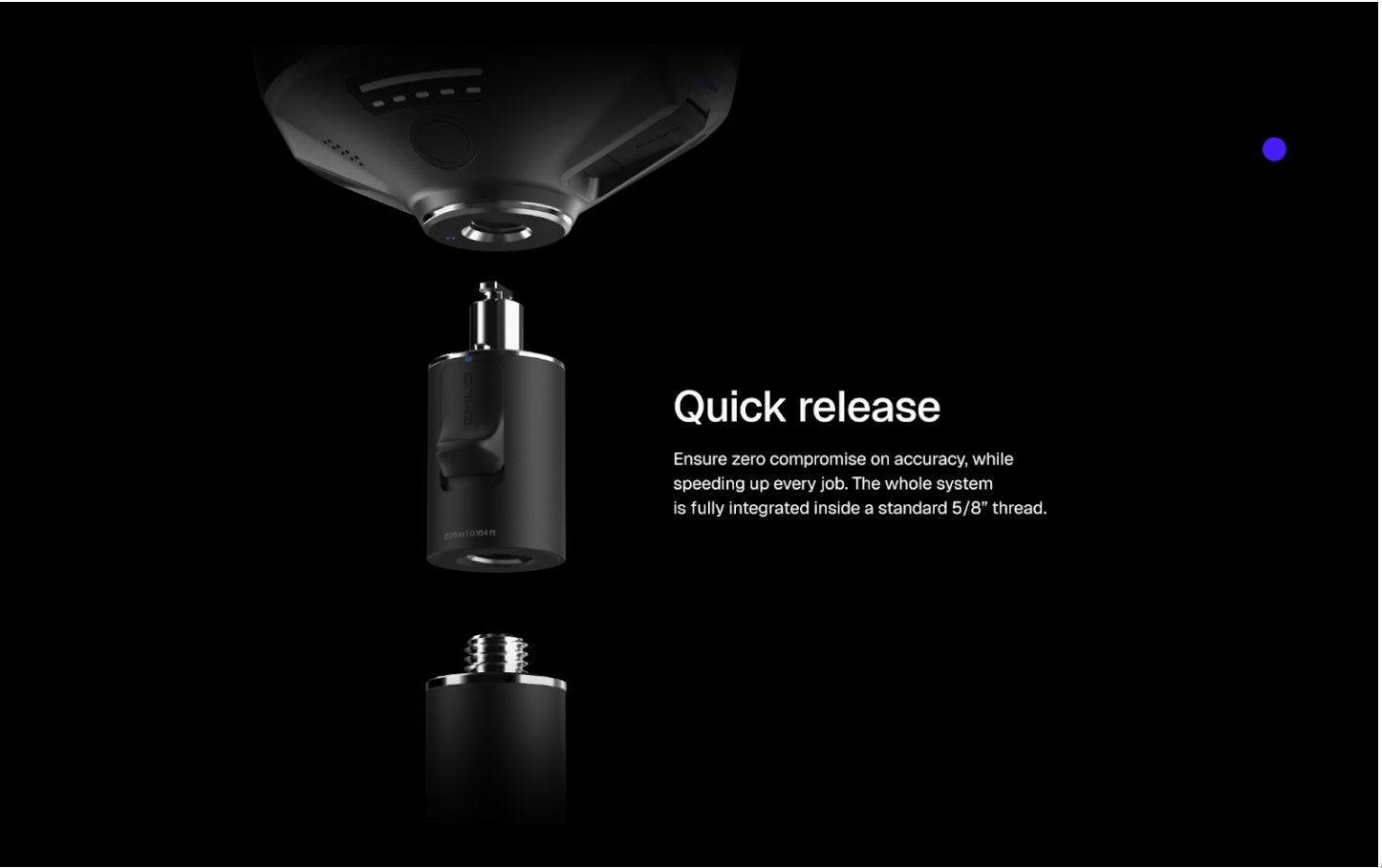
“You see the quick release… it’s something that is a dream coming true. This will allow all our users to use it quickly, attach it, remove it, connect it on a pole.”
Mateo Gismondi, Pix4D Japan
Super fast and safe workflows with the RS4 Pro camera vision
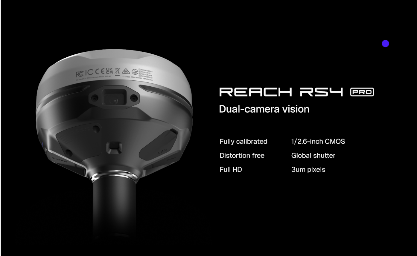
The Reach RS4 Pro camera vision is designed for faster and safer surveying on complex sites. AR-assisted stakeout anchors the design in the live scene for better navigation, no matter the terrain. Visual RTK allows your team to capture unreachable points, keeping the crew out of hazardous zones. This way, the RS4 Pro also introduces a new way to survey and keep field operations efficient in high-stakes environments like mining, large-scale construction, and more.
AR-assisted stakeout
The dual camera system overlays your design on the live camera feed, helping you find stake points faster, even on cluttered construction sites or roads. You navigate visually, no need to rely on abstract coordinates alone.
As you move, the front camera enables dynamic navigation that updates in real-time, providing clear distance, direction, and approach cues. Also, as you close in, the interface snaps to a bottom-camera-powered auto bullseye, centering the target for effortless fine placement.
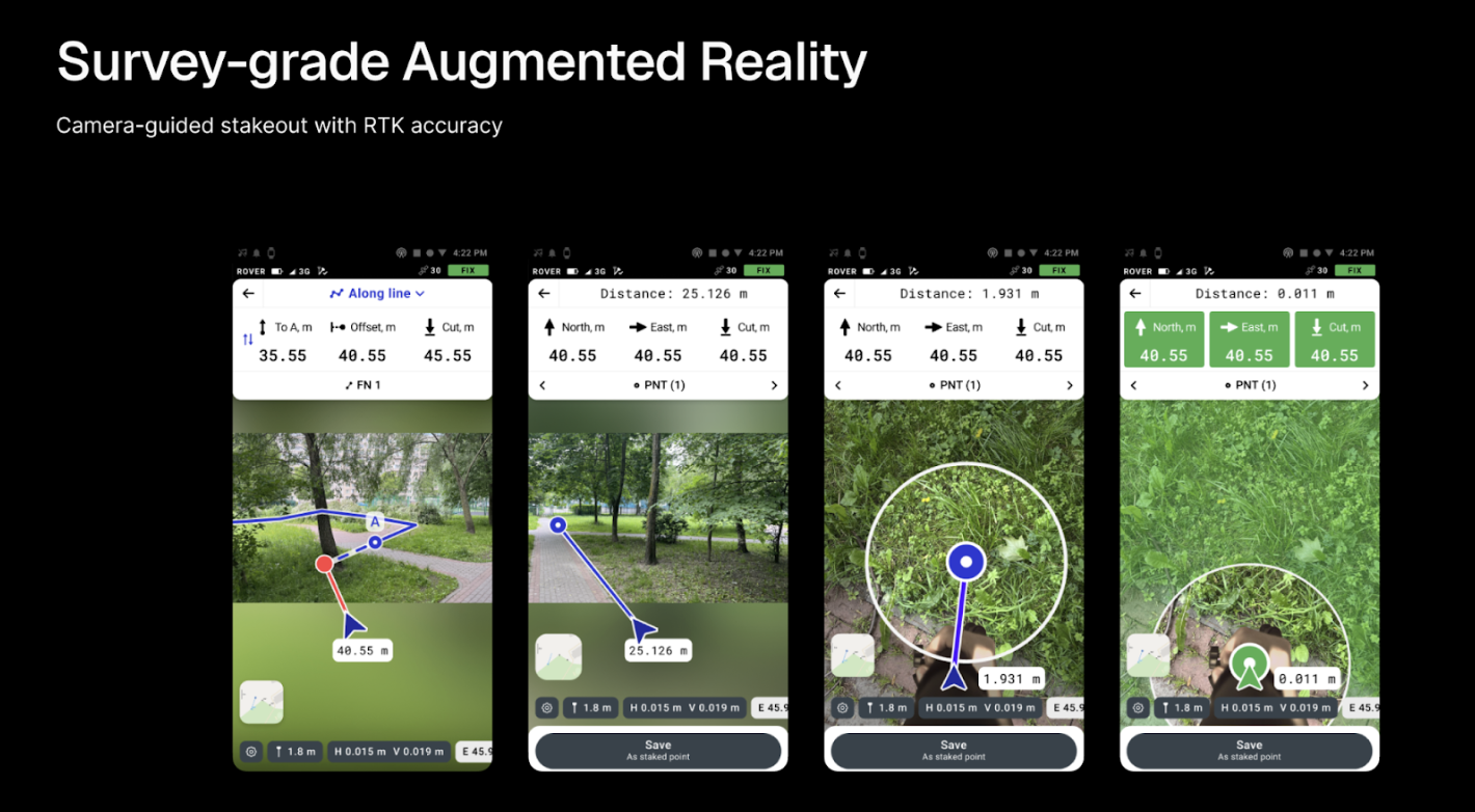
“With the new AR feature, it’s even faster to stake out points. On huge projects, there’s a real difference in timing.”
Lennart Stollberg, MOST Robotics GmbH, Germany
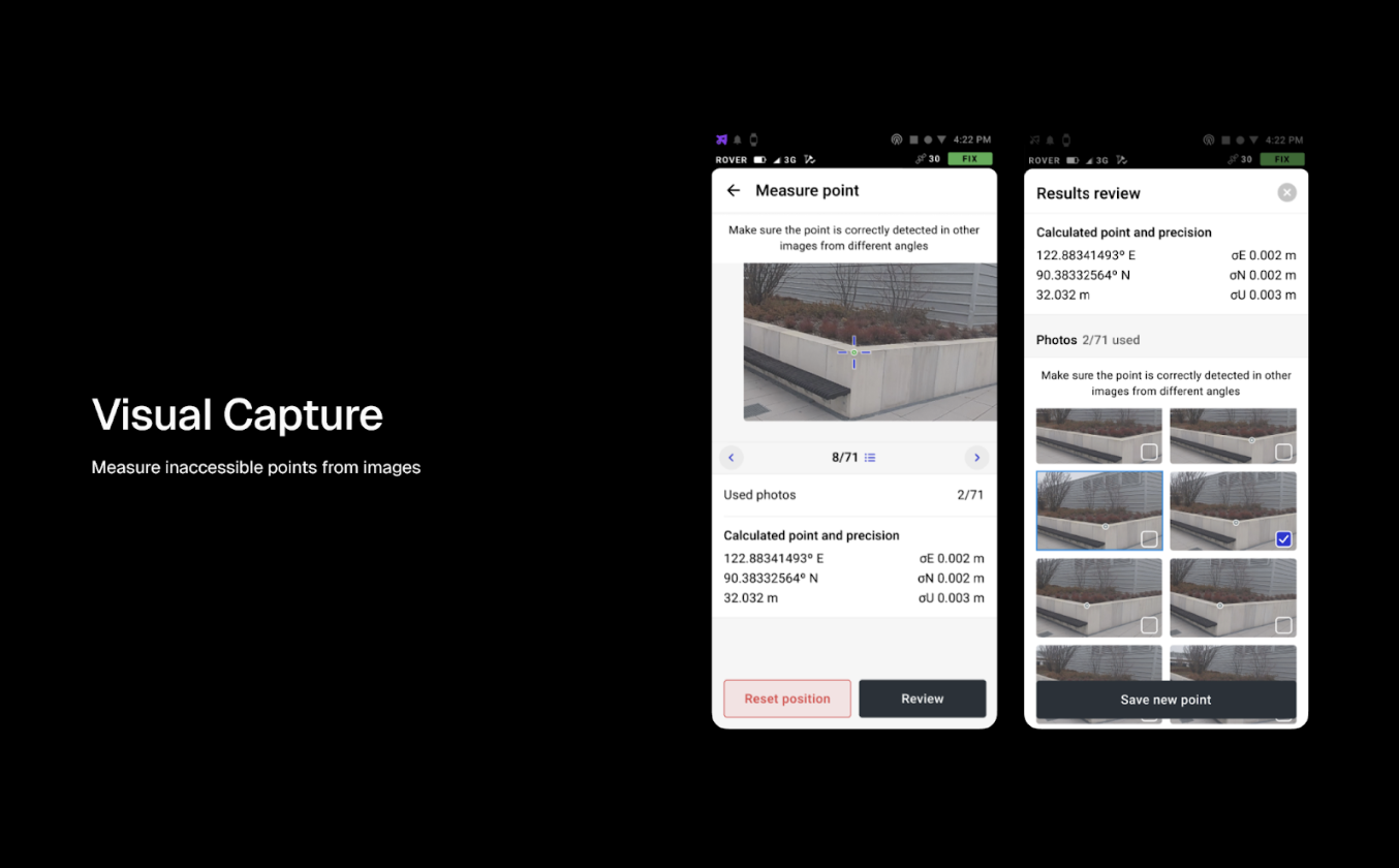
Visual point capture
The RS4 Pro’s camera also helps you measure points you can’t reach directly: behind fences, across a ditch, over water, on unstable slopes, excavation edges, busy roads, or in other no-go zones.
Thus, with visual RTK, the system records video for 3D modeling. Using RTK and IMU data, it processes spatially aligned images to create geo-referenced 3D models.
When you mark a point on the image in the Emlid Flow app, the algorithm calculates its 3D position by triangulating multiple views and assigns precise coordinates.
Also, for the best results, review the detected point in the captured images. Usually, a few pictures are enough, and the app will guide you through it.
This workflow ensures faster, safer data collection without compromising accuracy.
Despite the advanced tech inside, the RS4 Pro keeps things simple. That means both seasoned professionals and newer team members can confidently use the same equipment, scaling your projects faster, without extra training.
“Really easy to learn, and you don’t need to be a surveyor to start using it. We had a job where we needed to collect a point under a tree or below a fence. Before, we had to use total stations. Now, this just becomes part of the workflow.”
Ugurtan Akyurek, Mangoesmapping, Australia
Emlid dual radio for more flexibility on a jobsite
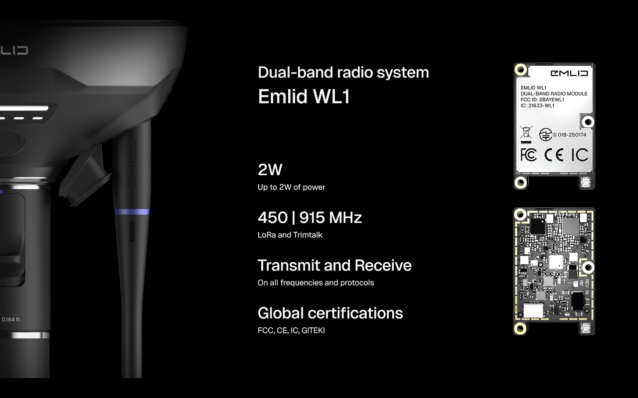
The RS4 series also introduces two-way UHF and LoRa radios to send and receive RTK corrections. The new system allows you to choose the radio setup that fits your workflow and regional regulations.
- UHF 450 MHz works with third-party gear over the TRIMTALK 450S (trademark of Trimble Inc.), and transmits at up to 2 W. Keep in mind that UHF requires compliance with local licensing rules.
- LoRa 915 MHz is license-free and low power, ideal for working with other Emlid devices. Its transmission power can be up to 1 W, and it’s pre-determined considering local regulations.
You can quickly switch between modes in Emlid Flow. This flexibility is useful for jobsites with changing conditions or hybrid fleets.
Built to handle long days and rough conditions
Both RS4 models come with thoughtful updates that make them even more field-ready:
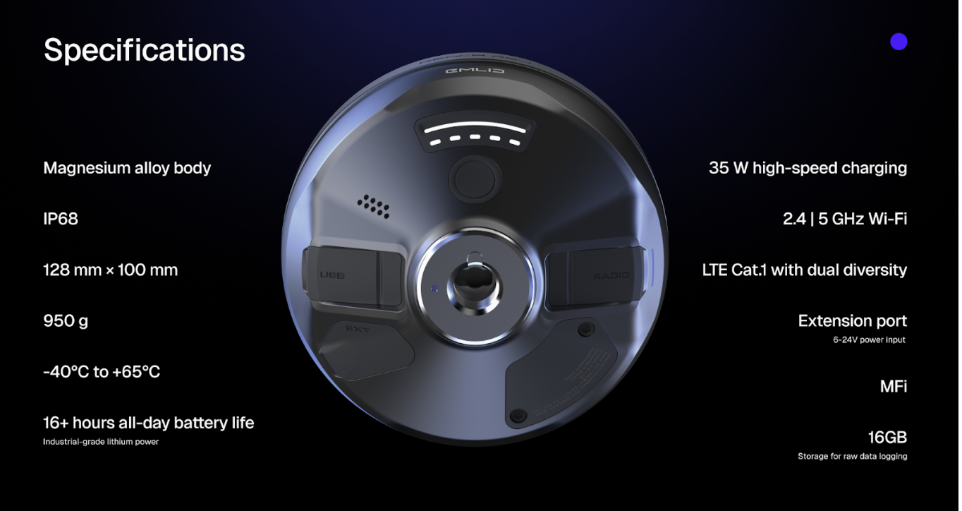
- Magnesium alloy body offers exceptional strength without the extra weight. It’s rugged enough for demanding job sites—and light enough for all-day use.
- Protective replaceable bumpers are designed to handle knocks, drops, and everyday field use.
- With an IP68 rating, it’s completely sealed against water and debris.
- Battery life is long enough to log data for two working days. Powers up via USB-C or plug in a power bank on the go—maximum uptime, minimum hassle.
“Compact, affordable, easy to use: best of class.”
Alistair Hart, Mangoesmapping, Australia
Efficiency at every stage of large-scale projects
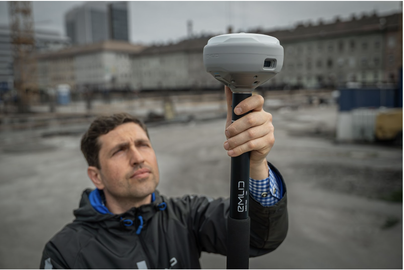
The Reach RS4: your go-to rover and reliable base station
The Reach RS4 is engineered for versatility and precision in real-world conditions. Use it as a rover for countless applications, from GIS and construction to archaeology, environmental research, and beyond.
Do you need a base? The RS4 seamlessly pairs with both Emlid and third-party receivers, making it an ideal choice for coordinating multi-receiver workflows and for drone mapping projects.
The Reach RS4 Pro GNSS receiver: speed and safety for complex environments
When you’re working on large-scale construction or mining sites, the RS4 Pro is an all-in-one tool for every project stage:
- environmental assessments and wetland surveys on rough terrain,
- recording site features and laying out designs on large sites,
- earthworks in hazardous areas,
- as-builts near machinery and barriers.
Thus, with visual point capture, you can measure locations that are physically out of reach—no need to set up a total station or enter a hazardous zone. The AR stakeout workflow guides your crew directly to each point with on-screen directions, saving time and eliminating guesswork across vast or complex sites.
Also, these features are built to improve your bottom line. By speeding up stakeout, reducing risk, and unlocking more flexible data capture, the RS4 Pro helps your team work faster, safer, and more efficiently.
Ready to boost your projects’ efficiency? Pre-order the new Reach receivers.
Versatile receiver and ideal base station. Maintains precision under the canopy and in urban areas.

Powerful rover for fast and safe surveys with AR guidance
and visual data capture.