
 BLOG
BLOG
Choose the Emlid Reach receiver that fits your survey job
Every survey team, construction crew, and GIS specialist works differently—and has a different idea of the perfect setup. Some need a rugged all-rounder that works anywhere. Others want the lightest rover they can grab and go. And some are ready to push further with vision tools, especially when working in spots with hard-to-reach objects. Let’s compare the Reach RS4, Reach RS4 Pro, Reach RX2, and Reach RS3 receivers—what’s new, what they share, and how to choose the one that fits your workflow best.
Reach RS4 and RS4 Pro, extending what versatility means
Ensure reliable precision even in harsh conditions, take advantage of versatile workflows, and ease your job with visual aid when opting for Pro.
Use cases:
- The Reach RS4 rover handles utilities, infrastructure, and topo surveys anywhere. As a base, it pairs seamlessly with Emlid and third-party receivers for coordinated workflows, including drone mapping.
- Use the Reach RS4 Pro on large construction and mining sites where access is limited, safety constraints are common, and timelines are tight.
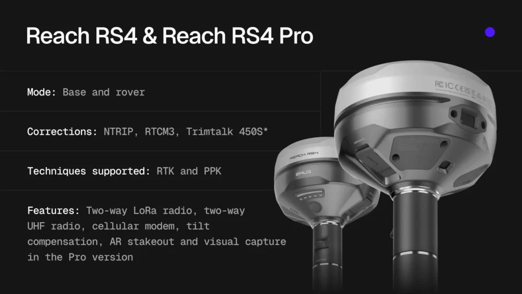
The Reach RS4 and Reach RS4 Pro models are true all-rounders. The receivers offer enhanced signal tracking, integrated two-way LoRa and UHF radios, and dual cameras in the Pro version, providing visual guidance. Let’s break it down.
Precision under canopy with advanced IMU and radios
The Reach RS4 series introduces the L5 band, offering faster, cleaner FIX, and enhanced multipath resistance under canopy and in urban canyons. L5’s wider signal bandwidth, higher transmit power, and dedicated pilot channel strengthen tracking in obstructed or noisy environments.
To further enhance data reliability, the receivers provide a second-generation IMU that provides smooth tilt compensation. The initialization takes just 7–10 seconds. Additionally, you can opt for the quick-release mount, which locks the receiver to the pole, minimizing micro-movement and maintaining accuracy even at higher tilt angles.
To expand communication capabilities, the RS4 and RS4 Pros feature updated LoRa and UHF radios for two-way corrections. UHF allows integration with third-party equipment via the Trimtalk 450S* protocol. The adjustable output power of up to 1 W and 2 W helps you stay compliant. The receivers ship with region-appropriate power limits and channel plans preconfigured in most regions. Depending on your local jurisdiction, a license may still be required for UHF operation.
For those interested in integrating with third-party GIS apps, the Reach RS4 connects natively and reliably to iPhones and iPads, and pairing on Android is just as smooth. Both models work seamlessly with ArcGIS Field Maps, Survey123, QuickCapture, and other leading GIS and mapping apps through standard NMEA output over Bluetooth.
Finally, the new form factor features a magnesium-alloy body with optional protective bumpers, providing exceptional strength—rugged for tough sites yet lightweight for all-day use.
Both the RS4 and RS4 Pro share these core features, while the Reach RS4 Pro takes them to the next level.
Reach RS4 Pro’s cameras for tight timelines and no-go zones
The RS4 Pro is designed for teams working on large construction and mining projects with restricted access, safety regulations, and tight deadlines—where every minute counts and reliability is non-negotiable.
RS4 Pro’s dual integrated Full-HD cameras enable visual workflows that standard GNSS receivers can’t. With AR stakeout, you see your target point directly on the live camera feed, guided by on-screen arrows even near obstacles, traffic, or restricted areas. With visual point capture, you measure locations that are out of reach or unsafe to approach. The result is faster layout, safer crews, and reliable measurements—especially in environments where precision and efficiency are critical.
AR stakeout
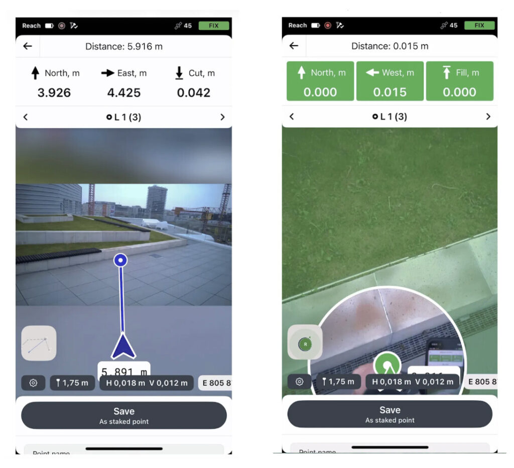
With augmented reality stakeout, your design isn’t trapped on a map—it’s placed right in the world around you. Whether the site is bustling or the area is new, every staked location is clear and easy to follow. As you move, the front camera provides real-time guidance—distance, direction, and approach cues. The interface snaps to a bottom-camera bullseye as you close in, centering the target for precise placement. At the same time, the live cut/fill indicator displays elevation differences at a glance and lets you confirm specifications before marking.
Visual capture
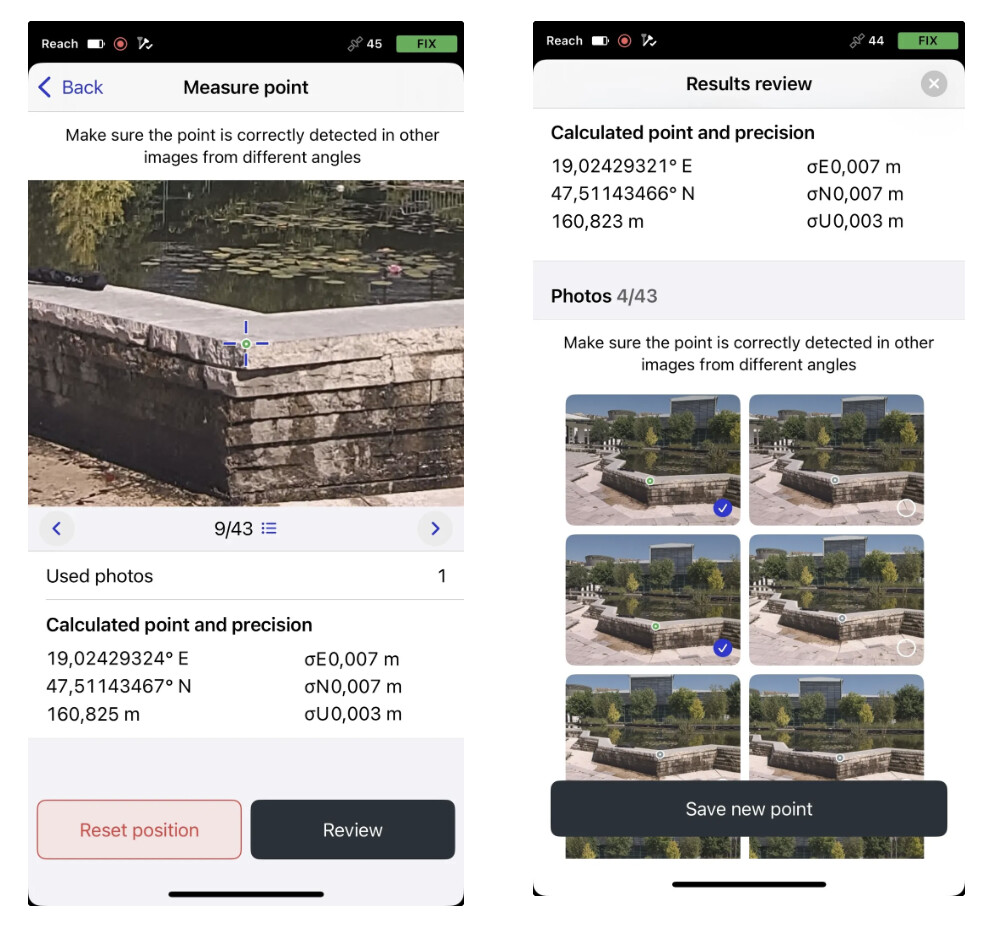
With the visual capture option, the receiver’s camera and the Emlid Flow app turn into a measuring tool. It shines in situations where getting close just isn’t possible. The option fuses centimeter-level RTK with camera vision to measure from photos when you can’t set the pole on the point. Capture the scene, review the point in the image in Emlid Flow, and let the algorithm calculate its precise coordinates. Visual capture brings the advantages of centimeter-accurate photogrammetry to your everyday field work—now you can do it on the go.
From steep pit walls in mining and stockpiles in quarries to busy roads, fenced areas, and unstable ground on construction sites, it lets you measure safely from a distance.
Reach RS4 vs Reach RS4 Pro
In short, both the Reach RS4 and Reach RS4 Pro redefine what field efficiency looks like—from fast, all-band precision to vision-powered workflows that expand how and where you can measure.
Use the Reach RS4 Pro on large construction and mining sites where access is limited or safety constraints are common: tunnels, facades and bridges, areas behind fences or traffic, and locations across water. AR stakeout speeds up layout and cuts errors. Visual capture eliminates the need for a total station or entering hazardous zones.
The Reach RS4 features everything that the RS4 Pro has, except AR and visual data capture. The RS4 is built for teams that need robust RTK performance and centimeter-level accuracy in any environment. Without visual guidance, you can survey the way you always have, just faster and more reliably. Whether you’re mapping utilities, documenting infrastructure, or collecting topographic data in forested, rugged, or urban areas, the RS4 delivers consistent, survey-grade results every day.
When used as a base, RS4 pairs seamlessly with both Emlid and third-party receivers, making it ideal for coordinating multi-receiver workflows and powering drone mapping projects.
Easy operation in any conditions with Reach RX2
Grab, connect, and measure. Centimeter-level accuracy at any tilt angle and in any environment, zero setup, and seamless app integration. Perfect for non-surveyor crews jumping between projects.
Use case:
The Reach RX2 handles daily fieldwork in urban canyons, dense forests, and more, supporting rapid data collection and stakeout required for construction and GIS work.
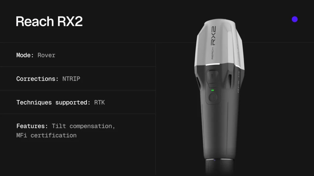
The Reach RX2 is best for fast-moving field teams that switch between sites and require dependable, centimeter-level RTK without complex setup or additional steps. It’s a smart fit for utilities, GIS, telecom, construction, water management, and environmental research.
The receiver is preconfigured. Connect RX2 via your phone’s internet to a CORS or NTRIP service, get a FIX, enable tilt compensation, and start collecting. No training is needed. That’s why many crews can equip field staff and supervisors (not just surveyors) with the RX2 units, making it easy to scale across multiple teams.
The RX2 tracks all major constellations across multiple bands, including L5. This enables fast, clean fixes and strong multipath resistance, which is essential in canopy environments and urban canyons.
The teams or members can measure accurately even when the pole isn’t perfectly vertical—near walls, in tight corners, or under overhangs. The factory-calibrated tilt engine resists interference from nearby metal. Additionally, you can get the advantage of the quick-release mount, which locks the receiver firmly to the pole to maintain accuracy at high tilt angles.
The Reach RX2 drops right into your GIS stack. Apple MFi certification means native, reliable connections to iPhones and iPads, and pairing on Android is just as quick. With Emlid being an official Esri partner, the RX2 works seamlessly with ArcGIS Field Maps, Survey123, and QuickCapture for data collection. The receiver pairs with PIX4Dcatch on LiDAR iPhones for survey-grade 3D capture and works with other mobile scanning apps that support external RTK.
One ecosystem for field and office
Control. Configure. Collaborate. The Emlid Flow mobile app runs your Reach receivers, and, together with the Flow 360 web app, allows easy data management for end-to-end surveying with your team.
Emlid Flow is the control center for every Reach receiver, bringing configuration and setup management into a single mobile app. Connected with Emlid Flow 360 on the web, it forms a unified ecosystem that supports multi-user collaboration, consistent project configurations, synchronized field and office data, and end-to-end survey workflows.
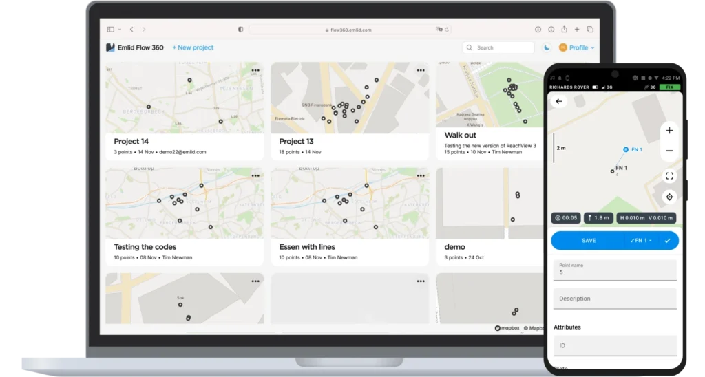
With Emlid Flow 360, you can ensure that everyone collects data under the same standards and settings:
- Add and manage all team members from a single workspace. Every team member works under your plan and automatically gains access to its features.
- Use default project settings to control what your team sees and uses, and share additional data, such as NTRIP profiles, localization settings, code libraries, and more, to maintain consistent setups.
- Keep clear data authorship—every object in a project records who collected or added it.
- Import geometries and reference data such as surfaces and CAD drawings.
Once setup is complete, your team continues in Emlid Flow, which supports every survey task:
- Capture reliable survey and control data with coded attributes.
- Lay out design features with offsets and verify their elevations.
- Run QA checks or update your data immediately in the field using the COGO tools.
- Calculate local coordinate system parameters or adjust the existing one to fit control points in your area.
As new data is captured in the field, it appears automatically in your Flow 360 project back in the office—no manual transfers, no delays.
Together, Emlid Flow and Emlid Flow 360 form a complete, closed-loop workflow that connects the office and field. Continuous data exchange and unified project configurations make the workflow consistent, efficient, and less prone to errors. The survey workflows available to you in the apps depend on the selected plan, either Free or Survey.
How to pick a model that is truly yours?
Ask yourself:
- How bad is my sky view? Do I need to work in urban conditions or under the thick foliage? In these types of challenging environments, the new-gen RX2, RS4, or RS4 Pro would be your choice.
- Which setups do I use? If you need a rover, opt for the easy-to-use RX2. If you need a versatile receiver that can serve as a base or rover, choose the RS3, RS4, or RS4 Pro.
- Do I need an AR stakeout to ease navigation or visual capture to capture hard-to-reach bundles? If so, the RS4 Pro is your ultimate choice.
- Is portability and simplicity the priority? Then the RX2 is a go-to solution for you.
- What’s the payoff between cost and productivity?
Ready to choose your receiver? Dive into the robust breakdown comparing each Reach receiver against your specific needs, and let your next field day become smoother with the Emlid Reach receiver.
| Criteria | Reach RS3 | Reach RS4 | Reach RS4 Pro | Reach RX2 |
|---|---|---|---|---|
| Industry focus | Individual surveyors, small surveying businesses | Utilities, infrastructure, topo, general construction | Large-scale construction, mining, and high-demand fieldwork | Construction, utilities, GIS, landscaping, asset mapping |
| Surveying conditions | Reliable GNSS in mixed environments | Any locations, including rugged, forested, and urban sites | Complex/limited-access sites, hazardous or restricted areas | Areas with good mobile/NTRIP coverage |
| Setup | Base or rover | Base or rover | Base or rover | Rover only |
| Connectivity | LoRa radio, UHF for reception only, network NTRIP corrections | LoRa and UHF radios with region-aware power and frequency, network NTRIP corrections | LoRa and UHF radios with region-aware power and frequency, network NTRIP corrections | Network NTRIP corrections |
| PPK support | RINEX logging | RINEX logging | RINEX logging | N/A |
| Hazardous-zone and speeding up stakeout options | IMU tilt compensation | 2nd-generation tilt compensation; robust all-band reception | 2nd-generation tilt compensation; robust all-band reception; visual guidance and capture for hard-to-reach points | 2nd-generation tilt compensation; robust all-band reception |
| Learning curve | Low–medium | Low–medium (familiar RTK workflows) | Medium (adds visual capture workflow) | Low (zero-setup) |
| Budget | $$ | $$$ | $$$$ | $ |
Order your Reach online

Versatile receiver and ideal base. Maintains precision in both canopy and urban areas.
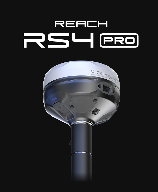
Powerful receiver for fast and safe surveys with AR guidance and visual data capture.
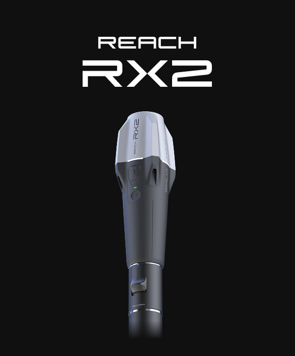
Perfect RTK rover for GIS teams. Stays centimeter-precise even at high tilt angles.
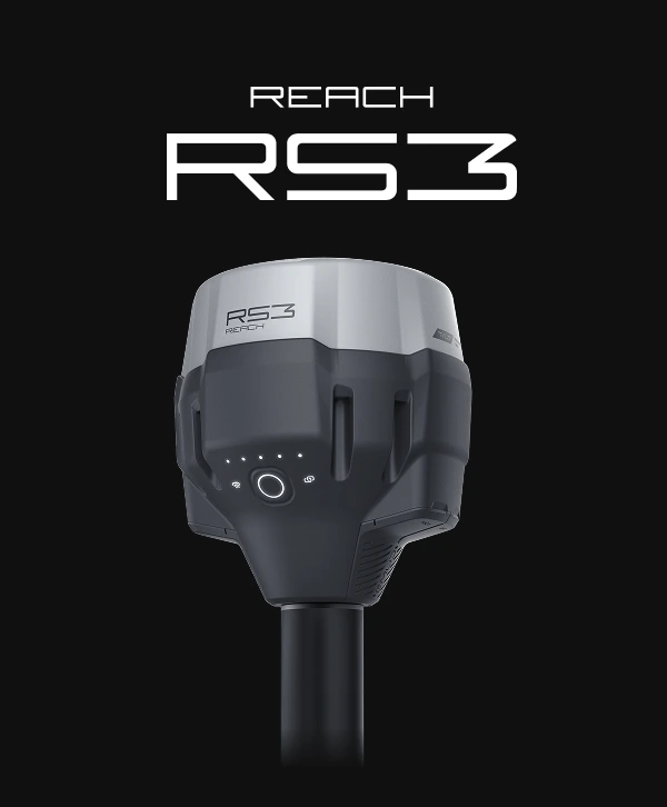
Versatile and budget-friendly base or rover receiver with all must-have features.
*Trimtalk is a trademark of Trimble Inc.
Which unit works with the DJI Matrice 4T? Considering SAR and wildlife vs survey?
Hey Jenny!
The Reach RS4 works well with DJI RTK-enabled drones, including the Matrice 4, and provides reliable positioning accuracy. You can explore the RS4 capabilities here https://emlid.com/reachrs4/