What Factors Influence Drone Mapping Accuracy
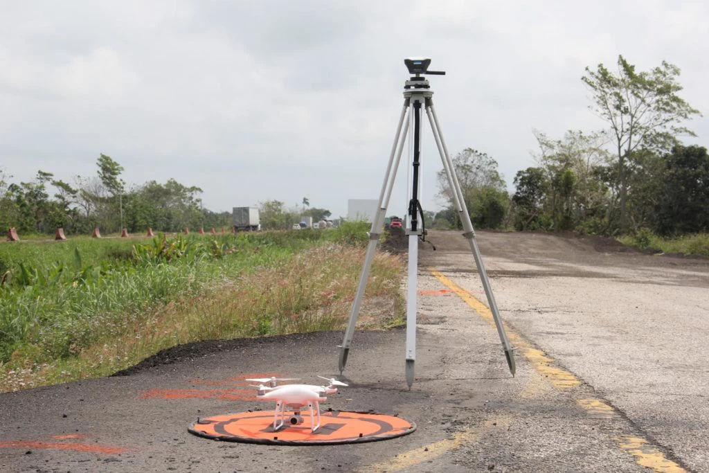
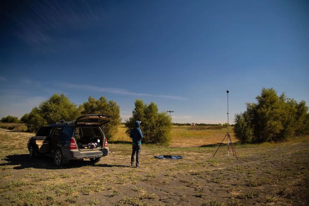
Quite often drone pilots consider delivering not just aerial imagery, but mapping projects. Here, newcomers usually face the stumbling block of accurate georeferencing images to real-world coordinates. At this point, Real-Time Kinematic (RTK) comes into play.
With the RTK technique, drone pilots can achieve centimeter-accurate positioning as the UAV receives the GNSS corrections during the flight. There are multiple RTK-ready drones on the market, but a drone on its own doesn’t guarantee survey-level accuracy. Beyond the aircraft itself, mission parameters, environmental conditions, and the number and placement of Ground Control Points all play a role in mapping accuracy.
For those who are starting out in drone mapping, here is an overview of the basic factors to wrap your head around. In case you want to dive deeper into the topic, feel free to discuss all the accuracy factors on the Community Forum or with our dedicated support team.
Mission Parameters
If your contract requires a certain level of cm accuracy, you will want to think about several mission parameters to achieve it. Image resolution, altitude, and image overlap must be part of your thought process when creating accurate maps.
Simply put, higher resolution imagery will produce better data. To achieve it, you should use a camera with a high pixel resolution. A minimum required resolution is 12 megapixels with 20 megapixels being ideal. The camera resolution, as well as the altitude you fly, strongly affect the accuracy.
If you choose to fly higher, you can cover larger areas in less time but with less accuracy. Flying lower will take longer but significantly improve the results. For this reason, flying lower is your best option for improved mapping accuracy.
Another mission parameter you should consider is the overlapping of images. In general, the greater overlap prevents possible gaps in the imagery occurring due to rotations of the camera, tilt, flying height, and terrain variations. Flight times increase as you have more overlap, but it is worth it for greater accuracy. A good starting point is at least 60% side and 75% front overlap, with up to 85% overlap for challenging cases.
Environmental Conditions
Weather conditions and obstacles are two environmental considerations that should concern you when looking for accurate UAV mapping.
Whenever possible, avoid flying on days with strong winds, dense or rolling cloud formations, or smog. While many drones can fly in high winds, it is best to avoid winds greater than 7 meters per second (15 mph).
When mapping in or near cities, avoid tall structures such as skyscrapers and other high constructions in the “Urban Canyon.” Buildings can block GNSS signals and cause multi-path interference leading to inaccurate data.
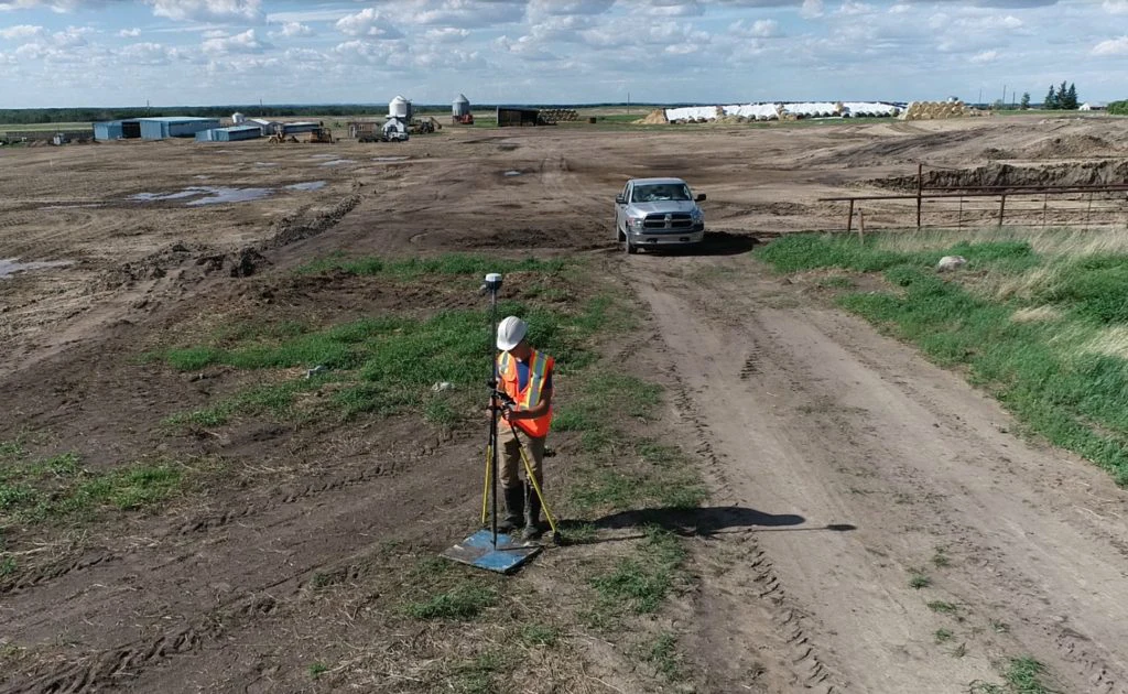
Ground Control Points
GCPs are your final consideration. Ground control points are essentially markers laid out over the area to be mapped that act as reference points. GCPs represent points with accurate coordinates on the ground. Since the locations of GCPs are known, the images your drone takes can use this information to recalibrate the recorded location. This leads to greater accuracy and also helps scale and rotate your map correctly.
A sufficient number of GCPs is now a subject of study. In general, the right amount of GCPs can significantly affect the mapping accuracy, though it can’t endlessly improve the results and should be considered depending on the area and terrain. We recommend placing at least five GCPs on your site.
Another point to take into account is the placement of GCPs in a well-organized order. Studies have shown that evenly distributed GCPs in a triangular mesh grid formation can double the effectiveness of GCPs. Besides, it’s worth placing GCPs in the corners of a site and on the highest and lowest points.
As you can see, numerous factors affect the accuracy of UAV mapping. Many of these are entirely within your control. With the proper equipment, optimal mission parameters, good flying conditions, and multiple GCPs, you can achieve survey-level accuracy with ease.
Reach for Drone Mapping
In RTK mapping, a drone needs to get corrections during the flight from the base station. That requirement makes Reach RS2+ / RS3 a comprehensive fit for the flight mission. For PPK mapping, you can also use Reach RS2+ or Reach RS3 base station to log raw GNSS data and then post-process it. Order your Reach receiver in the official Emlid Store.
To explore the extensive capabilities of Reach devices, visit our pages on PPK modules and GCPs for drone mapping.