Customer Story: Accurate drone mapping with an Emlid Reach RS4 Pro base
3DroneMapping, a specialist in long-range aerial surveying, evaluated the Emlid Reach RS4 Pro as a next-generation GNSS base station for drone mapping.
The goal was to determine whether the RS4 Pro could deliver stable, repeatable, and future-proof positioning for both LiDAR and photogrammetry workflows, particularly in remote and demanding environments.
Using its proprietary BESSIE VTOL drone platform, the company conducted a controlled test over a 30-hectare site with 50 ground control points. The results demonstrated sub-25 mm LiDAR accuracy and approximately 10 mm positional accuracy using PPK processing, confirming that the RS4 Pro is well-suited for high-precision drone mapping applications.
The system also delivered operational advantages, including faster deployment, reliable satellite tracking, reduced fieldwork requirements, and compatibility with evolving GNSS constellations.
These benefits make the RS4 Pro a strong candidate for surveyors, engineers, and geospatial professionals working in large-scale or remote environments.
- How does 3DroneMapping survey with a VTOL drone?
- What are the challenges in using GNSS for large-scale drone mapping?
- Why did 3DronesMapping choose Emlid?
- What does a PPK drone mapping workflow with Reach receivers look like?
- What are the results and performance of the RS4 Pro?
- Frequently asked questions
How does 3DroneMapping survey with a VTOL drone?
3DroneMapping is a South Africa–based geospatial services provider specializing in high-accuracy aerial surveying. Headquartered in the Western Cape, the company operates across Africa, delivering mapping solutions for industries such as mining, agriculture, infrastructure development, and environmental management.
A key differentiator is its in-house development of long-range UAV platforms tailored for large-scale data acquisition.
These systems integrate LiDAR sensors, high-resolution cameras, and advanced GNSS positioning technology to deliver survey-grade outputs across vast and often inaccessible areas.
At the center of its operations is the BESSIE platform, a fixed-wing VTOL (vertical take-off and landing) drone with a wingspan of approximately 3.4 meters.
This hybrid design combines the endurance and efficiency of fixed-wing aircraft with the operational flexibility of multirotor systems. As a result, BESSIE can take off and land in confined or remote areas without requiring runways, making it ideal for field operations in challenging terrain.
The platform is designed to carry heavy payloads, including LiDAR scanners and high-resolution cameras, while maintaining long flight times and stable flight characteristics. This makes it particularly suitable for large-area mapping missions where both coverage and precision are critical.
What are the challenges in using GNSS for large-scale drone mapping?
Large-scale drone mapping introduces a unique set of GNSS-related challenges that directly impact data accuracy.
BESSIE is capable of covering tens of thousands of hectares in a single mission, often in remote environments such as deserts, mountainous regions, and infrastructure corridors. While these capabilities enable efficient data acquisition, the drone is exposed to environmental conditions that can degrade GNSS performance.
These challenges underline the importance of a GNSS setup that can actually hold up in challenging real-world conditions and still keep accuracy on point.
Why did 3DronesMapping choose Emlid?
3DroneMapping had previously used Emlid’s Reach RS2 and RS3 receivers in its drone mapping workflows, which meant they were already familiar with the workflows, as well as the receivers’ performance and results.
They selected the Emlid Reach RS4 Pro for this project with the goal of serving as a potential upgrade to existing RS2 and RS3 receivers, due to its improved GNSS chipset, enhanced antenna design, and support for multiple satellite constellations. These features are essential for maintaining reliable positioning in environments where signal quality may vary.
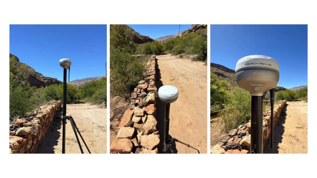
As a base station, the RS4 Pro also provides reliable PPK workflows, good price-performance ratio, and easy integration with custom UAV systems such as BESSIE.
The survey setup included:
- The Reach RS4 Pro operating as the GNSS base station in a PPK mode.
- BESSIE VTOL drone, built for long-range mapping missions.
- The Reach M2 module installed on a drone for GNSS data logging.
- Mad Nadir Mapping (MNM) LiDAR system.
- 102 MP high-resolution camera.
What does a PPK drone mapping workflow with Reach receivers look like?
Unlike RTK-only workflows, PPK does not depend on a continuous real-time link between a base and a rover. Instead, raw GNSS data is recorded during the flight and processed afterward, which is especially valuable in long-range operations where signal interruptions are common.
In this project:
- The team first collected GCPs with Reach RS4 and RS4 Pro as a base and a rover connected over LoRa radio for a faster and reliable setup in rural areas.
- Then the RS4 Pro was set up as a base station for raw data logging during the full survey session
- The Reach M2 recorded onboard GNSS observations throughout the flight.
- LiDAR and imagery data were captured with synchronized timestamps.
- Once the mission was over, the GNSS data was processed in a PPK software, Emlid Studio, to compute a corrected trajectory.
- Corrected positioning was applied to the final mapping outputs.
This approach provided a more robust workflow for large-scale drone mapping, ensuring consistent results even when connectivity is limited.
What are the results and performance of the RS4 Pro?
The test results demonstrated the effectiveness of the RS4 Pro as a high-precision GNSS base station for drone mapping.
Key outcomes included:
- Stable tracking of more than 40 satellites simultaneously.
- Reliable performance across varying environmental conditions.
- LiDAR accuracy better than 25 mm when compared to ground control points.
- PPK positional accuracy of approximately 10 mm.
In addition to accuracy, the system delivered significant operational benefits. The built-in long-range radio simplified the base and rover station setup for GCPs collection, while the compact and portable design made the RS4 Pro easy to deploy in the field.
“The Reach RS4 brings several improvements that make it a strong candidate for drone survey applications, such as its updated GNSS chipset and antenna, resistance to multipath and interference, and built-in long-range radio.”
Charlie Wijnberg, 3DroneMapping
Overall, the system proved suitable for a wide range of applications, including:
- Engineering and construction surveys.
- Infrastructure planning and monitoring.
- Large-scale terrain modelling.
- Remote and rural mapping projects.
Ready to upgrade your mapping accuracy?
Don’t let challenging terrain or signal gaps compromise your data. Whether you are performing high-speed LiDAR sweeps or detailed photogrammetry, Emlid Reach receivers provide the precision your projects demand at a fraction of the traditional cost.
Discover how Emlid solutions can enhance your drone mapping operations
Frequently asked questions
It is a stationary GNSS receiver that provides correction data to improve the positioning accuracy of drone surveys from meter-level to centimeter-level precision.
An RTK base station enables real-time corrections, ensuring accurate positioning during LiDAR data capture and improving overall data quality.
VTOL drones often operate in remote or complex environments, making reliable GNSS positioning essential for maintaining mapping accuracy and consistency.