Protecting wildlife with ArcGIS apps and high-accuracy GNSS
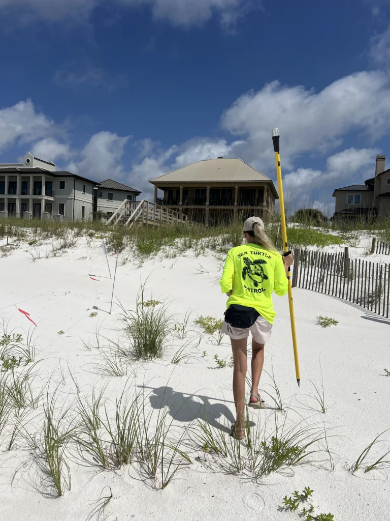
Sea turtles and beach mice might not look like frontline defenders of Florida’s coast, but for Kindall Butler, an Environmental Specialist in Escambia County, they are precisely that. To protect these species and the delicate ecosystems they support, the team she co-leads monitors over 12 miles of beaches using high-accuracy GNSS and GIS technologies: Emlid Reach RS2+ and Reach RX receivers combined with Esri tools like ArcGIS Survey123, ArcGIS Field Maps, and ArcGIS Pro.
This setup improves data precision and allows the team to work more efficiently in the field, ensuring they can respond faster and with greater confidence, even after storms disrupt physical markers.
From tape measures to high-accuracy
Before adopting modern GNSS solutions, sea turtle nest monitoring for Escambia County was a labor-intensive process involving manual tape measurements and phone GPS, often accurate only within 15 feet. In the storm-prone Gulf Coast, that margin for error made post-storm nest recovery nearly impossible.
“If we lose a nest because of a hurricane or overwash, and we lose our stakes, we still need to be able to find where it was. Having that accurate point is crucial,” Kindall said.
Now, using GNSS and GIS solutions, Kindall’s team can get 1-foot-accuracy data. This solution enables the reliable pinpointing of nests and streamlines the workflows.
When volunteers see turtle activity on the beach, they log the information in the Survey123 app. This alerts Kindall’s team to the rough location of the nest.
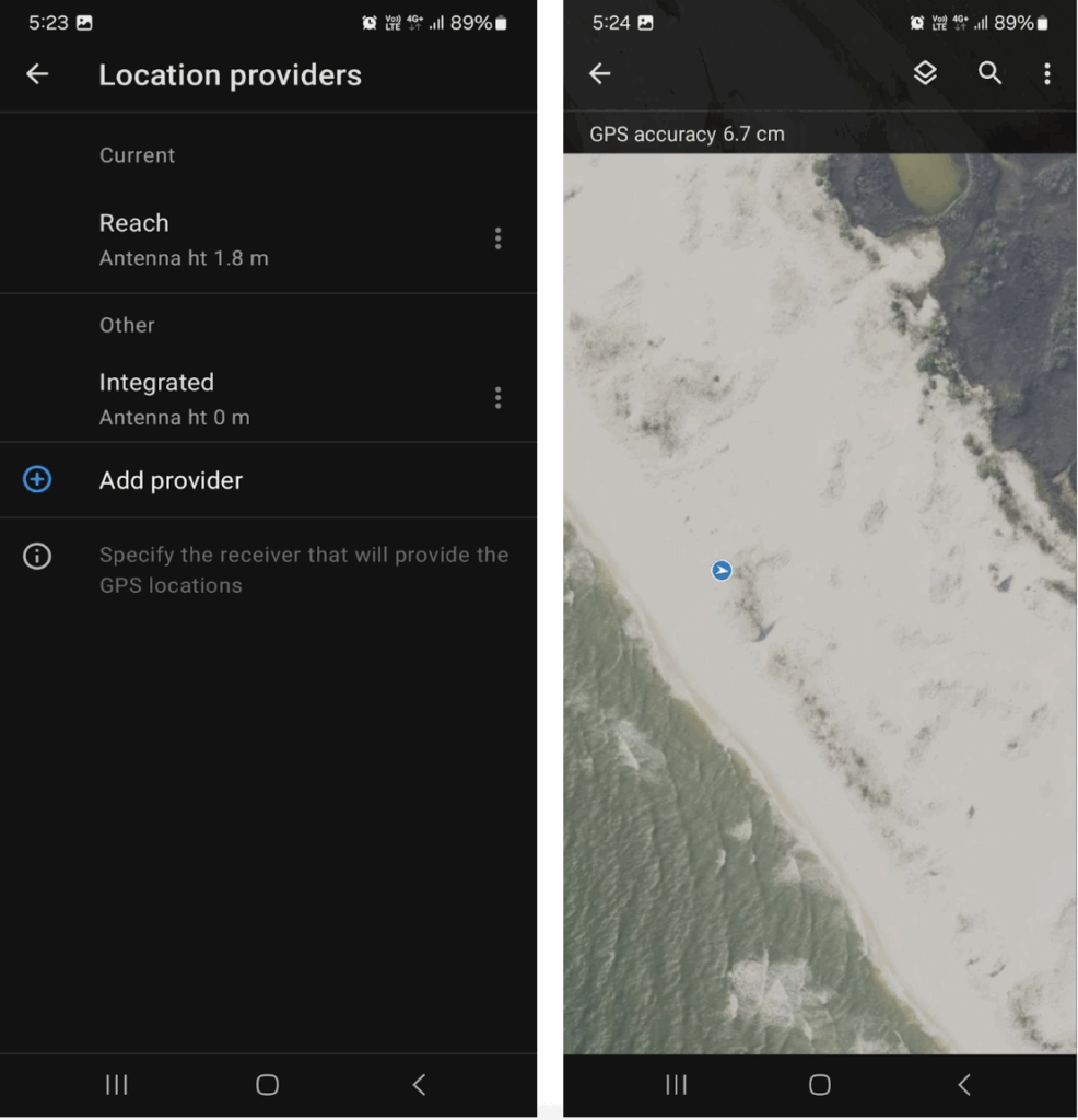
They validate the presence of nesting activity and then capture the coordinates with the Emlid Reach RS2+ or Reach RX receiver and ArcGIS Field Maps. To achieve high-accuracy data, the Reach receivers are connected to an NTRIP service to get RTK (real-time kinematic) GNSS corrections.
The receivers can then be connected to ArcGIS on an iPhone, which is used as a data collector. The Reach RX can be connected with ArcGIS Field Map via Bluetooth, while the Reach RS2+ connects over the TCP server.
Time savings realized
The high-accuracy workflow enables savings for the nest recording and the nest locating portion of their work. For nest recording, the team would previously need two people to measure with tapes, roughly taking 20 minutes for each nest. With the GNSS workflow, they only need one person who can walk out to the site and, within seconds, save their digital measurement.
The 1-foot data accuracy for the nest locating means a much shorter period of digging to find the nest. Before, there would be instances where they would hand-dig large holes for hours, only to come up empty-handed.
“No one wants to be digging in a 15-foot radius when you could be in a one-foot radius,” Kindall said.
Smarter conservation through GIS
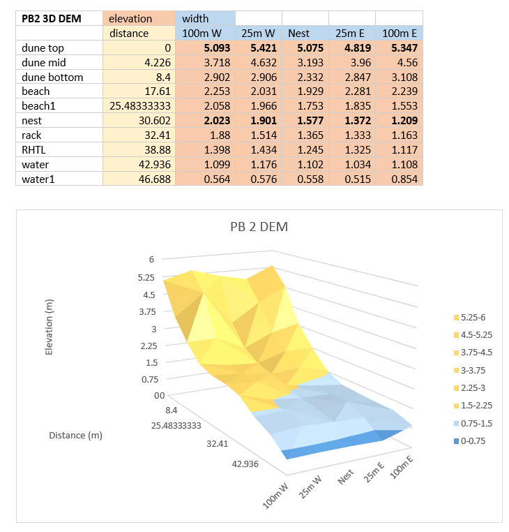
The precise location data feeds directly into the team’s nesting site suitability analysis using ArcGIS Pro. They measure elevation points from the nest location along a line from the dune crest to the waterline. They then compare these elevation profiles to adjacent beach sample profiles without nests, first 25 meters away and then 100 meters away.
“If we find that turtles only nest at certain elevations, we can advocate for policies to maintain those elevations and create protected zones,” Kindall explained.
This early-stage research is part of a broader effort to influence land use policy and coastal development in ways that benefit wildlife and residents. It is unique to Escambia County, as no other Florida conservation agency is doing it.
Efficient monitoring of other endangered species
Kindall’s conservation work doesn’t stop with turtles. The team also uses Reach RS2+ and ArcGIS Survey123 to monitor the endangered beach mouse population. Elevation data helps pinpoint potential high-ground refuge areas during hurricanes, which are critical for survival.
It is thought that the beach mouse has a preferred elevation where they most comfortably burrows, but until now, it was untested. Kindall’s team monitors beach mouse presence at different elevations using track tubes.
These track tubes are PVC pipes with card stock and an ink pad inside. The tubes are placed 300 meters apart. They bait the far end of the tube and look for inked-feet tracks on the cardstock.
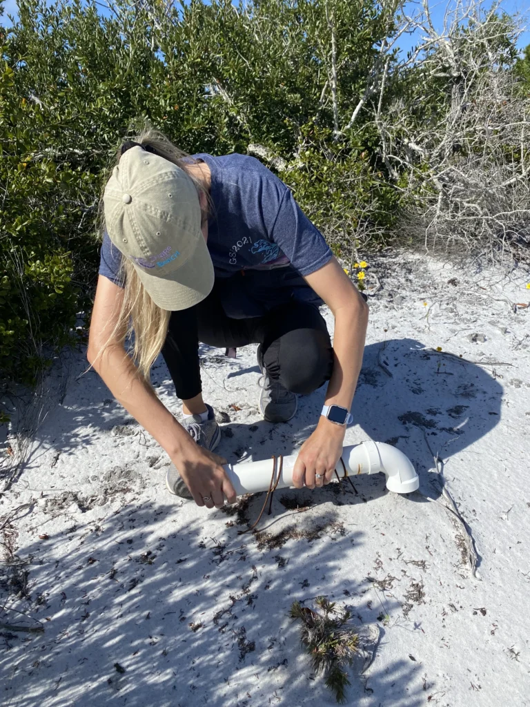
Staff check the tubes every other month and complete a form within the ArcGIS Survey123 app, asking for the presence/absence of beach mouse activity. If there is a deviation from the normal activity at a track tube site, an ArcGIS Pro map will alert the team to that location.
The same GNSS and GIS workflow supports shoreline erosion monitoring and artificial reef mapping. While reef mapping presents unique challenges, like maintaining GNSS lock from a moving boat, Kindall’s team continues to expand its capabilities.
How the daily job changed
Through their conservation efforts for both the beach mouse and the sea turtle, Escambia County is seeing a slew of benefits from its modernized GNSS and GIS workflow.
- Significantly increased data accuracy helps Kindall’s team precisely record and locate the turtles’ nests and mice’ activities.
- The data collection and location process became faster and easier.
- Various stakeholders have more access to visualize and disseminate data.
And year over year, they are growing a historical database to help answer questions about dune elevation preferences. These answers could result in greater efficacy of conservation programs aimed at helping endangered species.
Integrating Esri software and Emlid hardware for wildlife conservation
From habitat mapping to policy advocacy, integrating Esri software and Emlid hardware is transforming coastal conservation. For Escambia County, it’s not just about collecting data—it’s about protecting ecosystems that shield inland communities from storm damage and preserve biodiversity for future generations.
Whether you’re protecting wildlife, managing land use, or building smarter workflows with GIS, high-accuracy GNSS receivers Emlid Reach give you the accuracy and flexibility to do it right — even in the most demanding environments. Explore Reach GNSS receivers and see how Emlid can support your mission.
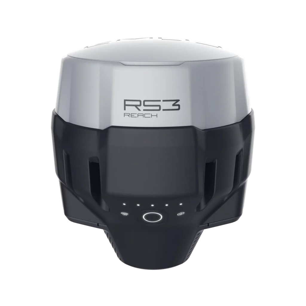
Reach RS3
Survey grade RTK GNSS receiver with tilt compensation.
Acts as a base or rover.

Reach RX
Lightweight and easy-to-use
RTK GNSS rover for GIS and surveying.

Reach RS2+
RTK GNSS receiver with
centimeter precision for surveying and mapping.