
 BLOG
BLOG
Transforming utilities and infrastructure surveying with Reach RX and Azmyth on Foot
Utility companies are often under pressure to maintain reliable infrastructure surveying while improving the speed and accuracy of data collection. For field crews, this usually means spending long hours on repetitive site surveys, struggling with outdated methods that slow down operations.
But in Alabama, US, a quiet revolution is underway. With the help of the Azmyth on Foot app, developed by Vulcan Line Tools, and Emlid’s Reach RX receivers, field teams are now cutting surveying time without compromising precision. What used to take 20 minutes per utility asset now takes less than 30 seconds. The result? Dramatic time savings, smoother workflows, and more actionable data from the field.
This shift isn’t driven by a single piece of software, but by a rethinking of how infrastructure data is captured, leaning on mobile-first tools and reliable GNSS performance.
- Meet the hero: Zac Young, founder of Vulcan Line Tools
- The challenge: slow workflows and limited access
- The solution: collecting accurate pole data with Azmyth on Foot and Reach RX
- Real-world use: surveying 45,000 power poles across Alabama
- Key benefits for utilities and engineers
- A GNSS tool for fast capture of infrastructure data
Meet the hero: Zac Young, founder of Vulcan Line Tools
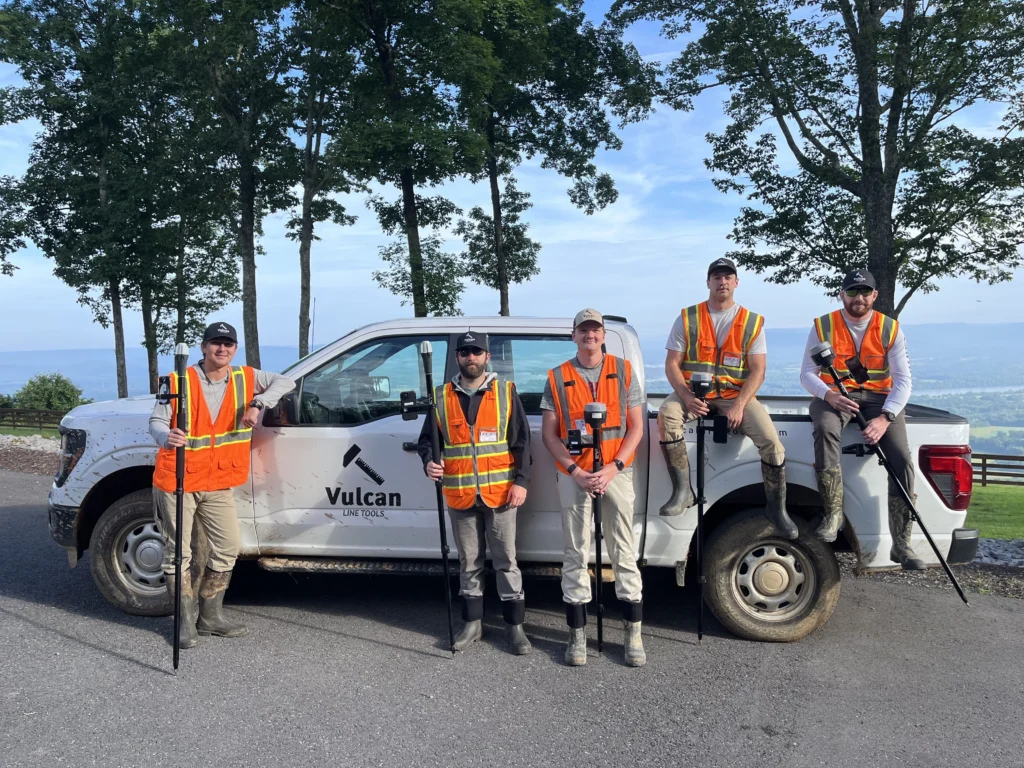
Zac Young, founder of Vulcan Line Tools, is no stranger to the challenges of field data collection in the utility sector. His company, based in Birmingham, Alabama, offers a complete toolkit for professionals who, from surveying to construction, work on utility poles and buried infrastructure. Combining hardware, software, and professional services, they work with electric utilities and cooperatives, Internet service providers, fiber engineering firms, and telecom contractors.
At the heart of Vulcan’s offering is Azmyth, a GIS platform, where field-collected GNSS and photographic data can be measured, analyzed, and exported into industry-standard formats. They built the platform around vehicle-collected 360° imagery. However, Zac and his team soon realized that their vehicle-based collections limited them to the objects and poles that were visible from the street. So they developed Azmyth on Foot, a mobile iOS app that allows teams to capture GPS-integrated imagery using just an iPhone and a GNSS receiver.
In addition to building tools, Vulcan also provides end-to-end surveying services, from large-scale joint-use audits to targeted data collection projects supporting utility clients across the US. By leveraging their own tech, the Vulcan team can make fast and accurate decisions for their wide range of customers.
“We help electric utilities, engineering firms, and broadband providers make better decisions about their infrastructure,” Zac explains. “Our technology and services transform how organizations collect, analyze, and act on pole and attachment data.”
That transformation is now powered, in part, by Emlid’s Reach RX receiver—bringing high-precision GNSS into Vulcan’s fast, flexible, and mobile-first workflow.
The challenge: slow workflows and limited access
Collecting data on power poles and buried infrastructure has traditionally required heavy investment and labor-intensive workflows. For example, most surveys involve fielders walking pole to pole, taking measurements by hand. More high-tech solutions, like LiDAR from drones or cars, are often overkill for large-scale collections due to the cost and sheer volume of data they output.
Azmyth on Foot is addressing exactly these challenges. In combination with Reach RX receivers, this setup replaces slow, manual surveys with an efficient and affordable digital workflow. It allows teams to collect accurate data on utility poles that vehicles can’t access and standardizes the output for engineering, permitting, and make-ready applications. For targeted collections or teams that simply prefer manual collections, Azmyth on Foot offers a new standard for surveying technology.
The solution: collecting accurate pole data with Azmyth on Foot and Reach RX
Paired with the Emlid Reach RX, Azmyth on Foot transforms any iPhone into a precise surveying tool capable of capturing centimeter-accurate, GPS-tagged images in seconds.
ForHere’s how it works:
- Turn on the Reach RX and connect it via Bluetooth to the Azmyth on Foot app.
- The app supplies RTK corrections through an NTRIP service and enables the receiver to achieve centimeter-level accuracy, within half an inch (1.3 cm) horizontally and 2 inches (5 cm) vertically.
- Snap a photo of the power pole from a distance. The app automatically logs the first GPS coordinate.
- Walk up to the pole and take a second measurement directly next to it.
- The photo and location data are uploaded to the Azmyth GIS platform, where everything becomes measurable.
Also, on the back end, Vulcan’s analysts or the client’s own GIS team can instantly extract key pole data from each image: height, equipment types, attachment positions, and clearance values. There’s no need for manual measuring, clunky data transfers, or second site visits.
This streamlined field-to-office workflow hinges on the performance and reliability of Reach RX. Vulcan chose Emlid’s receiver for its plug-and-play simplicity, all-day battery, and effortless integration with iOS.
“We needed a highly accurate GPS that wasn’t complicated. The Reach RX just works,” says Zac Young, founder of Vulcan Line Tools. “You turn it on, it connects, and gets the job done.”

Together, Azmyth on Foot and Reach RX provide a scalable, field-ready solution for fast and accurate infrastructure data collection. It delivers fully measurable imagery, precise coordinates, and ready-to-use datasets for engineering, permitting, and post-construction inspections.

Real-world use: surveying 45,000 power poles across Alabama
One of Vulcan’s most ambitious deployments of Azmyth on Foot is an ongoing project in Alabama. The team collects and analyzes field data of ~45,000 power poles for an electric cooperative.
In fact, the workflow includes locating every pole, measuring their heights, and identifying the lowest power attachment. It also involves identifying different types of equipment (transformers, streetlights), as well as the names and numbers of each communication company whose wires are attached to the co-op’s poles.
This is known as a Joint Use Audit, a service that provides pole owners with an accurate count of the number of attachments by different companies on their poles, thus allowing them to charge the companies accurately.
Thus, Vulcan’s approach blended two methods:
- 30,000 poles were captured using a vehicle-based setup with a 360° camera and a Reach RS3 receiver mounted on a car.
- 15,000 utility poles not accessible by vehicle were captured on foot using iPhones, Reach RX receivers, and Azmyth on Foot.
While the field teams were collecting the data, the back-office team was extracting the GPS points, heights, and attachment types/heights of every pole using our desktop platform, Azmyth. Because our field data flows seamlessly into the platform, collection and extraction took place simultaneously.

Thus, the result is a dynamic map/GIS database of the coop’s electric distribution grid. The database includes nodes (representing poles) and lines (representing the power lines connecting them in the field). In fact, each node is embedded with the poles’ height and attachment data, viewable on the Azmyth platform or exportable to industry formats like KML and Shapefiles. And the accuracy is right on target.
“Azmyth’s horizontal accuracy is half an inch (1.3 cm), and vertical accuracy is 2 inches (5 cm). The results of this project were consistent with those numbers,” says Zac.
Key benefits for utilities and engineers
Azmyth on Foot, powered by Reach RX, delivers measurable gains to Vulcan’s clients:
Faster collection
What used to take 20 minutes now takes 30 seconds per pole—no return visits, no tape measures.
Accessible tech
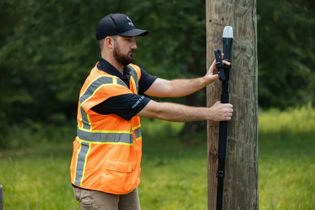
Field crews only need a smartphone, Reach RX, and a survey pole. Minimal training required.
High accuracy
Achieve sub-inch (centimeter) precision in GPS positioning—critical for permitting, clearance checks, and attachment audits.
Real-time workflow
Photos and GPS data flow instantly from the field app to the office GIS platform. That allows analysts to work in parallel with field teams.
Lower costs
No need for bulky, expensive gear or large crews. Smaller teams can handle large-scale projects efficiently.
A GNSS tool for fast capture of infrastructure data
The hardware companion of Vulcan’s innovative mobile workflow is the Emlid Reach RX. It is a compact, durable, and highly accurate GNSS receiver built for modern fieldwork. Whether used by utility crews, fiber engineers, or telecom contractors, Reach RX makes high-precision data collection accessible without requiring bulky gear or complex training.
With its one-button simplicity, long battery life, and real-time RTK support, Reach RX integrates directly with smartphone-based workflows. It enables teams to collect centimeter-accurate geospatial data—from utility poles to underground infrastructure—quickly, reliably, and with minimal setup.
Vulcan’s success shows what’s possible: pairing Emlid’s technology with user-friendly software cuts field time, avoids second visits, and delivers scalable, actionable data. From solo technicians to large-scale projects, Reach RX provides the performance professionals need—without the complexity.
Ready to cut survey time and boost accuracy in the field? Explore the Reach RX and see how it fits your workflow.