
 BLOG
BLOG
Simple enough for non-surveyors: how Hausmann Construction’s superintendents run Emlid’s GNSS
A landscaping-heavy project in downtown Omaha needed layout checks nearly every day: curved sidewalks winding past plants, trees, and sprinkler heads, the kind of work that doesn’t wait. Hausmann Construction assigned one layout superintendent to it, and he was a shared resource, roaming between job sites company-wide.
Lining him up to be there every day was hard to guarantee. That’s the gap Derek Hays went looking to close.
As Construction Technology Director at Hausmann, Derek Hays manages BIM, VDC coordination, drone mapping, and site layout across projects ranging from K-12 schools and university facilities to multifamily housing and water infrastructure.
With job sites running on superintendents rather than dedicated surveying staff, Hays needed a layout solution that non-surveyors could independently operate in the field. That search ran into a familiar wall in construction: not enough surveyors to go around.
Key takeaways
- With 40–50 active projects and no dedicated surveyors on staff, Hausmann needed a tool that puts layout capability directly in a superintendent’s hands.
- Once they got to know Emlid Reach RX2 and the workflow was set, results came fast. One project near Kansas City had a superintendent verifying elevations alongside a third-party inspector in real time. And a project in Bennington, Nebraska paid for the receiver in under a month by the number of times they didn’t have to call a surveyor.
- The clearest signal that it worked came from outside Hausmann: subcontractor trade partners started buying their own RX2 units after seeing them in use on Hausmann sites.
- Superintendents now use the Reach RX2 for quality control (QC), stakeout, as-built and existing conditions collection, and site grading verification.
The challenge: high costs of expanding the gear fleet or hiring a surveyor
Hausmann leaned on outside surveyor partners to establish site control, backed by 5 robotic total stations shared across the company. “The RTS units are very precise when set up properly, but we only have 5 within the company, so scheduling them between 40-50 projects gets to be challenging,” Derek says.
Getting something wrong meant rework, though Derek is careful to note it never caused a delay.
“Professional Surveyors are not inexpensive, every time a project needs to schedule a Surveyor to lay something out, there are higher costs than if we were able to lay it out ourselves.“
– Derek Hays, Construction Technology Director at Hausmann
Derek started looking for a way to put layout capability directly into a superintendent’s hands, but the bar wasn’t just cost. Whatever the solution, it had to work for people who aren’t surveyors.
A tool that required specialist knowledge to set up would simply move the problem, not solve it.
In the field: a dozen superintendents, running verification on their own
Deploying any RTK workflow for the first time means working through some setup nuances, since RTK itself is a precise technology, and getting it right on a real job site takes a few runs to dial in.
For Derek, that process was hands-on: Emlid’s support team walked him through a key step in person, on the same landscaping job site where the search for a solution had started.
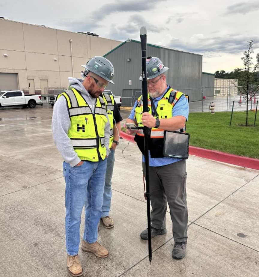
“What used to take 5-10 minutes to set up a robotic total station I can now do in about 30 seconds,” Derek says.
“Being able to deploy an RX2 onto a job site, training a Superintendent in 5-10 minutes, and then stepping back and watching them confidently stake out and collect points proves how efficient this system can be.”
– Derek Hays, Construction Technology Director at Hausmann
Superintendents now use the Reach RX2 for quality control (QC), stakeout, as-built and existing conditions collection, and site grading verification. Elevation accuracy, the detail Derek’s team worried about most going in, came back within 1-2cm once he had the workflow dialed in—a result Derek still describes as far better than he’d expected.
Tilt compensation adds a safety benefit, too: “I can place the tip of the pole into a trench and collect the top of the pipe without having to enter the trench, helping keep our crews safe.”
Superintendents access the receiver through Emlid Flow, Emlid’s app for GNSS survey work. It runs on your mobile device (iOS or Android) in the field for point collection and stakeout, and syncs with Emlid Flow 360 in the office so the same project data is available on both ends.
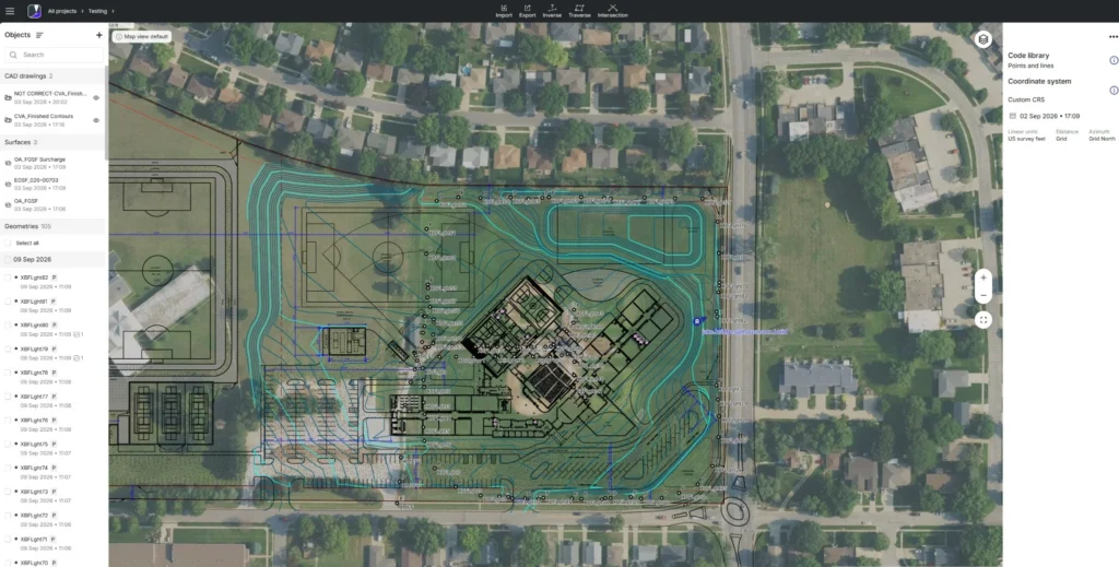
With the Pro plan active, each superintendent has an individual login instead of one shared set of credentials passed around the team. This allows for individual tracking and accountability being able to identify who staked out or collected certain points or features.
Related reading: Customer story: what happens when superintendents get survey-grade tools
At scale: the same payoff, on two different projects
On a project near Kansas City, Missouri, a Reach RX2 arrived on-site early, while mass grading was still underway, so the superintendent could spot-check elevations throughout the site while the equipment and operators were still there.
He later sent Derek a note about it: “Our third-party inspection engineering company provided a testing inspection report. All of the locations and elevations were given while walking with the inspector, marking accurate locations from various structures. Before the Reach, I would not have had time, nor would it be practical to set up the total station for compaction tests or soils verifications.” Derek says the same pattern has repeated on other sites since.
On a project in Bennington, Nebraska, “it literally paid for itself in less than one month,” the crew told Derek, “simply by the number of times they did not have to call a surveyor to layout minor details like site fence and laydown areas.”
What’s next: still deploying, and already spreading beyond Hausmann’s own sites
For Derek, the bigger shift is what happens once verification stops requiring a phone call: superintendents now check location and elevation data in real time, without waiting on a surveyor or a shared layout superintendent. Mistakes often surface while the subcontractor or responsible party is still on-site.
Pre-mobilization work, like collecting existing conditions and utility locates, moves faster too, which helps with site logistics before a project even breaks ground.
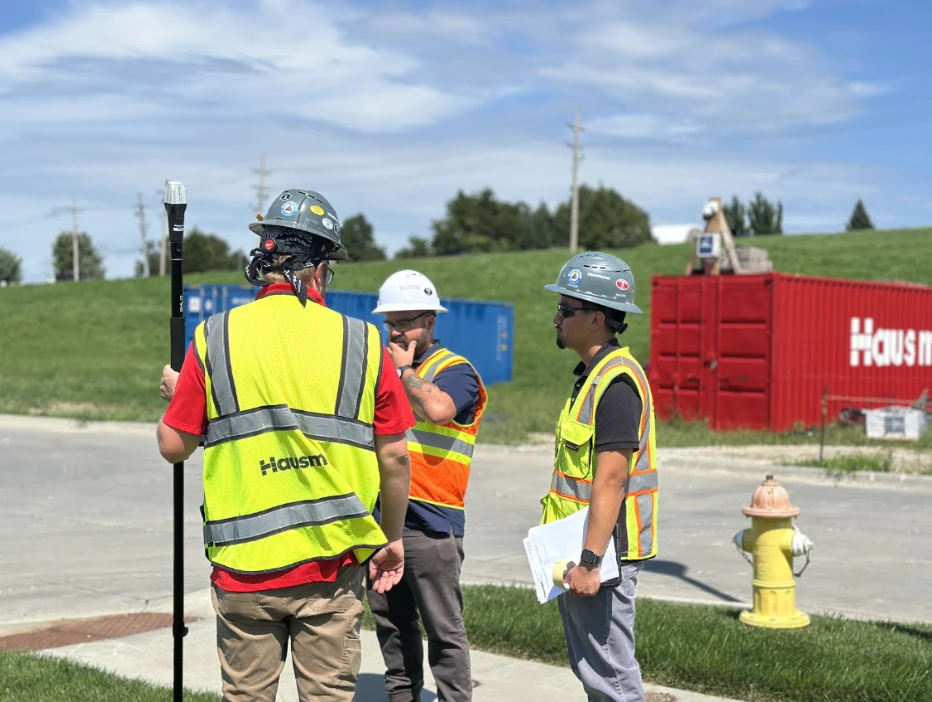
Hausmann is still in the deployment phase, but the signal Derek cares about most has already shown up outside his own company. “I’ve even seen a handful of our subcontractor trade partners purchase and deploy their own Emlid Reach RX2 devices,” he says, “due to our experience and the impact they have had on our sites.”
For a Construction Technology Director with no surveyors on staff, that’s the real measure of whether a receiver works: whether it’s simple enough that the right hands don’t need to be a surveyor’s. “In construction, trust is earned, never given. The Emlid system has earned my trust,” Derek says.
GNSS workflows for residential construction: a phase-by-phase guide
The utility trench as-built survey checklist: what reviewers look for before they approve
Customer story: How Dellbrook cut rework on the job site with GNSS for superintendents
As-built surveys: a field-to-office workflow with Emlid Reach receivers