
 BLOG
From float to fix: getting GNSS accuracy under canopy with Reach receivers
Every surveyor has a tree-line story. You set up over the point you need, half the sky gone behind branches, and the solution sits in float: close, but never close enough to trust.
So you wait, shift the pole, or walk out to a clearing and hope the reading ties back to where you stood.
All-band reception has been changing that for a few years now. The major survey brands moved their high-end receivers to L1, L2, L5, and L6 across every constellation, and the Reach RX2, Reach RS4, and Reach RS4 Pro bring the same all-band tracking to the Reach lineup.
In one field test, they fixed six property pins under heavy canopy that a land surveyor’s older receivers hadn’t fixed in over three years, all within 3 cm horizontally of the plans.
Below, we cover how canopy affects the signal and how the Reach RS4, RS4 Pro, and RX2 handle it, three field tests under tree cover, and what to do on the points that still won’t fix.
Key Takeaways
- Multi-band, multi-constellation receivers (L1/L2/L5/L6, 672 channels) hold a fixed RTK solution under canopy where older dual-band gear only gets a float.
- Tilt compensation doesn’t get you a fix by itself, but once you have one, it means you don’t need a perfectly plumb pole around trunks and branches.
- When a point still won’t fix, a closer base, a longer static observation, PPK, or an offset from the nearest fixed point can get you a usable coordinate.
How canopy affects the signal and how GNSS gear handles it
Under canopy, leaves and branches block some satellite signals and reflect others, so the receiver picks up a delayed copy of the signal. That multipath is the main reason a solution slips from fix to float.
Canopy also leaves fewer satellites in view, bunched into whatever gaps show through the leaves, which weakens the geometry the receiver relies on.
Moisture makes it harder. Water absorbs GNSS signals, so the same trees that allowed a fix in dry weather can drop you to float after rain or in thick spring growth. And the sky never holds still: satellites move, branches sway, and every interruption forces the receiver to rebuild part of its solution.
With enough of them, the RTK engine is challenged to get the steady run of data it needs to commit to a fix.
All-band reception
The Reach RS4, Reach RS4 Pro, and Reach RX2 track all four signal bands (L1, L2, L5, and L6) across every satellite constellation. 672 channels follow 40+ satellites at once, so more of them line up with the gaps in the canopy.
The L5 and L6 bands matter most here: they handle multipath and interference better than the older bands, so the receiver holds up when signals bounce off trunks and branches. You don’t need a special field technique for this: you set up and get a fix in about 5 seconds in good conditions, and a much better chance at one under cover.
Integrated antenna system
On the RX2, RS4, and RS4 Pro, the GNSS antenna shares one integrated system with diversity LTE, dual-band Wi-Fi, and Bluetooth, designed to keep the GNSS signal clean and the fix stable. Diversity LTE also helps keep NTRIP corrections coming on wooded sites, where cell coverage is often weak.
Related reading: Reach receivers now have built-in RTK corrections
Radio link to your own base
A fix needs a steady correction stream as much as it needs sky. When you run your own base close to the work, the Emlid multi-band radio on the RS4 and RS4 Pro sends and receives corrections at up to 2 W.
It supports licensed and license-free operation at 450 MHz and 915 MHz and works with third-party gear, so you can match the setup to the project and local regulations.
Tilt compensation
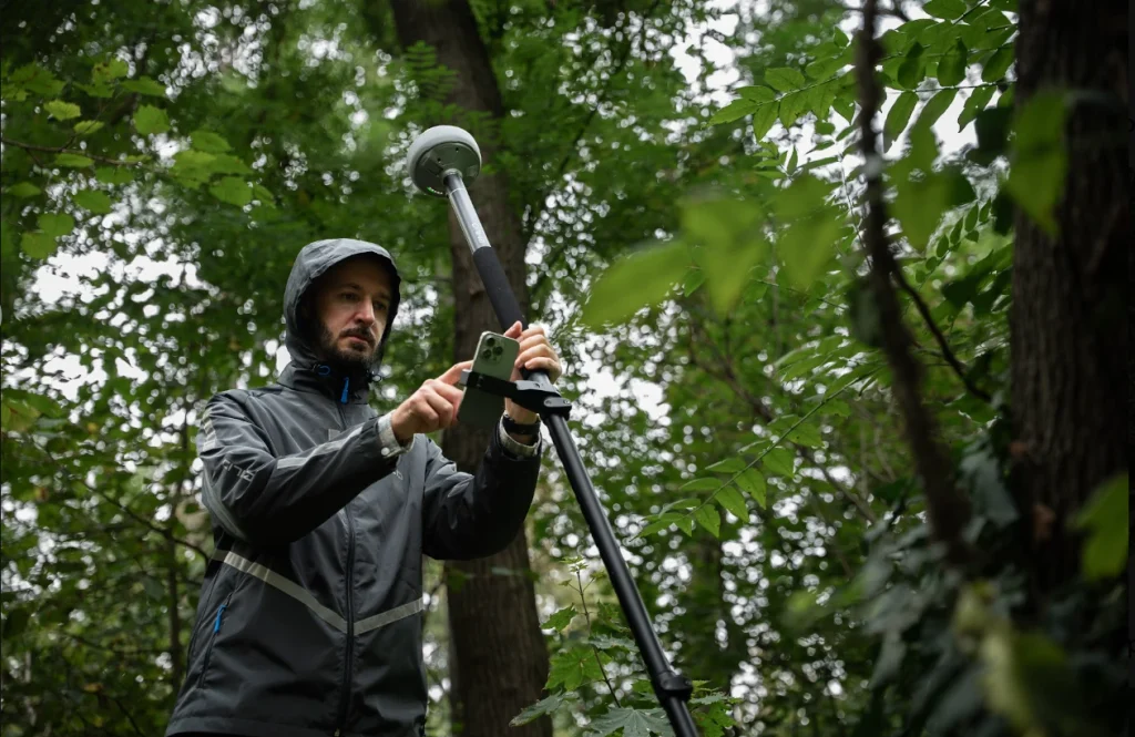
Getting the fix is half the job under canopy. The other half is taking the point when you can’t hold the pole plumb around trunks, roots, and low branches.
All three receivers carry next-generation IMU tilt compensation, which calculates the pole’s tilt and works out the true position of the tip. It initializes up to 5 times faster than before, so you spend less time moving the pole around before you can measure.
Side-by-side field tests: new-gen Reach vs. the gear surveyors already use
Each test below puts the Reach RS4, RS4 Pro, or RX2 next to gear the testers already relied on, on the same points: a surveyor’s property pins that hadn’t fixed in years, a dealer’s old-vs-new rover comparison, and a survey firm’s check against its existing fleet.
Reach RS4 vs. Reach RS2 vs. Topcon HiPer VR on property pins under heavy canopy
Grant Mills knew of six property pins in British Columbia that he hadn’t been able to shoot for more than three years: three on his own property and three on a friend’s. All six sit under heavy tree cover, and he had never been able to get a fix on them.
Instead of an elaborate test, he took everything he had to those pins: the Reach RS2 and Topcon HiPer VR he’d been using, plus a new Reach RS4 and RS4 Pro. He ran three bases, each with two rovers:
- RS2 base (900 MHz) with the RS2 and the RS4 Pro as rovers.
- HiPer VR base (450 MHz) with the HiPer VR and the RS4 Pro as rovers.
- RS4 base (450 MHz) with the RS4 Pro and the HiPer VR as rovers.
The RS4 base with the RS4 Pro rover was the only setup that got a fix on any of the pins, and it got one on all of them.
Grant didn’t have to wait or move into the clear to grab a quick shot. He gave the RS2 and HiPer VR time too, but neither ever reached a fix. The best he got was a float of about 8.5 cm RMS on the RS2 and 25 cm on the HiPer VR. The recorded locations for all the pins came in under 3 cm horizontally from the locations calculated from the plans.
He also found another pin buried directly beside a metal gate post, one he couldn’t locate with a pin finder, under heavy canopy and a power pole.
As Grant put it: “For an RS4 kit to not just be as good, but outperform the HiPer VR setup at nearly 1/5th the cost? There isn’t much else I can say.”
Controlled comparison: Reach RX2 vs Reach RX
Emlid dealer K K Sales ran a controlled comparison of the Reach RX2 and the original Reach RX under dense tree canopy with limited sky visibility, near Ahmedabad, India. They kept the location, time, and satellite constellations the same for both receivers and recorded both Emlid Flow status screens side by side.
Both receivers showed a fix with about 1 cm horizontal precision at the start of the recording. Within the first minute, the RX lost its fix, and its horizontal precision dropped to around 0.6–0.7 m.
The RX2 held its fix throughout, tracking 33 satellites on NTRIP corrections, with tilt compensation off. K K Sales attributes the difference to the RX2’s enhanced multi-frequency GNSS support, signal processing, and interference mitigation.
Reach RX and Reach RX2 vs. Topcon
A surveying and engineering firm in Indiana tested the Reach RX and Reach RX2 against its Topcon equipment, both as rovers on their own and in a base-and-rover setup.
Going in, they planned to use Emlid only for boundary surveys, because they weren’t sure about its vertical accuracy. The results were “right where we were expecting,” elevation included, and they now see the receivers covering more than boundary work. They’ve since added a Reach RS4 Pro and a Reach RX2.
They’re candid that every brand in their fleet has pluses and minuses. Whether Emlid can take on more of their work will come down to software, especially coding and team management.
Related reading: How Fyfe supervises its 40-surveyor team from the office with Emlid
Getting the best fix, and what to do when you still can’t
The new-gen Reach receivers do most of the work, but a few general rules still help:
- Set up your own base close to the work, under the same canopy if you can. A short baseline gives you cleaner corrections.
- Give the receiver time. If the fix doesn’t come right away, it often does once the satellites move and a gap opens overhead.
- Turn on tilt compensation before you start, so you can take the point without holding the pole plumb around trunks and branches.
- For points you can’t stand over, use measurement from images on the Reach RS4 Pro to get a coordinate without placing the pole on the spot.
In this short video, Julia Shestakova, Emlid Application Engineer, shares her tips for things to check on-site to get back to a solid fix:
Closed canopy is still a challenge for GNSS. With the new-gen Reach receivers and a few basic rules, you can get a fix in spots that used to leave you in float.
Want to discuss whether Reach can handle tough conditions on your survey sites? Talk to our team.
Yes, though it depends on how dense the canopy is, how many satellite signal bands and constellations your receiver tracks, and how stable your correction source is. Multi-band, multi-constellation receivers can often still resolve a fix.
GPS can typically provide a float solution, which is typically accurate to a few decimeters, not centimeters. That’s usable for a rough check but not for a property corner, a boundary line, or a grade stake.
It doesn’t get you a fix on its own; that still depends on signal. But once you have a fix, tilt compensation means you don’t have to hold the pole perfectly plumb around trunks and low branches to trust the point.