
 BLOG
How Skanska built a field verification workflow that scales across every site
Skanska is a global construction and development company operating across the US, running projects simultaneously from coast to coast. At that scale, giving every field team the GNSS tools to verify their own work is what makes the difference.
Esteban Loya, Senior VDC Engineer at Skanska, travels between project sites helping field teams adopt drones, GNSS surveying, and 3D scanning to check the accuracy of their work. For every project, he starts with two questions: what does the team need, and what’s their budget?
When field teams requested surveying equipment, traditional survey gear failed on both counts. What they needed was:
- A GNSS receiver and software simple enough that doesn’t require survey expertise.
- A price affordable enough that every site can buy one.
Emlid checked both needs. On a major data center project in the Bay Area, Tomas Mata, a project engineer, now runs field verification independently. The same setup is already rolling out to other sites.
- Key Takeaways
- The challenge: surveyors doing tasks field engineers could handle
- The discovery: a 3D scanning device that turned out to do a lot more
- In the field: catching discrepancies before the pour and keeping office and field in sync
- At scale: standardizing GNSS adoption across project sites
- The reaction when a phone replaces a tablet data controller
- What’s next: Bay Area through 2028 and beyond
Key Takeaways
- Skanska’s VDC team supports construction projects across the US and needed field engineers to run their own verification checks on site.
- Professional survey equipment was on site but built for specialists. Calling in a third-party surveyor for routine checks meant scheduling delays and thousands of dollars per visit.
- On a Bay Area data center build, project engineer Tomas Mata used an Emlid base-and-rover setup to catch drain and piping discrepancies before concrete was poured—and the cost savings freed up budget for a drone that now runs alongside the ground workflow.
- Skanska standardized the setup across project sites with a simple equipment list: each site buys its own kit, trains its own people, and runs independently. No central team required.
The challenge: surveyors doing tasks field engineers could handle
Skanska’s Bay Area team called third-party surveyors for field verification. It worked, but at a cost.
Mobilizing an outside team for even simple checks—a drain location, a concrete pad—meant scheduling lead times, waiting windows, and stopping work on tasks that didn’t justify the intervention. At a minimum, each visit ran into the thousands of dollars.
The alternative was the professional survey equipment already on site: accurate, capable, and practically unusable for anyone without survey training.
The controller was a separate device, and the setup involved enough steps that, in practice, only dedicated surveyors touched it. Esteban described watching Skanska’s in-house surveyor move through the workflow so fast he couldn’t follow—let alone replicate it himself.
The discovery: a 3D scanning device that turned out to do a lot more
Skanska came to Emlid through the Reach RX2, which the team had been using with Pix4D for terrestrial 3D scanning.
Later, while browsing the Emlid website, Esteban noticed the RTK surveying receivers. The team hadn’t been looking for one, but it solved a challenge they’d had for a long time.
They tested Emlid’s Reach RS4 to test. The team set up the base-and-rover configuration, ran it through the checks the Bay Area project needed, and it held up. Half-inch tolerance across QA/QC checks, underground utility verification, and building point collection. The interface ran on a smartphone. Compared to what they’d been using before, the difference was immediate.
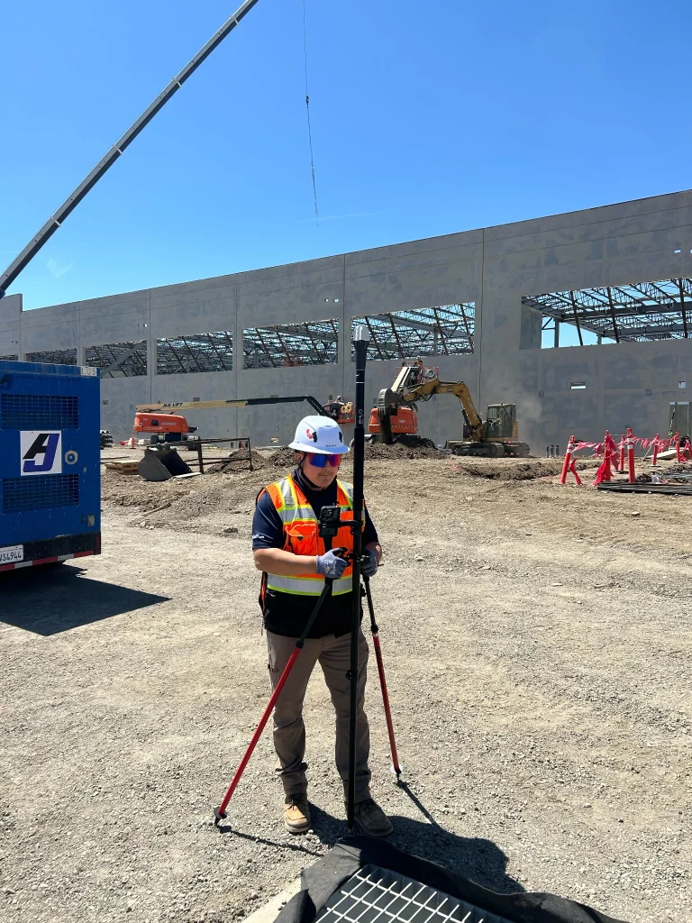
Getting up and running on site took some figuring out. The team’s first base station position—near the ConEx container the crew was using as a temporary office—had too much interference to get a reliable connection.
Moving it to an open spot in the field solved that. Cell coverage on the semi-rural site was also patchy, so Tomas set up the base station with its own hotspot. Once the setup was dialed in, it held.
In the field: catching discrepancies before the pour and keeping office and field in sync
Tomas runs the day-to-day on site. For the Bay Area data center—a project currently in the framing and roof phase—his work with Emlid covers three areas.
The most tangible is underground and utility verification. Early in the project, Tomas walked the site checking drain and piping locations against the plan. “I went out and did a lot of the drains, a lot of piping. Actually found some they missed, and they went out there and fixed them. So, they were very grateful before they poured on the concrete slabs.”
Catching a discrepancy between plan and installed position before concrete goes down is exactly the QA/QC function the VDC team was trying to build in-house.
Concrete removal and re-pouring on a commercial slab runs into tens of thousands of dollars, before accounting for schedule impact. Tomas caught it with a Reach rover and a phone.
He also uses Emlid to establish reference points for the building footprint and check them against aerial data from DroneDeploy. Tomas handles ground-level verification; Esteban manages the aerial layer from the office.
The cost savings from choosing Emlid over a higher-end receiver freed up budget for the drone—so both workflows came out of the same decision.
Throughout the project, points collected in the field feed directly onto the CAD drawings in Emlid Flow 360. Esteban loads the drawings and coordinate systems from his desk. Tomas opens the project in the field with everything already there.
At scale: standardizing GNSS adoption across project sites
“It’s easy to scale,” Esteban says. “We have an email that we sent out to the team. Someone like Tomas would have received an email from us with the list of equipment—the rover, the pole, the bipod legs, the cost, the link where to buy. Each site owns its own equipment.”
The VDC team tested the setup in Phoenix and then on the Bay Area site before making it standard. Now, every new project follows the same steps:
- Esteban’s team asks the project team what they need and what their budget is.
- They send the equipment list, and the project buys its own kit.
- The VDC team loads the CAD drawings into Emlid Flow 360.
- A field engineer, VDC engineer, or QA/QC lead opens the project on site and starts collecting points.
The price is what makes this possible. A full Emlid surveying setup with accessories comes in under $10,000, a fraction of what traditional survey equipment costs. That’s what lets every project own its kit instead of waiting for one.
Skanska is clear about where Emlid fits. For the 2% of tasks that need a quarter inch or tighter, like anchor bolts, they still bring in a third-party surveyor or use a total station. For the other 98%, half-inch tolerance is enough.
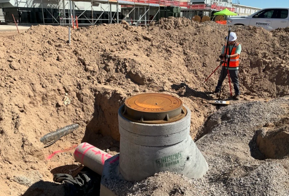
The reaction when a phone replaces a tablet data controller
Trades on site are used to seeing surveyors with tablet controllers and dedicated data collectors. Tomas shows up with a receiver and his phone.
The reaction from trade partners is consistent: surprise that something this simple produces the results it does.
For Esteban, that reaction captures what the setup is actually for. Someone like Tomas can step outside, fire up the base station, and verify work the same afternoon—without scheduling anyone, without a separate controller, without a mobilization fee.
As Esteban puts it, Tomas has become the on-site surveyor for Skanska on this project.
What’s next: Bay Area through 2028 and beyond
The Bay Area project runs into 2028, and Tomas continues to use Emlid for day-to-day verification. Esteban has been rolling out the same standard equipment list to other Skanska project sites across the US. Skanska teams now use Emlid in Phoenix, the Bay Area, Atlanta, and Virginia, and a team in Florida is next in line for setup.
The team is also moving further into Emlid Flow 360–CAD overlays, surface stakeout, drone map integration to tighten the connection between aerial data and ground checks.
Any large general contractor running multiple sites could set this up. The simplicity is what makes it work at scale.
Interested in how Emlid fits into construction workflows?