
 BLOG
BLOG
Zero rework: how construction subcontractors win with GNSS
Construction is a business of tight margins. A misplaced trench, a slab poured at the wrong elevation, a retaining wall staked two feet off: these mistakes cost real money to fix.
Rework eats into profit, delays ripple downstream, and waiting around for a surveyor isn’t always an option. Here’s the shift happening on job sites: more subcontractors are picking up RTK GNSS receivers and doing positioning work in-house.
Not to replace their surveyor, but to reduce daily dependence on them. Routine checks, stakeouts, and as-builts that used to require scheduling a third party can now be done by your own crew, on your own time.
This article breaks down what that shift means in practice. We’ll cover how RTK GNSS helps subcontractors win more work, how it helps make sure you get paid for the work you’ve done, and—because GNSS isn’t the right tool for every job—where a total station still does the job better.
- Key takeaways
- Utility and wet utility
- Earthwork
- Concrete
- Paving
- Landscaping
- How GNSS helps subcontractors win work and get paid
- What it takes to bring GNSS in-house
- Recommended setup for subcontractors and specialty contractors
- RTK GNSS for subcontractors and specialty contractors: more control on the job site
- Frequently asked questions
Key takeaways
- Do it yourself, don’t replace the surveyor. RTK GNSS lets subcontractors handle grade checks, stakeout, and as-builts themselves, cutting daily dependence on scheduling a survey crew for routine work.
- It changes what you can bid. Lower cost per job, access to machine-control-spec work, and a documented track record that wins repeat business.
- It protects what you get paid. Fewer defects that trigger backcharges, plus a dated record to point to if a quantity dispute comes down to evidence.
- Know the limit. GNSS performs best with open sky:grading, paving, utility trenches, foundations. For tight-tolerance vertical or indoor layout, a total station still does the job better.
- The math works. A receiver runs a few thousand dollars and typically pays for itself in 6 to 12 months against day-rate survey costs.
Utility and wet utility
Installing water mains, sewer lines, storm drains, gas, and telecom lines takes precision, and most of that precision has to hold up underground, where nobody can double-check it once the trench is closed.
The pain points repeat project after project: trench depths that don’t match design specifications, pipelines misaligned by a few feet, and as-built documentation that gets rushed together after the fact because nobody captured it in the field.
Any one of these can trigger expensive rework or, worse, conflicts with other utilities buried nearby later.
RTK GNSS helps at every stage of the work. Before digging, crews stake out the designed alignment directly in the field, without waiting on a survey crew. During installation, they check depth and slope in real time, so nothing gets backfilled on a guess.
Before that trench closes, they also capture as-built data while the utility is still exposed, giving the general contractor—and whoever digs nearby next—an accurate record instead of a rough sketch. Pair the receiver with a scanning app, and crews can model open trenches in 3D before backfill too, with volumes calculated automatically.
For a closer look at these workflows, see our guide to RTK GNSS for utility and wet utility work.
But precision underground isn’t just about avoiding rework. It’s also about liability and safety on site:
- Strike liability. If your crew hits a line during excavation, your company can be held financially responsible for the repair. GPRS puts the average cost at $56,000 per strike, plus 2 to 3 months of downtime while it gets fixed. UK industry estimates cited by HSE put it at around 60,000 strikes a year and £2.4 billion in total costs: roughly £40,000 per incident. Either way, prevention pays for itself: industry data from the states of California and Arizona, in the US, cited by util-locate shows $4.62 saved for every $1 spent on proper locating.
- Documentation defense. In 2024 alone, the Common Ground Alliance‘s DIRT report logged 196,977 damage incidents to underground utilities: nearly 540 a day. RTK-accurate records of your stakeout and as-built work are your best defense if a dispute comes down to who did what, and when.
- Confined-space safety. Trench entry carries its own risk, from cave-ins to limited escape routes. With tilt compensation, your crew can measure from the trench edge instead of climbing down into it for every check.
Related reading: How to get precise 3D models in minutes
Earthwork
In earthwork, volume accuracy equals money. Mass grading, cut-and-fill work, and building pad prep all depend on reliable terrain data from start to finish.
Also, earthwork sites change fast. A grade check that’s correct on Monday can be wrong by Friday, and waiting on a survey crew slows that feedback loop down. Equipment time and material quantities often get decided on rough estimates instead of hard numbers. That same uncertainty shows up even earlier: bid a job on the wrong cut-and-fill quantity, and the profit is gone before the first shovel hits dirt.
With a GNSS rover, crews check grade as work progresses, run cut-and-fill checks, measure stockpile and excavation volumes, and stake reference points for equipment operators. Crews verify progress in real time, using terrain data collected directly on site.
Those same volume numbers matter again once it’s time to bill for the work:
- Measured quantities. GPS and drone-based volume data replace the truck-count arguments that used to be how everyone settled how much material actually moved.
- Dispute leverage. A dated, georeferenced record turns a quantity disagreement into something you can answer with evidence instead of negotiation. Manual estimation methods can run 10–20% off; RTK-referenced surveys bring that down to 1–2%.The same pattern holds in Europe: Drone Services Ireland puts traditional tape-and-formula stockpile measurement at 5–15% error, against 1–3% for drone-based surveys.
- Cuts both ways. The party holding the record holds the advantage. If your crew isn’t the one measuring, someone else’s numbers become the ones the conversation runs on.
Related reading: The Reach RX2 for GIS and construction teams: simple and scalable data collection
Concrete
Concrete work is unforgiving. Once the pour happens, you’re committed. A column in the wrong spot, slab edges misaligned with steel, sleeves placed off-center: any one of these means cutting, patching, or full demolition.
Hand measurements of control points compound across large slabs and casting beds. Each transfer from one control point to the next adds a little drift, and on a big enough pour, that drift adds up to real cost.
On open-sky work—foundations, footings, slab-on-grade, and site-cast or tilt-up casting beds—RTK GNSS lets crews stake directly from the design file and verify layout points before forms go up or concrete gets placed.
Column locations, slab corners, embeds, and penetrations get checked on the spot instead of chained from a previous control mark. And instead of transferring control point to point across the pour, crews return to the same coordinate system every time, so accumulated error never enters the picture.
For large pours or complex layouts, that adds up to fewer layout mistakes, fewer surprises during inspection, and far less rework after the concrete sets.
That precision has one hard requirement: open sky. Move indoors, upstairs, or into tight vertical tolerances, and a different tool takes over.
- GNSS strength. Open ground, clear sky, and accuracy that’s roughly centimeter-level: Cleveland Brothers cites GNSS base stations tracking to as tight as 8 mm in the right conditions.
- Total station. Tight-tolerance vertical work, interior layout, and upper floors, anywhere GNSS can’t get a clear view of the sky. Roughly millimeter-level, no satellites needed: the same comparison puts total stations down to 3 mm.
- Hybrid norm. Most crews run both: GNSS sets control out on the open pad, and the total station carries it indoors and up through the structure.
Related reading: QA/QC workflows in construction
Paving
In paving, grade is the whole job. A parking lot that doesn’t drain, an asphalt section that doesn’t tie into curb elevations, a base course that’s off by a tenth: these show up fast, and fixes are expensive.
Traditional grade control relies on stringlines and laser levels, which work fine on straightforward jobs. On larger sites with complex drainage patterns or multiple design surfaces, keeping everything tied to the same reference gets harder.
RTK GNSS lets paving crews stake grade points and verify elevations directly against the design, without resetting control for every new section. Paving sites are also about as open-sky as construction gets, which is exactly where GNSS performs best. Less setup, fewer hand-offs, more time paving.
Landscaping
Grading for drainage, locating irrigation infrastructure, and placing features that must align with architectural drawings leave little margin for error. Get it wrong and you’re dealing with drainage problems, warranty callbacks, and disputes with the general contractor.
Phone GPS isn’t built for this kind of work. With errors of 5 to 10 meters, a terrace, pond, or drainage swale can easily end up in the wrong place.
With RTK GNSS, landscaping crews can stake and verify design points with centimeter accuracy directly from the site plan. Pond edges, terraces, retaining walls, irrigation runs, and drainage features can all be laid out in the field without guesswork.
This matters even more for ecological designers and restoration crews. Rainwater-harvesting systems, infiltration basins, and terraces where water has to move in a specific direction all depend on getting the grade right the first time—accurate positioning is what makes that possible.
Instead of discovering problems after the first rainstorm, crews can confirm grades and placement while the work is still adjustable.
How GNSS helps subcontractors win work and get paid
So far, this has all been about fieldwork: doing the positioning yourself, catching errors early, keeping your own record as you go. That capability is only worth something if it changes two numbers that actually run your business: what you can bid, and what you collect once the job is done.
How do you win more bids?
Self-performing your own positioning changes what you can bid on and win, long before a crew shows up on site.
- Bid lower, keep margin. Faster, more accurate grading lowers your cost to do the work, which means you can bid tighter without giving up margin.
- Bid restricted jobs. Some scopes of work specify machine control or RTK-verified positioning as a bid requirement. Without it, you’re not in the running at all: the spec disqualifies you before price even comes up.
- Bid accurately. Running your own cut/fill takeoff before you bid means the quantities in your number are quantities you’ve actually measured, not quantities you’re hoping hold up once the job starts.
- Differentiate beyond price. A documented track record of grade accuracy and schedule reliability gives a GC a reason to pick you beyond the number on the page, and a reason to call you again on the next job.
How do you protect your payment?
Winning the bid is half the job. Getting paid the full amount you billed is the other half, and two things quietly chip away at it.
- Backcharges. If your work is defective or incomplete, the GC can deduct the cost of fixing it from what they owe you. Levelset describes a back charge as an offset the GC takes for unexpected costs your work created, from redoing bad grading to jobsite cleanup after a safety issue. It’s a contractual right, not an automatic one, but once it’s written into your subcontract, it applies. RTK GNSS cuts this risk twice over: it helps you avoid the defect in the first place, and if a dispute does come up, your own recorded data is what you point to.
- Quantity disputes. When the final bill doesn’t match what someone else expected, whoever holds a measured, dated record has the leverage in that conversation. That means capturing volumes and as-builts as you go, not reconstructing them after the fact, once the trench is backfilled or the job’s already inspected.
What it takes to bring GNSS in-house
Bringing positioning in-house means buying equipment and building a new skill on your crew. Here’s what that actually costs, and what you get back for it.
- Cost comparison. A survey crew costs $1,000 to $5,000 a day to bring on site, depending on the job (SPH Engineering). A GNSS receiver you own outright, and can use every day after that, runs a few thousand dollars total—often less than a single day of survey crew time on a dense site.
- Payback. Robota‘s data on small survey operations shows RTK receivers paying for themselves in 6 to 12 months through labor savings alone. Setup time for a new area drops from about 30 minutes to under 5, and a solo operator with a rover often replaces what used to take a two-person crew.
- Labor tailwind. The labor shortage keeps compounding: ABC estimates the US construction industry needs 349,000 net new workers in 2026 just to keep up. Every task a crew can handle in-house instead of scheduling out is one less person you need to find.
- Practical notes. You still need corrections, either from a free CORS network in your area or your own base station. And a surveyor’s role stays where it was: clean underlying models and sound control are still theirs to set.
Recommended setup for subcontractors and specialty contractors
Most subcontractors and specialty contractors need positioning tools that are quick to deploy, easy to learn, and reliable on active job sites.
The setup should support routine tasks like grade checks, stakeout from plans, and as-built documentation without adding complexity to the workflow. Emlid GNSS receivers are designed specifically to simplify these daily tasks.
1. Reach RX2
Reach RX2 is often the most practical starting point. It delivers centimeter-level accuracy with a simple setup and minimal training, making it well-suited for crews without a surveying background. The receiver pairs with a phone or tablet and works with the Emlid Flow app for data collection, stakeout, and field measurements.
Tilt compensation allows crews to measure points without keeping the pole perfectly vertical, which speeds up work around obstacles or uneven terrain. For corrections, RX2 can connect to a local CORS network over the internet, providing RTK accuracy without the need to set up a base station.
2. Reach RS4 Pro
For crews that require more advanced capabilities, Reach RS4 Pro provides additional flexibility for demanding survey and layout workflows. It supports complex survey tasks, integrates with external equipment, and works across multiple correction sources, including NTRIP over the internet, long-range LoRa radio links, and traditional UHF radio.
This allows teams to adapt to different site conditions, whether they are connecting to a CORS network, running their own base-rover setup, or working in areas with limited connectivity.
RS4 Pro also includes camera-based stakeout and data collection. Using visual positioning, operators can quickly identify and verify design points directly through the camera view, which makes it easier to locate points on cluttered construction sites.
This is particularly useful for hard-to-reach or hazardous areas—such as steep slopes, busy road corridors, or locations behind barriers—where physically walking to the exact point may be difficult or unsafe. By combining visual guidance with RTK positioning, crews can confirm locations more quickly while minimizing time spent in risky zones.
3. Emlid Flow
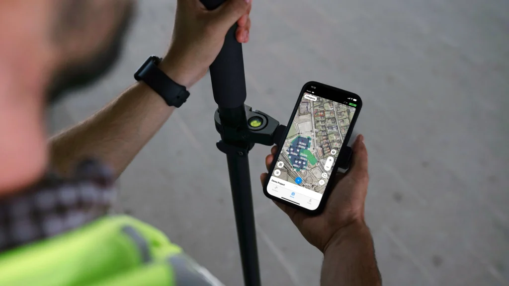
The Emlid Flow app supports both receivers and provides the main interface for fieldwork. Crews can import project data, including points and linework, and use the app to stake out design locations, collect site features, and verify positions directly from a phone or tablet.
Built-in maps, coordinate system support, and straightforward survey tools make it possible to work with design data and measurements without specialized surveying software in the field.
Collected points, lines, and notes are automatically organized within each project and synced to the cloud through Emlid Flow 360.
This allows office teams to view and manage the latest field data in real time, eliminating the need for manual file exports or transferring data between devices.
For most subcontractors, the choice comes down to workflow complexity:
- Reach RX2 + Emlid Flow: simple setup for daily positioning tasks on construction sites
- Reach RS4 Pro + Emlid Flow: expanded capabilities for teams handling more advanced layouts or hazardous sites.
Both setups give field crews the ability to verify work, document progress, and resolve positioning questions without waiting for a survey visit.
RTK GNSS for subcontractors and specialty contractors: more control on the job site
You don’t need to be a surveyor to use survey-grade tools. RTK GNSS is becoming part of everyday field workflows for subcontractors and specialty contractors who need fast, reliable measurements on site.
The right tool still depends on where you’re working. GNSS handles open-site work—grading, stakeout, earthwork, paving—while a total station takes over for tight-tolerance vertical layout and anything indoors or up a structure. Knowing which one a job calls for is part of using either one well.
Tasks like grade checks, stakeout from design files, as-built documentation, and cut/fill verification can be handled directly in the field. The result is fewer surprises, less rework, better control over schedule and costs, and cleaner records when it’s time to get paid.
Explore how Reach RX2, Reach RS4 Pro, and Emlid Flow help construction crews handle positioning tasks on site:
Frequently asked questions
How do subcontractors win more bids with GNSS?
GNSS lets subcontractors compete on more than price. Faster, more accurate grading lowers your cost to do the work, so you can bid tighter without losing margin: Projul puts the savings at 60–80 % lower staking costs and rework. It also qualifies you for machine-control-spec jobs, and lets you run your own cut/fill takeoff before bidding instead of guessing.
Can GNSS protect subcontractors from backcharges and payment disputes?
Yes, in two ways. RTK GNSS helps prevent the layout and grading errors that trigger backcharges: Levelset describes a backcharge as the cost a GC deducts from your pay to fix defective work. It also documents what you did as you did it: manual quantity estimates can run 10–20% off, while RTK-referenced surveys hold to 1–2% (Aeroyantra), giving you a record to point to if numbers get disputed.
Is RTK GNSS accurate enough for concrete and structural layout, or do I need a total station?
It depends on the scope. RTK GNSS handles open-sky work like foundations, footings, and slab-on-grade at roughly centimeter accuracy—as tight as 8 mm, per Cleveland Brothers. A total station is the better call for tight-tolerance vertical work, interior layout, or upper floors, reaching about 3 mm without needing satellite visibility. Most crews use both.
How does GNSS reduce utility-strike liability for excavation and utility subs?
RTK GNSS cuts liability two ways: it helps you stake and verify utility locations accurately enough to avoid hitting a line, and it creates a dated record proving proper procedures were followed if a strike happens anyway. GPRS puts the average cost of a strike at $56,000, and util-locate cites $4.62 saved for every $1 spent on proper locating.
What does it cost a subcontractor to bring GNSS in-house, and what is the payback?
A survey crew costs $1,000 to $5,000 a day (SPH Engineering), while a GNSS receiver you own outright runs a few thousand dollars total. Robota‘s data shows that investment paying back in 6 to 12 months through labor savings alone—a real hedge against the labor shortage, with ABC projecting a need for 349,000 new construction workers in 2026.