BLOG
Reach RS2 can be of a great help in the mountains. Check out glacier rock survey and learn how Reach RS2 helped our user survey difficult terrain.
by Valeriia Fursa December 22, 2020 Tags: Drone Mapping, Land Surveying, Reach RS2

Now you can wholly enjoy the advantages of RTK mapping with Phantom 4 RTK with Reach RS2 acting as a base station for RTK and PPK.
by Dmitriy Ershov November 24, 2020 Tags: Drone Mapping, News, Reach RS2
Ground control points are an important step in every drone mission. Check out a new video from Indiana Drones and learn more on how Reach RS2 can come handy for both LiDAR and photogrammetric projects.
by Dmitriy Ershov September 10, 2020 Tags: Drone Mapping, Reach RS2
Compact and rugged, Reach receivers can unlock centimeter precision even in the difficult terrain. A team of scientists went to the Himalayas to study proglacial lakes, causing catastrophic floods.
by Kseniia Volodina August 27, 2020 Tags: Drone Mapping, Education, Reach RS/RS+

Our user from Sweden held a microclimate research with the help of Reach RS2 and Yellowscan LiDAR.
by Kseniia Volodina May 28, 2020 Tags: Drone Mapping, Education, Reach RS2

Read about our user Brent Wiebe building a 3D model of a new school in Canada. With the help of Reach RS+, he incorporated the new building in the existing architectural group.
by Kseniia Volodina May 6, 2020 Tags: Architecture, Drone Mapping, Reach RS/RS+
Read about Shetland Flyer Aerial Media building a 3D model of the mysterious Kame of Isbister with the help of Reach RS+ and a drone.
by Kseniia Volodina April 21, 2020 Tags: Archaeology, Drone Mapping, Reach RS/RS+
3D mapping helps assess a place’s potential. Topodrone SA created a 3D model of two areas at nearby Lake Geneva with the help of Reach RS+ and drone. Read more about this case in our article.
by Kseniia Volodina February 25, 2020 Tags: Drone Mapping, Reach RS/RS+
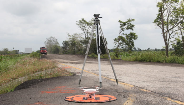
In March 2019, Mexican CoatzaDrone conducted a topographic survey of the “Las Choapas-Cárdenas” road section in Tabasco, Mexico using Reach RS+. The goal was to create a detailed 3D model and an orthomosaic as part of the road maintenance project.
by Dmitriy Ershov June 13, 2019 Tags: Construction, Drone Mapping, Land Surveying, Reach RS/RS+
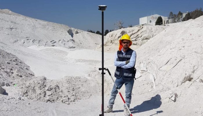
The Dromine team recently carried out a UAV-based volumetric survey to assess feldspar stock at the site. For this project, one DJI Phantom 4 and two Reach RS+ (base and rover) were utilized.
by Dmitriy Ershov March 12, 2019 Tags: Drone Mapping, Mining, Reach RS/RS+
Get news about Emlid devices, features, events, new services, and discounts